Directions to Hagop's Picture Framing (Cambridge) with public transportation
The following transit lines have routes that pass near Hagop's Picture Framing
 Bus: 71, 73, 75.
- Train: FITCHBURG, FRAMINGHAM/WORCESTER.
- Subway: RED LINE, GREEN LINE B.
How to get to Hagop's Picture Framing by bus?
Click on the bus route to see step by step directions with maps, line arrival times and updated time schedules.
From West Roxbury, Boston
53 minFrom Sweet Cheeks Q, Boston
58 minFrom Downeast Cider House, Boston
78 minFrom Charles River, Boston
51 minFrom Boston Children's Museum, Boston
67 minFrom Financial District, Boston
53 minFrom Edic Pier, Boston
67 minFrom Canobie Lake Park, Chelsea
76 minFrom Carson Beach, Boston
87 minFrom Harpoon Brewery, Boston
71 min
How to get to Hagop's Picture Framing by train?
Click on the train route to see step by step directions with maps, line arrival times and updated time schedules.
How to get to Hagop's Picture Framing by subway?
Click on the subway route to see step by step directions with maps, line arrival times and updated time schedules.
Bus stops near Hagop's Picture Framing in Cambridge
Subway stations near Hagop's Picture Framing in Cambridge
Train station near Hagop's Picture Framing in Cambridge
- Porter, 32 min walk,VIEW
Bus lines to Hagop's Picture Framing in Cambridge
What are the closest stations to Hagop's Picture Framing?
The closest stations to Hagop's Picture Framing are:
- Aberdeen Ave @ Mt Auburn St is 33 yards away, 1 min walk.
- Mt Auburn St Opp Homer Ave is 203 yards away, 3 min walk.
- Warren Street is 1263 yards away, 15 min walk.
- Harvard Square is 2359 yards away, 28 min walk.
- Porter is 2699 yards away, 32 min walk.
Which bus lines stop near Hagop's Picture Framing?
These bus lines stop near Hagop's Picture Framing: 71, 73.
Which train lines stop near Hagop's Picture Framing?
These train lines stop near Hagop's Picture Framing: FITCHBURG, FRAMINGHAM/WORCESTER.
Which subway line stops near Hagop's Picture Framing?
RED LINE (Alewife)
What’s the nearest subway station to Hagop's Picture Framing in Cambridge?
The nearest subway station to Hagop's Picture Framing in Cambridge is Warren Street. It’s a 15 min walk away.
What’s the nearest bus station to Hagop's Picture Framing in Cambridge?
The nearest bus station to Hagop's Picture Framing in Cambridge is Aberdeen Ave @ Mt Auburn St. It’s a 1 min walk away.
What time is the first subway to Hagop's Picture Framing in Cambridge?
The GREEN LINE B is the first subway that goes to Hagop's Picture Framing in Cambridge. It stops nearby at 5:12 AM.
What time is the last subway to Hagop's Picture Framing in Cambridge?
The GREEN LINE B is the last subway that goes to Hagop's Picture Framing in Cambridge. It stops nearby at 2:28 AM.
What time is the first train to Hagop's Picture Framing in Cambridge?
The FITCHBURG is the first train that goes to Hagop's Picture Framing in Cambridge. It stops nearby at 5:41 AM.
What time is the last train to Hagop's Picture Framing in Cambridge?
The FITCHBURG is the last train that goes to Hagop's Picture Framing in Cambridge. It stops nearby at 12:17 AM.
What time is the first bus to Hagop's Picture Framing in Cambridge?
The 73 is the first bus that goes to Hagop's Picture Framing in Cambridge. It stops nearby at 4:52 AM.
What time is the last bus to Hagop's Picture Framing in Cambridge?
The 71 is the last bus that goes to Hagop's Picture Framing in Cambridge. It stops nearby at 1:18 AM.
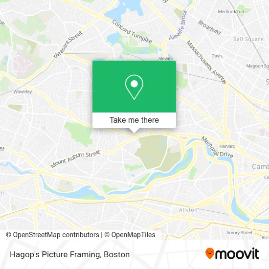
See Hagop's Picture Framing, Cambridge, on the map
Public Transit to Hagop's Picture Framing in Cambridge
Wondering how to get to Hagop's Picture Framing in Cambridge? Moovit helps you find the best way to get to Hagop's Picture Framing with step-by-step directions from the nearest public transit station.
Moovit provides free maps and live directions to help you navigate through your city. View schedules, routes, timetables, and find out how long does it take to get to Hagop's Picture Framing in real time.
Looking for the nearest stop or station to Hagop's Picture Framing? Check out this list of stops closest to your destination: Aberdeen Ave @ Mt Auburn St; Mt Auburn St Opp Homer Ave; Warren Street; Harvard Square; Porter.
Bus: 71, 73, 75.Train: FITCHBURG, FRAMINGHAM/WORCESTER.Subway: RED LINE, GREEN LINE B.
Want to see if there’s another route that gets you there at an earlier time? Moovit helps you find alternative routes or times. Get directions from and directions to Hagop's Picture Framing easily from the Moovit App or Website.
We make riding to Hagop's Picture Framing easy, which is why over 1.7 million users, including users in Cambridge, trust Moovit as the best app for public transit. You don’t need to download an individual bus app or train app, Moovit is your all-in-one transit app that helps you find the best bus time or train time available.
For information on prices of bus, subway and train, costs and ride fares to Hagop's Picture Framing, please check the Moovit app.
Use the app to navigate to popular places including to the airport, hospital, stadium, grocery store, mall, coffee shop, school, college, and university.
Hagop's Picture Framing Address: 33 Belmont St street in Cambridge
- The New England of Optometry,
- Sofra Bakery & Cafe,
- Mount Auburn,
- Star Market,
- Kitaeff Showroom,
- STARBUCKS,
- Coinstar - Bitcoin ATM,
- Corcoran Park Center,
- Kendall Green Luce Team,
- Religious Sacred Heart,
- Benoit Real Estate Group,
- Watertown-Cambridge Greenway,
- Belmont Variety,
- Haggery Library & Technology Center,
- Ravello Italian Kitchen,
- Beth Israel Lahey Health Primary Care - 625 Mount Auburn Street,
- Rachel Haft,
- Ben Francis, Counselor,
- Judith Fernando, MD, MPH,
- Nancy Akbari, MD
Places Near Hagop's Picture Framing (Cambridge)
- Isabella Stewart Gardner Museum, Boston,
- Cheers, Boston,
- Seaport District, Boston,
- House Of Blues, Boston,
- Boston Common, Boston,
- Wilbur Theatre, Boston,
- Leader Bank Pavilion (Leader Bank Pavillion), Boston,
- Faneuil Hall, Boston,
- Boston Medical Center, Boston,
- Quincy Market, Boston,
- Boston Children's Hospital, Boston,
- Massachusetts General Hospital, Boston,
- North End, Boston,
- Boston Convention & Exhibition Center, Boston,
- Museum Of Science, Boston,
- Mgm Music Hall, Boston,
- Wang Theater, Boston,
- Castle Island, Boston,
- Prudential Center, Boston,
- Td Garden, Boston
How to get to popular places in Boston with public transit
Get around Cambridge by public transit!
Traveling around Cambridge has never been so easy. See step by step directions as you travel to any attraction, street or major public transit station. View bus and train schedules, arrival times, service alerts and detailed routes on a map, so you know exactly how to get to anywhere in Cambridge.
When traveling to any destination around Cambridge use Moovit's Live Directions with Get Off Notifications to know exactly where and how far to walk, how long to wait for your line, and how many stops are left. Moovit will alert you when it's time to get off — no need to constantly re-check whether yours is the next stop.
Wondering how to use public transit in Cambridge or how to pay for public transit in Cambridge? Moovit public transit app can help you navigate your way with public transit easily, and at minimum cost. It includes public transit fees, ticket prices, and costs. Looking for a map of Cambridge public transit lines? Moovit public transit app shows all public transit maps in Cambridge with all Bus, Train, Subway and Ferry routes and stops on an interactive map.
Boston has 4 transit type(s), including: Bus, Train, Subway and Ferry, operated by several transit agencies, including MBTA, Southeastern Regional Transit Authority, MetroWest Regional Transit Authority, Rhode Island Public Transit Authority, WRTA, Lowell Regional Transit Authority, Merrimack Valley Transit, Montachusett Regional Transit Authority, Cape Cod Regional Transit Authority, Brockton Area Transit Authority, Martha's Vineyard Transit Authority, the WAVE - Nantucket Regional Transit Authority, GATRA, Cape Ann Transportation Authority and Massport