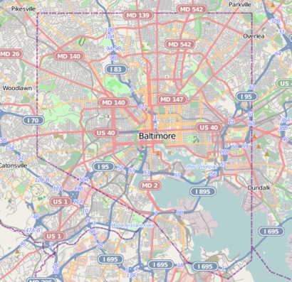
See Halethorpe, Lansdowne, on the map
Directions to Halethorpe (Lansdowne) with public transportation
The following transit lines have routes that pass near Halethorpe
 Bus:
Bus: - Train:
How to get to Halethorpe by bus?
Click on the bus route to see step by step directions with maps, line arrival times and updated time schedules.
How to get to Halethorpe by train?
Click on the train route to see step by step directions with maps, line arrival times and updated time schedules.
Bus stations near Halethorpe in Lansdowne
- 4711 Hollins Ferry Rd Eb,41 min walk,
- Waterview Ave & Westport St FS Wb,44 min walk,
- Knecht Ave & John Ave Eb FS,50 min walk,
Bus lines to Halethorpe in Lansdowne
- CITYLINK YELLOW,Patapsco Lr,
- 73,Wagner's Point,
- 29,Mondawmin Metro Via Violetville,
What are the closest stations to Halethorpe?
The closest stations to Halethorpe are:
- 4711 Hollins Ferry Rd Eb is 3471 yards away, 41 min walk.
- Waterview Ave & Westport St FS Wb is 3638 yards away, 44 min walk.
- Knecht Ave & John Ave Eb FS is 4164 yards away, 50 min walk.
Which bus lines stop near Halethorpe?
These bus lines stop near Halethorpe: 29, CITYLINK YELLOW.
Which train line stops near Halethorpe?
MARC
See Halethorpe, Lansdowne, on the map
Public Transit to Halethorpe in Lansdowne
Wondering how to get to Halethorpe in Lansdowne, United States? Moovit helps you find the best way to get to Halethorpe with step-by-step directions from the nearest public transit station.
Moovit provides free maps and live directions to help you navigate through your city. View schedules, routes, timetables, and find out how long does it take to get to Halethorpe in real time.
Looking for the nearest stop or station to Halethorpe? Check out this list of stops closest to your destination: 4711 Hollins Ferry Rd Eb; Waterview Ave & Westport St FS Wb; Knecht Ave & John Ave Eb FS.
Bus:Train:
Want to see if there’s another route that gets you there at an earlier time? Moovit helps you find alternative routes or times. Get directions from and directions to Halethorpe easily from the Moovit App or Website.
We make riding to Halethorpe easy, which is why over 1.5 million users, including users in Lansdowne, trust Moovit as the best app for public transit. You don’t need to download an individual bus app or train app, Moovit is your all-in-one transit app that helps you find the best bus time or train time available.
For information on prices of bus, metro and train, costs and ride fares to Halethorpe, please check the Moovit app.
Use the app to navigate to popular places including to the airport, hospital, stadium, grocery store, mall, coffee shop, school, college, and university.
Halethorpe Address: MD 21227 street in Lansdowne
Attractions near Halethorpe
Monroe & Son Roofing,BH&C Painting,Flat Price Moving and Auto Shipping,Super Duper Cleaning Services,Hofmann's Greenhouse Installations,301 Laverne Ave,Kate Bailey Photography,Limas Hvac,Charles Home Improvement,Highland,274 1st Ave,Heather Seebach,330 1st Ave,2460 Saratoga Ave,CMM Custom Carpentry,First Baptist Church,Our Saviour Lutheran Church,Lansdowne United Methodist Church Kitchen,216 Clyde Ave,B Knox Painting IncHow to get to popular attractions in Lansdowne with public transit
Lost Society, Washington,Green Lantern, Washington,Owings Mills, Maryland, Baltimore County,Costco Wholesale, Howard County,Manassas, VA, Manassas,Matchbox Vintage Pizza Bistro, Washington,District Chophouse & Brewery, Washington,Hyatt Regency Reston, Fairfax County,Perry Hall, Maryland, Baltimore County,Fogo de Chao, Washington,Glen Burnie, MD, Anne Arundel County,Mount Vernon Place, Baltimore,G&M Restaurant and Lounge, Anne Arundel County,The Cheesecake Factory, Washington,Looney's Pub, Baltimore,Walmart Supercenter, Baltimore County,Gordon Biersch Brewery Restaurant, Fairfax County,Ebenezers Coffeehouse, Washington,District Taco, Arlington County,Miss Shirley's Cafe, BaltimoreGet around Lansdowne by public transit!
Traveling around Lansdowne has never been so easy. See step by step directions as you travel to any attraction, street or major public transit station. View bus and train schedules, arrival times, service alerts and detailed routes on a map, so you know exactly how to get to anywhere in Lansdowne.
When traveling to any destination around Lansdowne use Moovit's Live Directions with Get Off Notifications to know exactly where and how far to walk, how long to wait for your line, and how many stops are left. Moovit will alert you when it's time to get off — no need to constantly re-check whether yours is the next stop.
Wondering how to use public transit in Lansdowne or how to pay for public transit in Lansdowne? Moovit public transit app can help you navigate your way with public transit easily, and at minimum cost. It includes public transit fees, ticket prices, and costs. Looking for a map of Lansdowne public transit lines? Moovit public transit app shows all public transit maps in Lansdowne with all bus, metro or train routes and stops on an interactive map.
Lansdowne has 3 transit type(s), including: bus, metro or train, operated by several transit agencies, including WMATA, WMATA, Montgomery County Ride On, Fairfax Connector, TheBus, DC Circulator, MDOT MTA, Marc, MDOT MTA, MDOT MTA, Virginia Railway Express (VRE), PRTC, DASH - Alexandria, Arlington Transit (ART) and DC Streetcar