Hamburg St.Pauli station - Friday schedule
| Line | Direction | Time |
|---|---|---|
| U3 | Hamburg Barmbek | 03:05 |
| U3 | Hamburg Barmbek(2) | 03:08 |
| U3 | Hamburg Kellinghusenstraße | 03:08 |
| U3 | Hamburg Wandsbek-Gartenstadt | 03:15 |
| U3 | Hamburg Barmbek(2) | 03:18 |
| U3 | Hamburg Kellinghusenstraße | 03:18 |
| U3 | Hamburg Wandsbek-Gartenstadt | 04:35 |
| U3 | Hamburg Barmbek(2) | 04:38 |
| U3 | Hamburg Kellinghusenstraße | 04:38 |
| U3 | Hamburg Wandsbek-Gartenstadt | 04:45 |
| U3 | Hamburg Barmbek(2) | 04:48 |
| U3 | Hamburg Kellinghusenstraße | 04:48 |
| U3 | Hamburg Wandsbek-Gartenstadt | 04:55 |
| U3 | Hamburg Barmbek(2) | 04:58 |
| U3 | Hamburg Kellinghusenstraße | 04:58 |
| U3 | Hamburg Wandsbek-Gartenstadt | 05:05 |
| U3 | Hamburg Barmbek(2) | 05:08 |
| U3 | Hamburg Kellinghusenstraße | 05:08 |
| U3 | Hamburg Wandsbek-Gartenstadt | 05:15 |
| U3 | Hamburg Barmbek(2) | 05:18 |
| U3 | Hamburg Kellinghusenstraße | 05:18 |
| U3 | Hamburg Wandsbek-Gartenstadt | 05:25 |
| U3 | Hamburg Barmbek(2) | 05:28 |
| U3 | Hamburg Kellinghusenstraße | 05:28 |
| U3 | Hamburg Wandsbek-Gartenstadt | 05:35 |
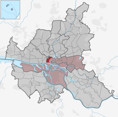
See Hamburg St.Pauli, Hamburg-Mitte, on the map
Directions to Hamburg St.Pauli (Hamburg-Mitte) with public transportation
The following transit lines have routes that pass near Hamburg St.Pauli
 Train:
 - S-Bahn:
- Subway:
- Bus:
- Ferry:
How to get to Hamburg St.Pauli by bus?
Click on the bus route to see step by step directions with maps, line arrival times and updated time schedules.
How to get to Hamburg St.Pauli by train?
Click on the train route to see step by step directions with maps, line arrival times and updated time schedules.
How to get to Hamburg St.Pauli by subway?
Click on the subway route to see step by step directions with maps, line arrival times and updated time schedules.
Bus stations near Hamburg St.Pauli in Hamburg-Mitte
- U St.Pauli,1 min walk,
- Hamburg U St.Pauli,2 min walk,
S-Bahn stations near Hamburg St.Pauli in Hamburg-Mitte
- Landungsbrücken,8 min walk,
Ferry stations near Hamburg St.Pauli in Hamburg-Mitte
- Hamburg Landungsbrücken,9 min walk,
Train stations near Hamburg St.Pauli in Hamburg-Mitte
- Hamburg Landungsbrücken,9 min walk,
Subway stations near Hamburg St.Pauli in Hamburg-Mitte
- St.Pauli,10 min walk,
Bus lines to Hamburg St.Pauli in Hamburg-Mitte
- 17,U S Barmbek,
- 16,Eez (Julius-Brecht-Straße),
- 112,Hamburg Bf. Altona,
- 601,S Wedel,
- 607,Hebebrandstraße,
- 609,Hamburg U Billstedt,
- 610,S Holstenstraße,
- 641,Hamburg S Reeperbahn,
- 16,Bf. Altona,
- 112,Teufelsbrück (Fähre),
- 608,S Reeperbahn,
- 17,Hamburg U S Barmbek,
- 601,Rathausmarkt,
- 607,S Poppenbüttel (Wentzelplatz),
- 609,U Billstedt,
- 610,Bf. Bergedorf,
- 641,S Reeperbahn,
- 608,Bf. Rahlstedt (Amtsstraße),
What are the closest stations to Hamburg St.Pauli?
The closest stations to Hamburg St.Pauli are:
- U St.Pauli is 42 meters away, 1 min walk.
- Hamburg U St.Pauli is 86 meters away, 2 min walk.
- Landungsbrücken is 606 meters away, 8 min walk.
- Hamburg Landungsbrücken is 623 meters away, 9 min walk.
- St.Pauli is 740 meters away, 10 min walk.
Which train lines stop near Hamburg St.Pauli?
These train lines stop near Hamburg St.Pauli: S1, S3.
Which subway line stops near Hamburg St.Pauli?
U3
Which bus lines stop near Hamburg St.Pauli?
These bus lines stop near Hamburg St.Pauli: 112, 16, 17.
What’s the nearest subway station to Hamburg St.Pauli in Hamburg-Mitte?
The nearest subway station to Hamburg St.Pauli in Hamburg-Mitte is St.Pauli. It’s a 10 min walk away.
What’s the nearest train station to Hamburg St.Pauli in Hamburg-Mitte?
The nearest train station to Hamburg St.Pauli in Hamburg-Mitte is Hamburg Landungsbrücken. It’s a 9 min walk away.
What’s the nearest bus stop to Hamburg St.Pauli in Hamburg-Mitte?
The nearest bus stop to Hamburg St.Pauli in Hamburg-Mitte is U St.Pauli. It’s a 1 min walk away.
What’s the nearest ferry station to Hamburg St.Pauli in Hamburg-Mitte?
The nearest ferry station to Hamburg St.Pauli in Hamburg-Mitte is Hamburg Landungsbrücken. It’s a 9 min walk away.
What’s the nearest S-Bahn station to Hamburg St.Pauli in Hamburg-Mitte?
The nearest S-Bahn station to Hamburg St.Pauli in Hamburg-Mitte is Landungsbrücken. It’s a 8 min walk away.
What time is the first subway to Hamburg St.Pauli in Hamburg-Mitte?
The U3 is the first subway that goes to Hamburg St.Pauli in Hamburg-Mitte. It stops nearby at 4:35 AM.
What time is the last subway to Hamburg St.Pauli in Hamburg-Mitte?
The U3 is the last subway that goes to Hamburg St.Pauli in Hamburg-Mitte. It stops nearby at 12:48 AM.
What time is the first train to Hamburg St.Pauli in Hamburg-Mitte?
The S1 is the first train that goes to Hamburg St.Pauli in Hamburg-Mitte. It stops nearby at 3:57 AM.
What time is the last train to Hamburg St.Pauli in Hamburg-Mitte?
The S1 is the last train that goes to Hamburg St.Pauli in Hamburg-Mitte. It stops nearby at 12:45 AM.
What time is the first bus to Hamburg St.Pauli in Hamburg-Mitte?
The 610 is the first bus that goes to Hamburg St.Pauli in Hamburg-Mitte. It stops nearby at 3:03 AM.
What time is the last bus to Hamburg St.Pauli in Hamburg-Mitte?
The 609 is the last bus that goes to Hamburg St.Pauli in Hamburg-Mitte. It stops nearby at 3:54 AM.
What time is the first ferry to Hamburg St.Pauli in Hamburg-Mitte?
The KAT is the first ferry that goes to Hamburg St.Pauli in Hamburg-Mitte. It stops nearby at 9:00 AM.
What time is the last ferry to Hamburg St.Pauli in Hamburg-Mitte?
The KAT is the last ferry that goes to Hamburg St.Pauli in Hamburg-Mitte. It stops nearby at 8:15 PM.
What time is the first S-Bahn to Hamburg St.Pauli in Hamburg-Mitte?
The S1 is the first S-Bahn that goes to Hamburg St.Pauli in Hamburg-Mitte. It stops nearby at 3:57 AM.
What time is the last S-Bahn to Hamburg St.Pauli in Hamburg-Mitte?
The S1 is the last S-Bahn that goes to Hamburg St.Pauli in Hamburg-Mitte. It stops nearby at 12:45 AM.
See Hamburg St.Pauli, Hamburg-Mitte, on the map
Public transit to Hamburg St.Pauli station in Hamburg-Mitte
Looking for directions to Hamburg St.Pauli in Hamburg-Mitte, Germany?
Download the Moovit App to find the current schedule and step-by-step directions for Bus, Train or Subway routes that pass through Hamburg St.Pauli.
Looking for the nearest stops closest to Hamburg St.Pauli ? Check out this list of closest stops to your destination: U St.Pauli; Hamburg U St.Pauli; Landungsbrücken; Hamburg Landungsbrücken; St.Pauli.
Train:S-Bahn:Subway:Bus:Ferry:
We make riding on public transit to Hamburg St.Pauli easy, which is why over 1.5 million users, including users in Hamburg-Mitte trust Moovit as the best app for public transit.
Use the app to navigate to popular places including to the airport, hospital, stadium, grocery store, mall, coffee shop, school, college, and university.
The first line to this station is U3, at 03:05, and the last line is U3 at 02:58.
Budapester Straße, Hamburg, Germany
This station serves Hochbahn U-Bahn’s lines
S-Bahn station near Hamburg St.Pauli
LandungsbrückenFerry station near Hamburg St.Pauli
Hamburg LandungsbrückenTrain station near Hamburg St.Pauli
Hamburg LandungsbrückenSubway station near Hamburg St.Pauli
St.PauliPopular public transit stations in Hamburg-Mitte
Elmenhorst Lanken/Kesselflickerstraße,Hamburg-Neuenfelde Marschkamper Deich 72,Kiel Nordmark-Sportfeld (Mare-Klinikum),Kopperby Heidesiedlung,Scharnebeck, Adendorfer Straße,Buxtehude, Estetalstraße,Meldorf Österstraße,Kiel Prey,Wulfsmoor,Cismar Hinter Dem Kloster,Hannover Hbf,Fuhlendorf(B Wiemserdorf) Im Winkel,Kiel Hauptbahnhof,Hamburg Neuwiedenthaler Straße (West),Itzehoe Berufsbildungszentrum Rbz,Lübeck Kohlmarkt,Bad Segeberg am Apfelgarten,Joldelund Högel Abzw.,Brunsbüttel Kanalfähre Nord,Hamburg WohlerswegGet around Hamburg-Mitte by public transit!
Traveling around Hamburg-Mitte has never been so easy. See step by step directions as you travel to any attraction, street or major public transit station. View bus and train schedules, arrival times, service alerts and detailed routes on a map, so you know exactly how to get to anywhere in Hamburg-Mitte.
When traveling to any destination around Hamburg-Mitte use Moovit's Live Directions with Get Off Notifications to know exactly where and how far to walk, how long to wait for your line, and how many stops are left. Moovit will alert you when it's time to get off — no need to constantly re-check whether yours is the next stop.
Wondering how to use public transit in Hamburg-Mitte or how to pay for public transit in Hamburg-Mitte? Moovit public transit app can help you navigate your way with public transit easily, and at minimum cost. It includes public transit fees, ticket prices, and costs. Looking for a map of Hamburg-Mitte public transit lines? Moovit public transit app shows all public transit maps in Hamburg-Mitte with all bus, train or subway routes and stops on an interactive map.
Hamburg-Mitte has 3 transit type(s), including: bus, train or subway, operated by several transit agencies, including Hamburger Verkehrsverbund (hvv), Hamburger Hochbahn AG, Deutsche Bahn AG, Hamburger Hochbahn AG, Deutsche Bahn AG, Verkehrsbetriebe Schleswig-Flensburg GmbH, Metronom, SchnellBusse, Hamburger Verkehrsverbund (hvv), cantus Verkehrsgesellschaft, Nahreisezug, Nordbahn Eisenbahngesellschaft, CeBus GmbH & Co. KG, Schlepp- und Fährgesellschaft Kiel mbh (SFK) and NordWestBahn