Directions to Hamel-Lydon Chapel And Cremation Society (Quincy) with public transportation
The following transit lines have routes that pass near Hamel-Lydon Chapel And Cremation Society
 Bus: 210, 217, RED LINE SHUTTLE, RED LINE SHUTTLE, RED LINE SHUTTLE.
- Train: FALL RIVER/NEW BEDFORD, GREENBUSH.
- Subway: RED LINE, MATTAPAN LINE.
- Ferry: QUINCY FERRY, WINTHROP/QUINCY FERRY.
How to get to Hamel-Lydon Chapel And Cremation Society by bus?
Click on the bus route to see step by step directions with maps, line arrival times and updated time schedules.
From The Salty Pig, Boston
95 minFrom Revere Hotel Boston Common, Boston
77 minFrom Northeastern University, Boston
64 minFrom The Friendly Toast, Boston
99 minFrom Back Bay Station, Boston
95 minFrom WESTIN Boston Waterfront (The WESTIN Boston Seaport District), Boston
99 minFrom Boston Municipal Court (Roxbury District Court), Boston
52 minFrom Bos21 - Amazon, Boston
98 minFrom Lemuel Shattuck Hospital, Boston
54 minFrom Wentworth Institute Of Technology, Boston
66 min
How to get to Hamel-Lydon Chapel And Cremation Society by train?
Click on the train route to see step by step directions with maps, line arrival times and updated time schedules.
From The Salty Pig, Boston
64 minFrom Revere Hotel Boston Common, Boston
63 minFrom Northeastern University, Boston
67 minFrom The Friendly Toast, Boston
63 minFrom Back Bay Station, Boston
63 minFrom WESTIN Boston Waterfront (The WESTIN Boston Seaport District), Boston
63 minFrom Boston Municipal Court (Roxbury District Court), Boston
81 minFrom Bos21 - Amazon, Boston
62 minFrom Lemuel Shattuck Hospital, Boston
85 minFrom Wentworth Institute Of Technology, Boston
73 min
How to get to Hamel-Lydon Chapel And Cremation Society by subway?
Click on the subway route to see step by step directions with maps, line arrival times and updated time schedules.
From The Salty Pig, Boston
32 minFrom Revere Hotel Boston Common, Boston
34 minFrom Northeastern University, Boston
37 minFrom The Friendly Toast, Boston
34 minFrom Back Bay Station, Boston
30 minFrom WESTIN Boston Waterfront (The WESTIN Boston Seaport District), Boston
38 minFrom Boston Municipal Court (Roxbury District Court), Boston
52 minFrom Bos21 - Amazon, Boston
37 minFrom Lemuel Shattuck Hospital, Boston
60 minFrom Wentworth Institute Of Technology, Boston
50 min
Bus stops near Hamel-Lydon Chapel And Cremation Society in Quincy
Ferry station near Hamel-Lydon Chapel And Cremation Society in Quincy
- Quincy, 33 min walk,VIEW
Subway stations near Hamel-Lydon Chapel And Cremation Society in Quincy
Bus lines to Hamel-Lydon Chapel And Cremation Society in Quincy
What are the closest stations to Hamel-Lydon Chapel And Cremation Society?
The closest stations to Hamel-Lydon Chapel And Cremation Society are:
- Hancock St @ Wentworth Rd is 241 yards away, 3 min walk.
- Wollaston - Newport Ave Opp Brook St is 268 yards away, 4 min walk.
- Quincy is 2790 yards away, 33 min walk.
- Wollaston is 3675 yards away, 44 min walk.
- Cedar Grove is 4046 yards away, 48 min walk.
Which bus line stops near Hamel-Lydon Chapel And Cremation Society?
210 (Quincy Center)
Which train lines stop near Hamel-Lydon Chapel And Cremation Society?
These train lines stop near Hamel-Lydon Chapel And Cremation Society: FALL RIVER/NEW BEDFORD, GREENBUSH.
Which subway line stops near Hamel-Lydon Chapel And Cremation Society?
RED LINE (Ashmont/Braintree)
What’s the nearest bus station to Hamel-Lydon Chapel And Cremation Society in Quincy?
The nearest bus station to Hamel-Lydon Chapel And Cremation Society in Quincy is Hancock St @ Wentworth Rd. It’s a 3 min walk away.
What time is the first subway to Hamel-Lydon Chapel And Cremation Society in Quincy?
The MATTAPAN LINE is the first subway that goes to Hamel-Lydon Chapel And Cremation Society in Quincy. It stops nearby at 5:10 AM.
What time is the last subway to Hamel-Lydon Chapel And Cremation Society in Quincy?
The MATTAPAN LINE is the last subway that goes to Hamel-Lydon Chapel And Cremation Society in Quincy. It stops nearby at 2:31 AM.
What time is the first bus to Hamel-Lydon Chapel And Cremation Society in Quincy?
The 210 is the first bus that goes to Hamel-Lydon Chapel And Cremation Society in Quincy. It stops nearby at 5:03 AM.
What time is the last bus to Hamel-Lydon Chapel And Cremation Society in Quincy?
The 210 is the last bus that goes to Hamel-Lydon Chapel And Cremation Society in Quincy. It stops nearby at 1:13 AM.
What time is the first ferry to Hamel-Lydon Chapel And Cremation Society in Quincy?
The QUINCY FERRY is the first ferry that goes to Hamel-Lydon Chapel And Cremation Society in Quincy. It stops nearby at 6:15 AM.
What time is the last ferry to Hamel-Lydon Chapel And Cremation Society in Quincy?
The QUINCY FERRY is the last ferry that goes to Hamel-Lydon Chapel And Cremation Society in Quincy. It stops nearby at 8:55 PM.
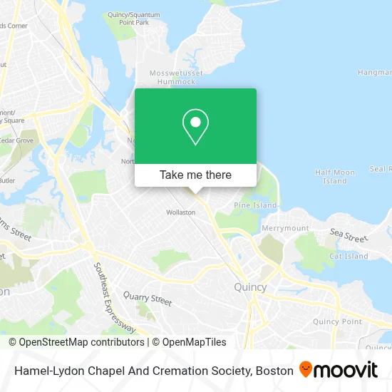
See Hamel-Lydon Chapel And Cremation Society, Quincy, on the map
Public Transit to Hamel-Lydon Chapel And Cremation Society in Quincy
Wondering how to get to Hamel-Lydon Chapel And Cremation Society in Quincy? Moovit helps you find the best way to get to Hamel-Lydon Chapel And Cremation Society with step-by-step directions from the nearest public transit station.
Moovit provides free maps and live directions to help you navigate through your city. View schedules, routes, timetables, and find out how long does it take to get to Hamel-Lydon Chapel And Cremation Society in real time.
Looking for the nearest stop or station to Hamel-Lydon Chapel And Cremation Society? Check out this list of stops closest to your destination: Hancock St @ Wentworth Rd; Wollaston - Newport Ave Opp Brook St; Quincy; Wollaston; Cedar Grove.
Bus: 210, 217, RED LINE SHUTTLE, RED LINE SHUTTLE, RED LINE SHUTTLE, RED LINE SHUTTLE.Train: FALL RIVER/NEW BEDFORD, GREENBUSH.Subway: RED LINE, MATTAPAN LINE.Ferry: QUINCY FERRY, WINTHROP/QUINCY FERRY.
Want to see if there’s another route that gets you there at an earlier time? Moovit helps you find alternative routes or times. Get directions from and directions to Hamel-Lydon Chapel And Cremation Society easily from the Moovit App or Website.
We make riding to Hamel-Lydon Chapel And Cremation Society easy, which is why over 1.7 million users, including users in Quincy, trust Moovit as the best app for public transit. You don’t need to download an individual bus app or train app, Moovit is your all-in-one transit app that helps you find the best bus time or train time available.
For information on prices of subway, bus and train, costs and ride fares to Hamel-Lydon Chapel And Cremation Society, please check the Moovit app.
Use the app to navigate to popular places including to the airport, hospital, stadium, grocery store, mall, coffee shop, school, college, and university.
Hamel-Lydon Chapel And Cremation Society Address: 650 Hancock St street in Quincy
- New Lucky Star,
- Fat Boy BBQ,
- South Shore Home Info,
- Brewster Ambulance Service,
- Brewster Ambulance,
- Doody Calls,
- Pos Center Boston,
- Five J's Convenient & Lottery,
- Kung Fu Tea Shop,
- Donburi Sushi,
- TKK Fried Chicken,
- Waku Waku,
- Mango Mango Dessert-Quincy,
- Beauty Chinatea Store,
- Cash World Tours,
- Pink Banana Nail Beauty,
- Ruud Hvac Systems Repair,
- Stop Foreclosure of Boston,
- Dagu Rice Noodle,
- Tiranga by P&D
Places Near Hamel-Lydon Chapel And Cremation Society (Quincy)
- Quincy Market, Boston,
- Museum Of Science, Boston,
- Cheers, Boston,
- North End, Boston,
- Castle Island, Boston,
- Seaport District, Boston,
- Wilbur Theatre, Boston,
- Td Garden, Boston,
- Mgm Music Hall, Boston,
- Isabella Stewart Gardner Museum, Boston,
- Boston Children's Hospital, Boston,
- Boston Medical Center, Boston,
- Wang Theater, Boston,
- House Of Blues, Boston,
- Prudential Center, Boston,
- Faneuil Hall, Boston,
- Leader Bank Pavilion (Leader Bank Pavillion), Boston,
- Boston Common, Boston,
- Massachusetts General Hospital, Boston,
- Boston Convention & Exhibition Center, Boston
How to get to popular places in Boston with public transit
Get around Quincy by public transit!
Traveling around Quincy has never been so easy. See step by step directions as you travel to any attraction, street or major public transit station. View bus and train schedules, arrival times, service alerts and detailed routes on a map, so you know exactly how to get to anywhere in Quincy.
When traveling to any destination around Quincy use Moovit's Live Directions with Get Off Notifications to know exactly where and how far to walk, how long to wait for your line, and how many stops are left. Moovit will alert you when it's time to get off — no need to constantly re-check whether yours is the next stop.
Wondering how to use public transit in Quincy or how to pay for public transit in Quincy? Moovit public transit app can help you navigate your way with public transit easily, and at minimum cost. It includes public transit fees, ticket prices, and costs. Looking for a map of Quincy public transit lines? Moovit public transit app shows all public transit maps in Quincy with all Bus, Train, Subway and Ferry routes and stops on an interactive map.
Boston has 4 transit type(s), including: Bus, Train, Subway and Ferry, operated by several transit agencies, including MBTA, Southeastern Regional Transit Authority, MetroWest Regional Transit Authority, Rhode Island Public Transit Authority, WRTA, Lowell Regional Transit Authority, Merrimack Valley Transit, Montachusett Regional Transit Authority, Cape Cod Regional Transit Authority, Brockton Area Transit Authority, Martha's Vineyard Transit Authority, the WAVE - Nantucket Regional Transit Authority, GATRA, Cape Ann Transportation Authority and Massport