How to get to Hampshire Community Correction by bus?
Click on the bus route to see step by step directions with maps, line arrival times and updated time schedules.
From South High Community School, Worcester
222 minFrom Registry Of Motor Vehicles (Rmv) Branch Office, Worcester
129 minFrom Gardner, MA, Gardner
199 minFrom Dcu Center, Worcester
127 minFrom Polar Park, Worcester
127 minFrom Palladium, Worcester
130 minFrom Worcester, MA, Worcester
125 minFrom Foxwoods, Worcester
154 min
How to get to Hampshire Community Correction by train?
Click on the train route to see step by step directions with maps, line arrival times and updated time schedules.
Bus stops near Hampshire Community Correction in Boston
Train station near Hampshire Community Correction in Boston
- Northampton, 4 min walk,VIEW
Bus lines to Hampshire Community Correction in Boston
- 904, Pittsfield Itc,VIEW
- B48, Holyoke Trans. Ctr. Via Rt. 5,VIEW
- G73E, Northampton Via Holyoke Mall,VIEW
- R41, Northampton Via Easthampton,VIEW
- R44, Williamsburg Via Va Hospital,VIEW
- R42, Williamsburg Via Va Hospital,VIEW
- PETER PAN, Boston (South Station),VIEW
- PETER PAN, Springfield,VIEW
- PETER PAN, Northampton,VIEW
- PETER PAN, South Hadley,VIEW
- G47, Northampton Via Westfield,VIEW
- NE, Northampton,VIEW
- GREYHOUND US0255S, New York Port Authority,VIEW
What are the closest stations to Hampshire Community Correction?
The closest stations to Hampshire Community Correction are:
- Live 155 is 87 yards away, 2 min walk.
- Northampton is 279 yards away, 4 min walk.
- Crafts Avenue / Peter Pan is 362 yards away, 5 min walk.
- Peter Pan Bus Terminal Northampton is 377 yards away, 5 min walk.
- Old South / Conz (Mcdonald House) is 484 yards away, 6 min walk.
- Northampton (Northampton Market) is 503 yards away, 7 min walk.
Which bus lines stop near Hampshire Community Correction?
These bus lines stop near Hampshire Community Correction: 31, B48, G73E.
Which train line stops near Hampshire Community Correction?
VERMONTER (St Albans)
What’s the nearest train station to Hampshire Community Correction in Boston?
The nearest train station to Hampshire Community Correction in Boston is Northampton. It’s a 4 min walk away.
What’s the nearest bus station to Hampshire Community Correction in Boston?
The nearest bus station to Hampshire Community Correction in Boston is Live 155. It’s a 2 min walk away.
What time is the first train to Hampshire Community Correction in Boston?
The VALLEY FLYER is the first train that goes to Hampshire Community Correction in Boston. It stops nearby at 6:30 AM.
What time is the last train to Hampshire Community Correction in Boston?
The VALLEY FLYER is the last train that goes to Hampshire Community Correction in Boston. It stops nearby at 10:07 PM.
What time is the first bus to Hampshire Community Correction in Boston?
The R44 is the first bus that goes to Hampshire Community Correction in Boston. It stops nearby at 5:42 AM.
What time is the last bus to Hampshire Community Correction in Boston?
The B48 is the last bus that goes to Hampshire Community Correction in Boston. It stops nearby at 10:14 PM.
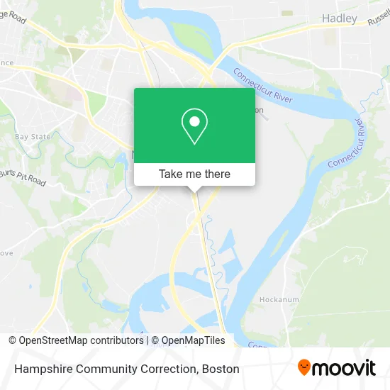
See Hampshire Community Correction, Boston, on the map
Public Transit to Hampshire Community Correction in Boston
Wondering how to get to Hampshire Community Correction in Boston? Moovit helps you find the best way to get to Hampshire Community Correction with step-by-step directions from the nearest public transit station.
Moovit provides free maps and live directions to help you navigate through your city. View schedules, routes, timetables, and find out how long does it take to get to Hampshire Community Correction in real time.
Looking for the nearest stop or station to Hampshire Community Correction? Check out this list of stops closest to your destination: Live 155; Northampton; Crafts Avenue / Peter Pan; Peter Pan Bus Terminal Northampton; Old South / Conz (Mcdonald House); Northampton (Northampton Market).
Bus: 31, B48, G73E, 904, R41, R44, R42, PETER PAN, PETER PAN, PETER PAN, PETER PAN, G47, NE, GREYHOUND US0255S.Train: VERMONTER, VALLEY FLYER.
Want to see if there’s another route that gets you there at an earlier time? Moovit helps you find alternative routes or times. Get directions from and directions to Hampshire Community Correction easily from the Moovit App or Website.
We make riding to Hampshire Community Correction easy, which is why over 1.7 million users, including users in Boston, trust Moovit as the best app for public transit. You don’t need to download an individual bus app or train app, Moovit is your all-in-one transit app that helps you find the best bus time or train time available.
For information on prices of bus and train, costs and ride fares to Hampshire Community Correction, please check the Moovit app.
Use the app to navigate to popular places including to the airport, hospital, stadium, grocery store, mall, coffee shop, school, college, and university.
Hampshire Community Correction Address: 492 Pleasant St Ste 4 street in Boston
- Club Metro,
- Golden Nozzle Car Wash,
- Pleasant Journey,
- Enhanced Cosmetics,
- This Old House,
- Molmex Scientific,
- Hayes P,
- Integrity Veterinary Center,
- Marci Yoss MD,
- Dr Stephanie D. Silverman, MD,
- Hampden Zimmerman,
- Northampton Wastewater Treatment Plant,
- Spare Time,
- Publishers Circulations,
- Smith Glass,
- Treatment Plan,
- Patricia E Joyc,
- Doris Cohen Psychologist,
- Zoe Zeichner,
- Fleitman Jay S Intrnst
Places Near Hampshire Community Correction (Boston)
- Castle Island, Boston,
- Wang Theater, Boston,
- Museum Of Science, Boston,
- Massachusetts General Hospital, Boston,
- Leader Bank Pavilion (Leader Bank Pavillion), Boston,
- Boston Children's Hospital, Boston,
- Cheers, Boston,
- Boston Convention & Exhibition Center, Boston,
- Td Garden, Boston,
- Boston Medical Center, Boston,
- North End, Boston,
- Faneuil Hall, Boston,
- House Of Blues, Boston,
- Boston Common, Boston,
- Mgm Music Hall, Boston,
- Wilbur Theatre, Boston,
- Quincy Market, Boston,
- Seaport District, Boston,
- Isabella Stewart Gardner Museum, Boston,
- Prudential Center, Boston
How to get to popular places in Boston with public transit
Get around Boston by public transit!
Traveling around Boston has never been so easy. See step by step directions as you travel to any attraction, street or major public transit station. View bus and train schedules, arrival times, service alerts and detailed routes on a map, so you know exactly how to get to anywhere in Boston.
When traveling to any destination around Boston use Moovit's Live Directions with Get Off Notifications to know exactly where and how far to walk, how long to wait for your line, and how many stops are left. Moovit will alert you when it's time to get off — no need to constantly re-check whether yours is the next stop.
Wondering how to use public transit in Boston or how to pay for public transit in Boston? Moovit public transit app can help you navigate your way with public transit easily, and at minimum cost. It includes public transit fees, ticket prices, and costs. Looking for a map of Boston public transit lines? Moovit public transit app shows all public transit maps in Boston with all Bus, Train, Subway and Ferry routes and stops on an interactive map.
Boston has 4 transit type(s), including: Bus, Train, Subway and Ferry, operated by several transit agencies, including MBTA, Southeastern Regional Transit Authority, MetroWest Regional Transit Authority, Rhode Island Public Transit Authority, WRTA, Lowell Regional Transit Authority, Merrimack Valley Transit, Montachusett Regional Transit Authority, Cape Cod Regional Transit Authority, Brockton Area Transit Authority, Martha's Vineyard Transit Authority, the WAVE - Nantucket Regional Transit Authority, GATRA, Cape Ann Transportation Authority and Massport