Directions to Hancock 309 Gallery (Boston) with public transportation
The following transit lines have routes that pass near Hancock 309 Gallery
 Bus: 15, 18, 201, RED LINE SHUTTLE.
- Train: FAIRMOUNT, FALL RIVER/NEW BEDFORD, GREENBUSH, KINGSTON, FRANKLIN/FOXBORO.
- Subway: RED LINE.
How to get to Hancock 309 Gallery by bus?
Click on the bus route to see step by step directions with maps, line arrival times and updated time schedules.
From The Mall At Chestnut Hill, Newton
76 minFrom Gateway Center, Everett
119 minFrom Verb Hotel, Boston
54 minFrom Arsenal Mall, Watertown Town
84 minFrom Granary Burying Ground, Boston
45 minFrom South Shore Plaza Mbta Bus Stop, Braintree Town
86 minFrom DoubleTree by Hilton Boston Logan Airport Chelsea, Chelsea
89 minFrom Target, Everett
119 minFrom Target Fenway, Boston
56 minFrom Mass Ave, Cambridge
61 min
How to get to Hancock 309 Gallery by train?
Click on the train route to see step by step directions with maps, line arrival times and updated time schedules.
How to get to Hancock 309 Gallery by subway?
Click on the subway route to see step by step directions with maps, line arrival times and updated time schedules.
Bus stops near Hancock 309 Gallery in Boston
Subway station near Hancock 309 Gallery in Boston
- Fields Corner, 16 min walk,VIEW
Train stations near Hancock 309 Gallery in Boston
Bus lines to Hancock 309 Gallery in Boston
What are the closest stations to Hancock 309 Gallery?
The closest stations to Hancock 309 Gallery are:
- Savin Hill - Dorchester Ave @ Bay St is 25 yards away, 1 min walk.
- Dorchester Ave @ Melvinside Ter is 51 yards away, 1 min walk.
- Bowdoin St @ Winter St is 657 yards away, 8 min walk.
- Fields Corner is 1348 yards away, 16 min walk.
- Jfk/Umass is 1627 yards away, 20 min walk.
- Four Corners/Geneva is 2299 yards away, 27 min walk.
- Uphams Corner is 2369 yards away, 28 min walk.
Which bus lines stop near Hancock 309 Gallery?
These bus lines stop near Hancock 309 Gallery: 15, 18, 201.
Which train line stops near Hancock 309 Gallery?
FAIRMOUNT (#1619 | Fairmount)
Which subway line stops near Hancock 309 Gallery?
RED LINE (Ashmont/Braintree)
What’s the nearest subway station to Hancock 309 Gallery in Boston?
The nearest subway station to Hancock 309 Gallery in Boston is Fields Corner. It’s a 16 min walk away.
What’s the nearest train station to Hancock 309 Gallery in Boston?
The nearest train station to Hancock 309 Gallery in Boston is Jfk/Umass. It’s a 20 min walk away.
What’s the nearest bus station to Hancock 309 Gallery in Boston?
The nearest bus stations to Hancock 309 Gallery in Boston are Savin Hill - Dorchester Ave @ Bay St and Dorchester Ave @ Melvinside Ter. The closest one is a 1 min walk away.
What time is the first subway to Hancock 309 Gallery in Boston?
The RED LINE is the first subway that goes to Hancock 309 Gallery in Boston. It stops nearby at 5:18 AM.
What time is the last subway to Hancock 309 Gallery in Boston?
The RED LINE is the last subway that goes to Hancock 309 Gallery in Boston. It stops nearby at 2:01 AM.
What time is the first train to Hancock 309 Gallery in Boston?
The FAIRMOUNT is the first train that goes to Hancock 309 Gallery in Boston. It stops nearby at 4:44 AM.
What time is the last train to Hancock 309 Gallery in Boston?
The FAIRMOUNT is the last train that goes to Hancock 309 Gallery in Boston. It stops nearby at 11:57 PM.
What time is the first bus to Hancock 309 Gallery in Boston?
The 15 is the first bus that goes to Hancock 309 Gallery in Boston. It stops nearby at 3:33 AM.
What time is the last bus to Hancock 309 Gallery in Boston?
The 15 is the last bus that goes to Hancock 309 Gallery in Boston. It stops nearby at 1:19 AM.
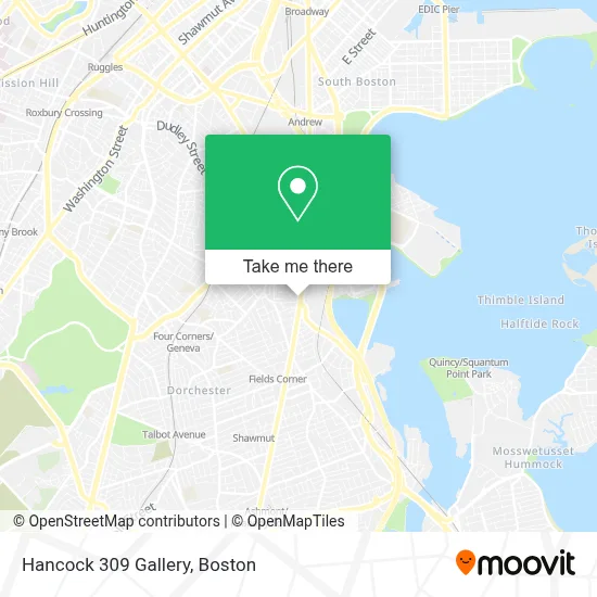
See Hancock 309 Gallery, Boston, on the map
Public Transit to Hancock 309 Gallery in Boston
Wondering how to get to Hancock 309 Gallery in Boston? Moovit helps you find the best way to get to Hancock 309 Gallery with step-by-step directions from the nearest public transit station.
Moovit provides free maps and live directions to help you navigate through your city. View schedules, routes, timetables, and find out how long does it take to get to Hancock 309 Gallery in real time.
Looking for the nearest stop or station to Hancock 309 Gallery? Check out this list of stops closest to your destination: Savin Hill - Dorchester Ave @ Bay St; Dorchester Ave @ Melvinside Ter; Bowdoin St @ Winter St; Fields Corner; Jfk/Umass; Four Corners/Geneva; Uphams Corner.
Bus: 15, 18, 201, RED LINE SHUTTLE.Train: FAIRMOUNT, FALL RIVER/NEW BEDFORD, GREENBUSH, KINGSTON, FRANKLIN/FOXBORO, PROVIDENCE/STOUGHTON.Subway: RED LINE.
Want to see if there’s another route that gets you there at an earlier time? Moovit helps you find alternative routes or times. Get directions from and directions to Hancock 309 Gallery easily from the Moovit App or Website.
We make riding to Hancock 309 Gallery easy, which is why over 1.7 million users, including users in Boston, trust Moovit as the best app for public transit. You don’t need to download an individual bus app or train app, Moovit is your all-in-one transit app that helps you find the best bus time or train time available.
For information on prices of bus, subway and train, costs and ride fares to Hancock 309 Gallery, please check the Moovit app.
Use the app to navigate to popular places including to the airport, hospital, stadium, grocery store, mall, coffee shop, school, college, and university.
Hancock 309 Gallery Address: 309 Hancock St street in Boston
- Dorchester,
- Church St & East St,
- Burger King,
- High Profile X Budega of Boston Dispensary,
- Mather School,
- Calvary Church Int'l Min (Calvary Church International),
- 93 Auto Exchange,
- Dorchester,
- Home Improvements of Massachusetts,
- Fair Foods,
- Social Security Office,
- Dorchester, Massachusetts,
- Kelly House,
- Boys And Girls Clubs Of Dorchester Paul R. Mclaughlin Youth Center,
- Actus Consulting Group,
- Dudley Terrace Apartments,
- Melvinside Play Area,
- Mujeres Unidas en Accion,
- Ronan Park,
- Savin Hill
Places Near Hancock 309 Gallery (Boston)
- Cheers, Boston,
- Castle Island, Boston,
- Boston Common, Boston,
- Massachusetts General Hospital, Boston,
- House Of Blues, Boston,
- Boston Convention & Exhibition Center, Boston,
- Wang Theater, Boston,
- Boston Medical Center, Boston,
- Faneuil Hall, Boston,
- Prudential Center, Boston,
- Isabella Stewart Gardner Museum, Boston,
- Mgm Music Hall, Boston,
- Wilbur Theatre, Boston,
- North End, Boston,
- Museum Of Science, Boston,
- Td Garden, Boston,
- Boston Children's Hospital, Boston,
- Quincy Market, Boston,
- Leader Bank Pavilion (Leader Bank Pavillion), Boston,
- Seaport District, Boston
How to get to popular places in Boston with public transit
Get around Boston by public transit!
Traveling around Boston has never been so easy. See step by step directions as you travel to any attraction, street or major public transit station. View bus and train schedules, arrival times, service alerts and detailed routes on a map, so you know exactly how to get to anywhere in Boston.
When traveling to any destination around Boston use Moovit's Live Directions with Get Off Notifications to know exactly where and how far to walk, how long to wait for your line, and how many stops are left. Moovit will alert you when it's time to get off — no need to constantly re-check whether yours is the next stop.
Wondering how to use public transit in Boston or how to pay for public transit in Boston? Moovit public transit app can help you navigate your way with public transit easily, and at minimum cost. It includes public transit fees, ticket prices, and costs. Looking for a map of Boston public transit lines? Moovit public transit app shows all public transit maps in Boston with all Bus, Train, Subway and Ferry routes and stops on an interactive map.
Boston has 4 transit type(s), including: Bus, Train, Subway and Ferry, operated by several transit agencies, including MBTA, Southeastern Regional Transit Authority, MetroWest Regional Transit Authority, Rhode Island Public Transit Authority, WRTA, Lowell Regional Transit Authority, Merrimack Valley Transit, Montachusett Regional Transit Authority, Cape Cod Regional Transit Authority, Brockton Area Transit Authority, Martha's Vineyard Transit Authority, the WAVE - Nantucket Regional Transit Authority, GATRA, Cape Ann Transportation Authority and Massport