Directions to Hancock Estates (Newton) with public transportation
The following transit lines have routes that pass near Hancock Estates
 Bus: 51, 60, 37.
- Train: NEEDHAM.
- Subway: GREEN LINE D.
How to get to Hancock Estates by bus?
Click on the bus route to see step by step directions with maps, line arrival times and updated time schedules.
From Agganis Arena, Boston
73 minFrom Tufts Medical Center MBTA Station - Orange & Silver Line, Boston
79 minFrom Wilbur Theatre, Boston
77 minFrom Target Fenway, Boston
56 minFrom Cambria Hotel, Boston
98 minFrom Market Basket, Somerville
98 minFrom Courtyard South Boston (COURTYARD by Marriott), Boston
79 minFrom Doubletree-Boston Bayside, Boston
94 minFrom Encore, Boston
78 minFrom AMC Theatres-Boston Common 19, Boston
79 min
How to get to Hancock Estates by train?
Click on the train route to see step by step directions with maps, line arrival times and updated time schedules.
From Agganis Arena, Boston
105 minFrom Tufts Medical Center MBTA Station - Orange & Silver Line, Boston
70 minFrom Wilbur Theatre, Boston
68 minFrom Target Fenway, Boston
91 minFrom Cambria Hotel, Boston
79 minFrom Courtyard South Boston (COURTYARD by Marriott), Boston
106 minFrom Doubletree-Boston Bayside, Boston
89 minFrom Encore, Boston
66 minFrom AMC Theatres-Boston Common 19, Boston
71 min
How to get to Hancock Estates by subway?
Click on the subway route to see step by step directions with maps, line arrival times and updated time schedules.
From Agganis Arena, Boston
77 minFrom Tufts Medical Center MBTA Station - Orange & Silver Line, Boston
71 minFrom Wilbur Theatre, Boston
70 minFrom Target Fenway, Boston
60 minFrom Cambria Hotel, Boston
80 minFrom Market Basket, Somerville
100 minFrom Courtyard South Boston (COURTYARD by Marriott), Boston
89 minFrom Doubletree-Boston Bayside, Boston
91 minFrom Encore, Boston
75 minFrom AMC Theatres-Boston Common 19, Boston
66 min
Subway station near Hancock Estates in Newton
- Chestnut Hill, 11 min walk,VIEW
Bus stop near Hancock Estates in Newton
- Corey St @ Lagrange St, 17 min walk,VIEW
Train station near Hancock Estates in Newton
- West Roxbury, 37 min walk,VIEW
Bus lines to Hancock Estates in Newton
- 37, Lagrange & Corey,VIEW
What are the closest stations to Hancock Estates?
The closest stations to Hancock Estates are:
- Chestnut Hill is 862 yards away, 11 min walk.
- Corey St @ Lagrange St is 1415 yards away, 17 min walk.
- West Roxbury is 3126 yards away, 37 min walk.
Which bus lines stop near Hancock Estates?
These bus lines stop near Hancock Estates: 51, 60.
Which train line stops near Hancock Estates?
NEEDHAM (#625 | Needham Heights)
Which subway line stops near Hancock Estates?
GREEN LINE D (Riverside)
What’s the nearest subway station to Hancock Estates in Newton?
The nearest subway station to Hancock Estates in Newton is Chestnut Hill. It’s a 11 min walk away.
What time is the first subway to Hancock Estates in Newton?
The GREEN LINE D is the first subway that goes to Hancock Estates in Newton. It stops nearby at 4:54 AM.
What time is the last subway to Hancock Estates in Newton?
The GREEN LINE D is the last subway that goes to Hancock Estates in Newton. It stops nearby at 2:37 AM.
What time is the first train to Hancock Estates in Newton?
The NEEDHAM is the first train that goes to Hancock Estates in Newton. It stops nearby at 7:22 AM.
What time is the last train to Hancock Estates in Newton?
The NEEDHAM is the last train that goes to Hancock Estates in Newton. It stops nearby at 6:18 PM.
What time is the first bus to Hancock Estates in Newton?
The 37 is the first bus that goes to Hancock Estates in Newton. It stops nearby at 6:15 AM.
What time is the last bus to Hancock Estates in Newton?
The 37 is the last bus that goes to Hancock Estates in Newton. It stops nearby at 3:28 PM.
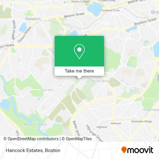
See Hancock Estates, Newton, on the map
Public Transit to Hancock Estates in Newton
Wondering how to get to Hancock Estates in Newton? Moovit helps you find the best way to get to Hancock Estates with step-by-step directions from the nearest public transit station.
Moovit provides free maps and live directions to help you navigate through your city. View schedules, routes, timetables, and find out how long does it take to get to Hancock Estates in real time.
Looking for the nearest stop or station to Hancock Estates? Check out this list of stops closest to your destination: Chestnut Hill; Corey St @ Lagrange St; West Roxbury.
Bus: 51, 60, 37.Train: NEEDHAM.Subway: GREEN LINE D.
Want to see if there’s another route that gets you there at an earlier time? Moovit helps you find alternative routes or times. Get directions from and directions to Hancock Estates easily from the Moovit App or Website.
We make riding to Hancock Estates easy, which is why over 1.7 million users, including users in Newton, trust Moovit as the best app for public transit. You don’t need to download an individual bus app or train app, Moovit is your all-in-one transit app that helps you find the best bus time or train time available.
For information on prices of bus, subway and train, costs and ride fares to Hancock Estates, please check the Moovit app.
Use the app to navigate to popular places including to the airport, hospital, stadium, grocery store, mall, coffee shop, school, college, and university.
Hancock Estates Address: 200 Estate Dr street in Newton
- Edith C. Baker School,
- Skyline Park,
- Front Landfill Park,
- Robert T. Lynch Municipal Golf Course,
- Green Mountain Consulting,
- Hancock Village Apartments,
- Holyhood Cemetery Association,
- Hancock Woods Reservation,
- Atrius Health,
- Chestnut Hill-West Roxbury - Harvard Vanguard,
- Harvard Vanguard Medical Associates,
- Shred Nations,
- CC Masonry & Restoration,
- Mane Tame Hair,
- Skymaxrealty,
- Signet Electronic Systems-Abt,
- Citizens Bank,
- Lowe Associates Architecture,
- Mal's Landscape & Design,
- Foley Ticket Agency
Places Near Hancock Estates (Newton)
- Castle Island, Boston,
- Faneuil Hall, Boston,
- Boston Common, Boston,
- Cheers, Boston,
- Boston Convention & Exhibition Center, Boston,
- House Of Blues, Boston,
- Boston Children's Hospital, Boston,
- Wilbur Theatre, Boston,
- Massachusetts General Hospital, Boston,
- Leader Bank Pavilion (Leader Bank Pavillion), Boston,
- Boston Medical Center, Boston,
- Quincy Market, Boston,
- Isabella Stewart Gardner Museum, Boston,
- Prudential Center, Boston,
- Td Garden, Boston,
- North End, Boston,
- Seaport District, Boston,
- Wang Theater, Boston,
- Museum Of Science, Boston,
- Mgm Music Hall, Boston
How to get to popular places in Boston with public transit
Get around Newton by public transit!
Traveling around Newton has never been so easy. See step by step directions as you travel to any attraction, street or major public transit station. View bus and train schedules, arrival times, service alerts and detailed routes on a map, so you know exactly how to get to anywhere in Newton.
When traveling to any destination around Newton use Moovit's Live Directions with Get Off Notifications to know exactly where and how far to walk, how long to wait for your line, and how many stops are left. Moovit will alert you when it's time to get off — no need to constantly re-check whether yours is the next stop.
Wondering how to use public transit in Newton or how to pay for public transit in Newton? Moovit public transit app can help you navigate your way with public transit easily, and at minimum cost. It includes public transit fees, ticket prices, and costs. Looking for a map of Newton public transit lines? Moovit public transit app shows all public transit maps in Newton with all Bus, Train, Subway and Ferry routes and stops on an interactive map.
Boston has 4 transit type(s), including: Bus, Train, Subway and Ferry, operated by several transit agencies, including MBTA, Southeastern Regional Transit Authority, MetroWest Regional Transit Authority, Rhode Island Public Transit Authority, WRTA, Lowell Regional Transit Authority, Merrimack Valley Transit, Montachusett Regional Transit Authority, Cape Cod Regional Transit Authority, Brockton Area Transit Authority, Martha's Vineyard Transit Authority, the WAVE - Nantucket Regional Transit Authority, GATRA, Cape Ann Transportation Authority and Massport