Directions to Hand In Hand Christian Preschool (Boston) with public transportation
The following transit lines have routes that pass near Hand In Hand Christian Preschool
 Bus: 1, 72, 75.
- Train: PROVIDENCE/STOUGHTON, FOXBORO EVENT SERVICE.
How to get to Hand In Hand Christian Preschool by bus?
Click on the bus route to see step by step directions with maps, line arrival times and updated time schedules.
How to get to Hand In Hand Christian Preschool by train?
Click on the train route to see step by step directions with maps, line arrival times and updated time schedules.
Bus stop near Hand In Hand Christian Preschool in Boston
- Lonsdale Opposite Bindord, 3 min walk,VIEW
Train station near Hand In Hand Christian Preschool in Boston
- Pawtucket/Central Falls, 16 min walk,VIEW
Bus lines to Hand In Hand Christian Preschool in Boston
- 75, Pawtucket Transit Center,VIEW
What are the closest stations to Hand In Hand Christian Preschool?
The closest stations to Hand In Hand Christian Preschool are:
- Lonsdale Opposite Bindord is 246 yards away, 3 min walk.
- Pawtucket/Central Falls is 1302 yards away, 16 min walk.
Which bus lines stop near Hand In Hand Christian Preschool?
These bus lines stop near Hand In Hand Christian Preschool: 1, 72, 75.
Which train line stops near Hand In Hand Christian Preschool?
PROVIDENCE/STOUGHTON (#825 | Providence)
What’s the nearest train station to Hand In Hand Christian Preschool in Boston?
The nearest train station to Hand In Hand Christian Preschool in Boston is Pawtucket/Central Falls. It’s a 16 min walk away.
What’s the nearest bus station to Hand In Hand Christian Preschool in Boston?
The nearest bus station to Hand In Hand Christian Preschool in Boston is Lonsdale Opposite Bindord. It’s a 3 min walk away.
What time is the first train to Hand In Hand Christian Preschool in Boston?
The PROVIDENCE/STOUGHTON is the first train that goes to Hand In Hand Christian Preschool in Boston. It stops nearby at 4:16 AM.
What time is the last train to Hand In Hand Christian Preschool in Boston?
The PROVIDENCE/STOUGHTON is the last train that goes to Hand In Hand Christian Preschool in Boston. It stops nearby at 12:56 AM.
What time is the first bus to Hand In Hand Christian Preschool in Boston?
The 75 is the first bus that goes to Hand In Hand Christian Preschool in Boston. It stops nearby at 6:27 AM.
What time is the last bus to Hand In Hand Christian Preschool in Boston?
The 75 is the last bus that goes to Hand In Hand Christian Preschool in Boston. It stops nearby at 6:05 PM.
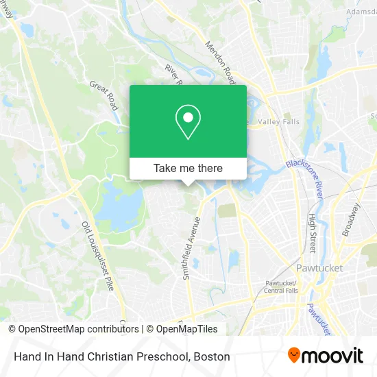
See Hand In Hand Christian Preschool, Boston, on the map
Public Transit to Hand In Hand Christian Preschool in Boston
Wondering how to get to Hand In Hand Christian Preschool in Boston? Moovit helps you find the best way to get to Hand In Hand Christian Preschool with step-by-step directions from the nearest public transit station.
Moovit provides free maps and live directions to help you navigate through your city. View schedules, routes, timetables, and find out how long does it take to get to Hand In Hand Christian Preschool in real time.
Looking for the nearest stop or station to Hand In Hand Christian Preschool? Check out this list of stops closest to your destination: Lonsdale Opposite Bindord; Pawtucket/Central Falls.
Bus: 1, 72, 75.Train: PROVIDENCE/STOUGHTON, FOXBORO EVENT SERVICE.
Want to see if there’s another route that gets you there at an earlier time? Moovit helps you find alternative routes or times. Get directions from and directions to Hand In Hand Christian Preschool easily from the Moovit App or Website.
We make riding to Hand In Hand Christian Preschool easy, which is why over 1.7 million users, including users in Boston, trust Moovit as the best app for public transit. You don’t need to download an individual bus app or train app, Moovit is your all-in-one transit app that helps you find the best bus time or train time available.
For information on prices of bus and train, costs and ride fares to Hand In Hand Christian Preschool, please check the Moovit app.
Use the app to navigate to popular places including to the airport, hospital, stadium, grocery store, mall, coffee shop, school, college, and university.
Hand In Hand Christian Preschool Address: 55 Woodland St street in Boston
- Lincoln Dental Care LL,
- Deer Hunter,
- Golden Roads Adult Day Center,
- Dancing with the Doctors Ri,
- J C Fitness & Wellness,
- Taco Dul Mundo,
- Zampini Industrial Group,
- Krzystyna Harber Photography,
- Approved Storage & Waste Hauling,
- The Dancing Loon Aerial Studio,
- Just Countertops,
- Coleman Locksmiths,
- Cores Unlimited,
- Sayles Mill Realty,
- Zaks Salon,
- Pakistani Food & Sweets,
- Central Falls Locksmith Gold Star,
- Iglesia Adventista Hispana en Central Falls Ri,
- Gustavo Castillo,
- Pams Front Street Grill
Places Near Hand In Hand Christian Preschool (Boston)
- Wang Theater, Boston,
- Boston Children's Hospital, Boston,
- Seaport District, Boston,
- Faneuil Hall, Boston,
- Cheers, Boston,
- Massachusetts General Hospital, Boston,
- Td Garden, Boston,
- Boston Common, Boston,
- Museum Of Science, Boston,
- Isabella Stewart Gardner Museum, Boston,
- North End, Boston,
- Mgm Music Hall, Boston,
- Wilbur Theatre, Boston,
- House Of Blues, Boston,
- Boston Convention & Exhibition Center, Boston,
- Boston Medical Center, Boston,
- Castle Island, Boston,
- Quincy Market, Boston,
- Prudential Center, Boston,
- Leader Bank Pavilion (Leader Bank Pavillion), Boston
How to get to popular places in Boston with public transit
Get around Boston by public transit!
Traveling around Boston has never been so easy. See step by step directions as you travel to any attraction, street or major public transit station. View bus and train schedules, arrival times, service alerts and detailed routes on a map, so you know exactly how to get to anywhere in Boston.
When traveling to any destination around Boston use Moovit's Live Directions with Get Off Notifications to know exactly where and how far to walk, how long to wait for your line, and how many stops are left. Moovit will alert you when it's time to get off — no need to constantly re-check whether yours is the next stop.
Wondering how to use public transit in Boston or how to pay for public transit in Boston? Moovit public transit app can help you navigate your way with public transit easily, and at minimum cost. It includes public transit fees, ticket prices, and costs. Looking for a map of Boston public transit lines? Moovit public transit app shows all public transit maps in Boston with all Bus, Train, Subway and Ferry routes and stops on an interactive map.
Boston has 4 transit type(s), including: Bus, Train, Subway and Ferry, operated by several transit agencies, including MBTA, Southeastern Regional Transit Authority, MetroWest Regional Transit Authority, Rhode Island Public Transit Authority, WRTA, Lowell Regional Transit Authority, Merrimack Valley Transit, Montachusett Regional Transit Authority, Cape Cod Regional Transit Authority, Brockton Area Transit Authority, Martha's Vineyard Transit Authority, the WAVE - Nantucket Regional Transit Authority, GATRA, Cape Ann Transportation Authority and Massport