Directions to Harvard China Fund (Cambridge) with public transportation
The following transit lines have routes that pass near Harvard China Fund
 Bus: 1, 109, 69, 86.
- Train: FITCHBURG, FRAMINGHAM/WORCESTER.
- Subway: RED LINE, GREEN LINE D, GREEN LINE E, GREEN LINE B, GREEN LINE C.
How to get to Harvard China Fund by bus?
Click on the bus route to see step by step directions with maps, line arrival times and updated time schedules.
From Uscis Biometrics Office, Revere
73 minFrom Haymarket, Boston, Boston
56 minFrom MBTA Jackson Square Station, Boston
59 minFrom Four Points by Sheraton Boston Logan Airport, Revere
72 minFrom Waltham, MA, Waltham
59 minFrom Lemuel Shattuck Hospital, Boston
81 minFrom 7F Everett Street, Revere
72 minFrom World Trade Center MBTA Station - Silver Line, Boston
57 minFrom Comfort Inn & Suites Logan International Airport, Revere
74 minFrom John F. Kennedy Presidential Library And Museum, Boston
72 min
How to get to Harvard China Fund by train?
Click on the train route to see step by step directions with maps, line arrival times and updated time schedules.
How to get to Harvard China Fund by subway?
Click on the subway route to see step by step directions with maps, line arrival times and updated time schedules.
From Uscis Biometrics Office, Revere
60 minFrom Haymarket, Boston, Boston
36 minFrom MBTA Jackson Square Station, Boston
40 minFrom Lemuel Shattuck Hospital, Boston
59 minFrom 7F Everett Street, Revere
60 minFrom World Trade Center MBTA Station - Silver Line, Boston
44 minFrom Comfort Inn & Suites Logan International Airport, Revere
62 minFrom John F. Kennedy Presidential Library And Museum, Boston
56 min
Bus stops near Harvard China Fund in Cambridge
Subway stations near Harvard China Fund in Cambridge
Train station near Harvard China Fund in Cambridge
- Porter, 28 min walk,VIEW
Bus lines to Harvard China Fund in Cambridge
What are the closest stations to Harvard China Fund?
The closest stations to Harvard China Fund are:
- Cambridge St @ Trowbridge St is 92 yards away, 2 min walk.
- Massachusetts Ave @ Bow St is 129 yards away, 2 min walk.
- Quincy St @ Harvard St is 176 yards away, 3 min walk.
- Harvard - Massachusetts Ave Opp Linden St is 297 yards away, 4 min walk.
- Kirkland St @ Kirkland Place is 329 yards away, 4 min walk.
- Broadway @ Felton St is 392 yards away, 5 min walk.
- Central is 772 yards away, 10 min walk.
- Union Square is 1633 yards away, 20 min walk.
- Gilman Square is 1720 yards away, 21 min walk.
- Porter is 2332 yards away, 28 min walk.
Which bus lines stop near Harvard China Fund?
These bus lines stop near Harvard China Fund: 1, 109, 69, 86.
Which train lines stop near Harvard China Fund?
These train lines stop near Harvard China Fund: FITCHBURG, FRAMINGHAM/WORCESTER.
Which subway line stops near Harvard China Fund?
RED LINE (Alewife)
What’s the nearest subway station to Harvard China Fund in Cambridge?
The nearest subway station to Harvard China Fund in Cambridge is Central. It’s a 10 min walk away.
What’s the nearest train station to Harvard China Fund in Cambridge?
The nearest train station to Harvard China Fund in Cambridge is Porter. It’s a 28 min walk away.
What’s the nearest bus station to Harvard China Fund in Cambridge?
The nearest bus stations to Harvard China Fund in Cambridge are Cambridge St @ Trowbridge St and Massachusetts Ave @ Bow St. The closest one is a 2 min walk away.
What time is the first subway to Harvard China Fund in Cambridge?
The GREEN LINE E is the first subway that goes to Harvard China Fund in Cambridge. It stops nearby at 4:50 AM.
What time is the last subway to Harvard China Fund in Cambridge?
The GREEN LINE E is the last subway that goes to Harvard China Fund in Cambridge. It stops nearby at 2:36 AM.
What time is the first train to Harvard China Fund in Cambridge?
The FITCHBURG is the first train that goes to Harvard China Fund in Cambridge. It stops nearby at 5:47 AM.
What time is the last train to Harvard China Fund in Cambridge?
The FITCHBURG is the last train that goes to Harvard China Fund in Cambridge. It stops nearby at 12:17 AM.
What time is the first bus to Harvard China Fund in Cambridge?
The 109 is the first bus that goes to Harvard China Fund in Cambridge. It stops nearby at 4:58 AM.
What time is the last bus to Harvard China Fund in Cambridge?
The 1 is the last bus that goes to Harvard China Fund in Cambridge. It stops nearby at 2:34 AM.
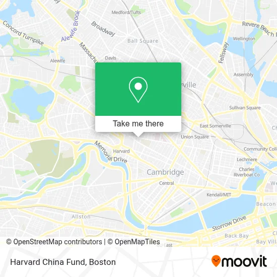
See Harvard China Fund, Cambridge, on the map
Public Transit to Harvard China Fund in Cambridge
Wondering how to get to Harvard China Fund in Cambridge? Moovit helps you find the best way to get to Harvard China Fund with step-by-step directions from the nearest public transit station.
Moovit provides free maps and live directions to help you navigate through your city. View schedules, routes, timetables, and find out how long does it take to get to Harvard China Fund in real time.
Looking for the nearest stop or station to Harvard China Fund? Check out this list of stops closest to your destination: Cambridge St @ Trowbridge St; Massachusetts Ave @ Bow St; Quincy St @ Harvard St; Harvard - Massachusetts Ave Opp Linden St; Kirkland St @ Kirkland Place; Broadway @ Felton St; Central; Union Square; Gilman Square; Porter.
Bus: 1, 109, 69, 86.Train: FITCHBURG, FRAMINGHAM/WORCESTER.Subway: RED LINE, GREEN LINE D, GREEN LINE E, GREEN LINE B, GREEN LINE C.
Want to see if there’s another route that gets you there at an earlier time? Moovit helps you find alternative routes or times. Get directions from and directions to Harvard China Fund easily from the Moovit App or Website.
We make riding to Harvard China Fund easy, which is why over 1.7 million users, including users in Cambridge, trust Moovit as the best app for public transit. You don’t need to download an individual bus app or train app, Moovit is your all-in-one transit app that helps you find the best bus time or train time available.
For information on prices of bus, subway and train, costs and ride fares to Harvard China Fund, please check the Moovit app.
Use the app to navigate to popular places including to the airport, hospital, stadium, grocery store, mall, coffee shop, school, college, and university.
Harvard China Fund Address: 1730 Cambridge St street in Cambridge
- Tsai Auditorium - CGIS South,
- GSD CSFP,
- La Officina De Durand Y Mondt,
- Campion Residence and Renewal Center,
- Chauhaus,
- Harvard University-Graduate School of Design,
- Sanders Theatre,
- Fogg Museum Of Art,
- Swedenborg Musalla,
- Harvard Art Museum,
- Middlesex County Jail,
- Littauer Lot,
- Irving House at Harvard Cambridge,
- Metalab Harvard,
- Treadwell - Sparks House,
- Cambridge Rindge & Latin High School,
- Clover Food Lab,
- The Institute for Meditation and Psychotherapy,
- Harvard Barker Center,
- 9kpl
Places Near Harvard China Fund (Cambridge)
- Td Garden, Boston,
- Wilbur Theatre, Boston,
- Seaport District, Boston,
- Faneuil Hall, Boston,
- Wang Theater, Boston,
- Leader Bank Pavilion (Leader Bank Pavillion), Boston,
- Boston Medical Center, Boston,
- Castle Island, Boston,
- North End, Boston,
- Boston Convention & Exhibition Center, Boston,
- Mgm Music Hall, Boston,
- Isabella Stewart Gardner Museum, Boston,
- Boston Common, Boston,
- Quincy Market, Boston,
- Prudential Center, Boston,
- House Of Blues, Boston,
- Boston Children's Hospital, Boston,
- Massachusetts General Hospital, Boston,
- Museum Of Science, Boston,
- Cheers, Boston
How to get to popular places in Boston with public transit
Get around Cambridge by public transit!
Traveling around Cambridge has never been so easy. See step by step directions as you travel to any attraction, street or major public transit station. View bus and train schedules, arrival times, service alerts and detailed routes on a map, so you know exactly how to get to anywhere in Cambridge.
When traveling to any destination around Cambridge use Moovit's Live Directions with Get Off Notifications to know exactly where and how far to walk, how long to wait for your line, and how many stops are left. Moovit will alert you when it's time to get off — no need to constantly re-check whether yours is the next stop.
Wondering how to use public transit in Cambridge or how to pay for public transit in Cambridge? Moovit public transit app can help you navigate your way with public transit easily, and at minimum cost. It includes public transit fees, ticket prices, and costs. Looking for a map of Cambridge public transit lines? Moovit public transit app shows all public transit maps in Cambridge with all Bus, Train, Subway and Ferry routes and stops on an interactive map.
Boston has 4 transit type(s), including: Bus, Train, Subway and Ferry, operated by several transit agencies, including MBTA, Southeastern Regional Transit Authority, MetroWest Regional Transit Authority, Rhode Island Public Transit Authority, WRTA, Lowell Regional Transit Authority, Merrimack Valley Transit, Montachusett Regional Transit Authority, Cape Cod Regional Transit Authority, Brockton Area Transit Authority, Martha's Vineyard Transit Authority, the WAVE - Nantucket Regional Transit Authority, GATRA, Cape Ann Transportation Authority and Massport