See Hatboro on the map
Directions to Hatboro with public transportation
The following transit lines have routes that pass near Hatboro
 Bus:
Bus: - Train:
How to get to Hatboro by bus?
Click on the bus route to see step by step directions with maps, line arrival times and updated time schedules.
How to get to Hatboro by train?
Click on the train route to see step by step directions with maps, line arrival times and updated time schedules.
Train stations near Hatboro
- Hatboro,1 min walk,
Bus stations near Hatboro
- York Rd & Byberry Rd,5 min walk,
Bus lines to Hatboro
- 22,Warminster,
What are the closest stations to Hatboro?
The closest stations to Hatboro are:
- Hatboro is 52 yards away, 1 min walk.
- York Rd & Byberry Rd is 395 yards away, 5 min walk.
Which bus line stops near Hatboro?
22
Which train line stops near Hatboro?
WARMINSTER LINE
What’s the nearest train station to Hatboro?
The nearest train station to Hatboro is Hatboro. It’s a 1 min walk away.
What’s the nearest bus stop to Hatboro?
The nearest bus stop to Hatboro is York Rd & Byberry Rd. It’s a 5 min walk away.
See Hatboro on the map
Public Transportation to Hatboro
Wondering how to get to Hatboro, United States? Moovit helps you find the best way to get to Hatboro with step-by-step directions from the nearest public transit station.
Moovit provides free maps and live directions to help you navigate through your city. View schedules, routes, timetables, and find out how long does it take to get to Hatboro in real time.
Looking for the nearest stop or station to Hatboro? Check out this list of stops closest to your destination: Hatboro; York Rd & Byberry Rd.
Bus:Train:
Want to see if there’s another route that gets you there at an earlier time? Moovit helps you find alternative routes or times. Get directions from and directions to Hatboro easily from the Moovit App or Website.
We make riding to Hatboro easy, which is why over 1.5 million users, including users in Hatboro, trust Moovit as the best app for public transit. You don’t need to download an individual bus app or train app, Moovit is your all-in-one transit app that helps you find the best bus time or train time available.
For information on prices of bus and train, costs and ride fares to Hatboro, please check the Moovit app.
Use the app to navigate to popular places including to the airport, hospital, stadium, grocery store, mall, coffee shop, school, college, and university.
Hatboro Address: S Penn St street in Hatboro
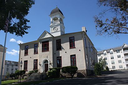
Hatboro is a borough in Montgomery County, Pennsylvania, United States. The population was 7,360 at the 2010 census.Wiki
Attractions near Hatboro
SEPTA R2-Hatboro,Galinski Tillman & Zygmont,Garner House Apartments,Shelly M Greene DDS,Hatboro Podiatry Ctr,Holmes Dental Co,Levy Maurice,Solutions Hair Salon,Hatboro Station,Hatboro Railway Substation,40 South Penn Street,Stephen C Rumpf Plumbing Inc,Clean Freaks,SEPTA Hatboro Station,Hatboro Municipal Parking Lot,Rolling Suds Inc,Mr Jims Furniture,Rumpf Stephen C Plumbing & Heating,Pager Guy,C U Staffing IncHow to get to popular attractions in Hatboro with public transit
The Franklin Fountain, Philadelphia,Sesame Place, Middletown,Wayne, PA, Radnor,Quaker Bridge Mall,Vedge, Philadelphia,The Cheesecake Factory, Golden Triangle,Iron Hill Brewery & Restaurant, West Chester,Westville, NJ, Westville,Amada, Philadelphia,Lansdowne, PA, Lansdowne,John's Roast Pork, Philadelphia,Dalessandro’s Steaks and Hoagies, Philadelphia,Moriarty's Restaurant & Irish Pub, Philadelphia,Geno's Steaks, Philadelphia,Lockheed Martin Rotary and Mission Systems,Maggiano's Little Italy, King Of Prussia,SEPTA Conshohocken Station, Conshohocken,McCarter Theatre, Princeton,Target, Middletown,The Cheesecake Factory, Willow GroveGet around Hatboro by public transit!
Traveling around Hatboro has never been so easy. See step by step directions as you travel to any attraction, street or major public transit station. View bus and train schedules, arrival times, service alerts and detailed routes on a map, so you know exactly how to get to anywhere in Hatboro.
When traveling to any destination around Hatboro use Moovit's Live Directions with Get Off Notifications to know exactly where and how far to walk, how long to wait for your line, and how many stops are left. Moovit will alert you when it's time to get off — no need to constantly re-check whether yours is the next stop.
Wondering how to use public transit in Hatboro or how to pay for public transit in Hatboro? Moovit public transit app can help you navigate your way with public transit easily, and at minimum cost. It includes public transit fees, ticket prices, and costs. Looking for a map of Hatboro public transit lines? Moovit public transit app shows all public transit maps in Hatboro with all bus or train routes and stops on an interactive map.
Hatboro has 2 transit type(s), including: bus or train, operated by several transit agencies, including SEPTA Subway, SEPTA Trolley, SEPTA Rail, SEPTA, SEPTA, NJ TRANSIT RAIL-Rail, NJ TRANSIT RAIL-Tram, NJ TRANSIT BUS, Port Authority Transit Corporation, Navy Yard, Penn Transit, Drexel University, Pottstown Area Rapid Transit (PART), Fullington Tours and Chescobus