Directions to Havalimani İstasyonu (Bakirköy) with public transportation
The following transit lines have routes that pass near Havalimani İstasyonu
How to get to Havalimani İstasyonu by bus?
Click on the bus route to see step by step directions with maps, line arrival times and updated time schedules.
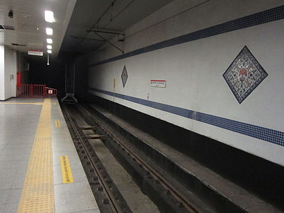
How to get to Havalimani İstasyonu by metro?
Click on the metro route to see step by step directions with maps, line arrival times and updated time schedules.
Which bus lines stop near Havalimani İstasyonu?
These bus lines stop near Havalimani İstasyonu: TH-1, YH-1.
Which metro line stops near Havalimani İstasyonu?
M1A
See Havalimani İstasyonu, Bakirköy, on the map
Public Transit to Havalimani İstasyonu in Bakirköy
Wondering how to get to Havalimani İstasyonu in Bakirköy, Turkey? Moovit helps you find the best way to get to Havalimani İstasyonu with step-by-step directions from the nearest public transit station.
Moovit provides free maps and live directions to help you navigate through your city. View schedules, routes, timetables, and find out how long does it take to get to Havalimani İstasyonu in real time.
Bus:TH-1YH-1Metro:M1A
Want to see if there’s another route that gets you there at an earlier time? Moovit helps you find alternative routes or times. Get directions from and directions to Havalimani İstasyonu easily from the Moovit App or Website.
We make riding to Havalimani İstasyonu easy, which is why over 1.5 million users, including users in Bakirköy, trust Moovit as the best app for public transit. You don’t need to download an individual bus app or train app, Moovit is your all-in-one transit app that helps you find the best bus time or train time available.
For information on prices of bus, metro and Dolmus & Minibus, costs and ride fares to Havalimani İstasyonu, please check the Moovit app.
Use the app to navigate to popular places including to the airport, hospital, stadium, grocery store, mall, coffee shop, school, college, and university.
Location: Bakirköy, Istanbul
Attractions near Havalimani İstasyonu
Atatürk Havalimanı Metro İstasyonu,Fatih Tatlıcısı,Tandee's Waiting Area,Turknenistan Airlines,Ataturk Havalimani Esnsf Kokantasi,atatürk havalimanı iştima yeri,TAV Güvenlik Dış Hatlar İstirahat Odası,Havalimanı,Demlik,TK001 İstanbul Newyork,gate 223 duty free,Atatürk Havalimanı,Ataturk Hava Alanı Mert Turizm,Figen's Office,Baf Tour & Travel Agency,Atatürk Airport Demlik,Ataturk Airport - suudi Arabistan,Havaş,WOW Airport Otel Yari Açık Nöbet Sarayı,Ata Haber ajansıHow to get to popular attractions in Bakirköy with public transit
Başakşehir Belediyesi Nikah Sarayı, Basaksehir,GOSB (Gebze Organize Sanayi Bölgesi), Gebze,Eyüp Park AVM, Eyüp,Doğuş Üniversitesi Dudullu Yerleşkesi, Ümraniye,Kumburgaz, Büyükçekmece,İBB Florya Sosyal Tesisleri, Bakirköy,Bakırköy Cumartesi Pazarı, Bakirköy,Pendik Devlet Hastanesi, Pendik,Acıbadem Fulya Hastanesi, Beşiktaş,Eski Büyükdere İskelesi, Sariyer,Capacity Avm, Bakirköy,Mecidiyeköy Metrobüs Durağı, Şişli,kanuni sultan suleyman hastanesi, Küçükçekmece,Ataşehir Dudullu Terminali, Ataşehir,Topkapı İETT Durağı,Pendik - Kurtköy Minibüs Hattı, Pendik,Bakırköy - İncirli Metro İstasyonu, Bakirköy,Kalamış Sahili, Kadıköy,Beylikdüzü Atatürk Kültür ve Sanat Merkezi, Beylikduzu,Istiklal Caddesi, Taksim, BeyoğluGet around Bakirköy by public transit!
Traveling around Bakirköy has never been so easy. See step by step directions as you travel to any attraction, street or major public transit station. View bus and train schedules, arrival times, service alerts and detailed routes on a map, so you know exactly how to get to anywhere in Bakirköy.
When traveling to any destination around Bakirköy use Moovit's Live Directions with Get Off Notifications to know exactly where and how far to walk, how long to wait for your line, and how many stops are left. Moovit will alert you when it's time to get off — no need to constantly re-check whether yours is the next stop.
Wondering how to use public transit in Bakirköy or how to pay for public transit in Bakirköy? Moovit public transit app can help you navigate your way with public transit easily, and at minimum cost. It includes public transit fees, ticket prices, and costs. Looking for a map of Bakirköy public transit lines? Moovit public transit app shows all public transit maps in Bakirköy with all bus, metro or Dolmus & Minibus routes and stops on an interactive map.
Bakirköy has 3 transit type(s), including: bus, metro or Dolmus & Minibus, operated by several transit agencies, including Metro İstanbul, UAB, Marmaray, Metrobüs, UAB, Metro İstanbul, İETT, İETT, Şehir Hatları, Dentur Avrasya, Beyden, Turyol, Mavi Marmara, Prenstur and İETT