How to get to Hawk B blok by bus?
Click on the bus route to see step by step directions with maps, line arrival times and updated time schedules.
From Gültepe, Kagithane
91 minFrom Yedikule, Fatih
145 minFrom Marmaray Sirkeci İstasyonu, Sirkeci, Fatih
121 minFrom Kanyon AVM, Levent, Beşiktaş
53 minFrom Ayvansaray Metrobüs Durağı, Eyüp
88 minFrom Maltepe Devlet Hastanesi, Maltepe
60 minFrom Zincirlikuyu, Şişli
43 minFrom E3 4. Levent - Sabiha Gökçen Havalimanı, Levent, Beşiktaş
92 minFrom Cinci Arif Hoca, Fatih
84 min
How to get to Hawk B blok by train?
Click on the train route to see step by step directions with maps, line arrival times and updated time schedules.
How to get to Hawk B blok by metro?
Click on the metro route to see step by step directions with maps, line arrival times and updated time schedules.
Dolmus & Minibus stations near Hawk B blok in Kadıköy
Bus stops near Hawk B blok in Kadıköy
Metro station near Hawk B blok in Kadıköy
- Acıbadem, 7 min walk,VIEW
Metrobus station near Hawk B blok in Kadıköy
- Fikirtepe, 17 min walk,VIEW
Bus lines to Hawk B blok in Kadıköy
- 8A, Batı Ataşehir Peronlar-Kadıköy,VIEW
- 10B, Kadıköy-Bostancı Peronlar,VIEW
- HVL6, İstanbul Havalimanı ✈,VIEW
- C116, Üsküdar - Palladium - Ferhatpaşa,VIEW
- C116, Üsküdar - Ataşehir - Ferhatpaşa,VIEW
- 3B, Kadıköy - Ünalan Mahallesi,VIEW
- 5, Valievleri - Üsküdar,VIEW
- E-10, Sabiha Gökçen Havalimanı / Kurtköy - Kadıköy,VIEW
- 11T, Acarlar Sitesi - Harem,VIEW
- 13M, Şerifali - Üsküdar,VIEW
- 14A, Özyeğin Üniversitesi / Alemdağ - Kadıköy,VIEW
- 14BK, Çekmeköy/Parseller Mah-Kadıköy,VIEW
- 14DK, İnkılap Mahallesi - Libadiye Caddesi / Kadıköy,VIEW
- 15BK, Dereseki / Beykoz - Kadıköy,VIEW
- 15TK, Tokatköy-Kadıköy,VIEW
- 16A, Pendik - Üsküdar,VIEW
- 16F, Fındıklı Mahallesi - Harem,VIEW
- 16M, Acarlar Sitesi / Ataşehir - Üsküdar,VIEW
- 16S, S. G. Havalimanı - Uzunçayır Metrobüs/Harem Peronlar,VIEW
- 16U, Uğur Mumcu - Üsküdar,VIEW
What are the closest stations to Hawk B blok?
The closest stations to Hawk B blok are:
- Şehit Er Bülent Altınsoy - Kadıköy Yönü is 263 meters away, 5 min walk.
- Müverrih Ata Sokak - Kadiköy Yönü is 306 meters away, 5 min walk.
- İncirlibostan - Kadıköy Yönü is 459 meters away, 7 min walk.
- Acıbadem is 507 meters away, 7 min walk.
- Acıbadem Metro (Havaist) is 531 meters away, 8 min walk.
- Acıbadem Metro - Tuzla Yönü is 1033 meters away, 14 min walk.
- Acıbadem Metro - Kadıköy Yönü is 1038 meters away, 14 min walk.
- Fikirtepe is 1268 meters away, 17 min walk.
Which bus lines stop near Hawk B blok?
These bus lines stop near Hawk B blok: 18D, 19EK, 251, 8A.
Which Metrobus line stops near Hawk B blok?
34G (Beylikdüzü > Söğütlüçeşme)
Which metro line stops near Hawk B blok?
M4 (Kadıköy→Sabiha Gökçen Havalimanı)
Which train line stops near Hawk B blok?
B1 (Gebze)
What’s the nearest metro station to Hawk B blok in Kadıköy?
The nearest metro station to Hawk B blok in Kadıköy is Acıbadem. It’s a 7 min walk away.
What’s the nearest bus station to Hawk B blok in Kadıköy?
The nearest bus station to Hawk B blok in Kadıköy is Müverrih Ata Sokak - Kadiköy Yönü. It’s a 5 min walk away.
What’s the nearest Dolmus & Minibus station to Hawk B blok in Kadıköy?
The nearest Dolmus & Minibus station to Hawk B blok in Kadıköy is Şehit Er Bülent Altınsoy - Kadıköy Yönü. It’s a 5 min walk away.
What’s the nearest Metrobus station to Hawk B blok in Kadıköy?
The nearest Metrobus station to Hawk B blok in Kadıköy is Fikirtepe. It’s a 17 min walk away.
What time is the first metro to Hawk B blok in Kadıköy?
The M4 is the first metro that goes to Hawk B blok in Kadıköy. It stops nearby at 3:04 AM.
What time is the last metro to Hawk B blok in Kadıköy?
The M4 is the last metro that goes to Hawk B blok in Kadıköy. It stops nearby at 12:41 AM.
What time is the first bus to Hawk B blok in Kadıköy?
The HVL6 is the first bus that goes to Hawk B blok in Kadıköy. It stops nearby at 3:03 AM.
What time is the last bus to Hawk B blok in Kadıköy?
The 130A is the last bus that goes to Hawk B blok in Kadıköy. It stops nearby at 5:03 AM.
What time is the first Dolmus & Minibus to Hawk B blok in Kadıköy?
The C55 is the first Dolmus & Minibus that goes to Hawk B blok in Kadıköy. It stops nearby at 6:10 AM.
What time is the last Dolmus & Minibus to Hawk B blok in Kadıköy?
The C55 is the last Dolmus & Minibus that goes to Hawk B blok in Kadıköy. It stops nearby at 12:05 AM.
What time is the first Metrobus to Hawk B blok in Kadıköy?
The 34G is the first Metrobus that goes to Hawk B blok in Kadıköy. It stops nearby at 3:00 AM.
What time is the last Metrobus to Hawk B blok in Kadıköy?
The 34G is the last Metrobus that goes to Hawk B blok in Kadıköy. It stops nearby at 4:32 AM.
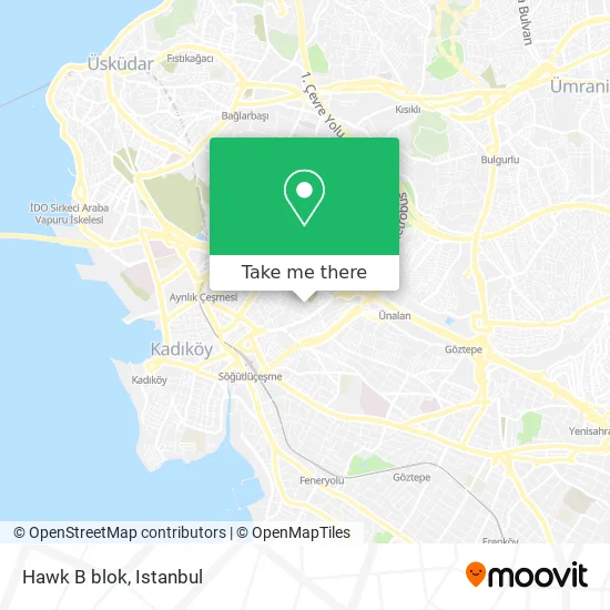
See Hawk B blok, Kadıköy, on the map
Public Transit to Hawk B blok in Kadıköy
Wondering how to get to Hawk B blok in Kadıköy? Moovit helps you find the best way to get to Hawk B blok with step-by-step directions from the nearest public transit station.
Moovit provides free maps and live directions to help you navigate through your city. View schedules, routes, timetables, and find out how long does it take to get to Hawk B blok in real time.
Looking for the nearest stop or station to Hawk B blok? Check out this list of stops closest to your destination: Şehit Er Bülent Altınsoy - Kadıköy Yönü; Müverrih Ata Sokak - Kadiköy Yönü; İncirlibostan - Kadıköy Yönü; Acıbadem; Acıbadem Metro (Havaist); Acıbadem Metro - Tuzla Yönü; Acıbadem Metro - Kadıköy Yönü; Fikirtepe.
Bus: 18D, 19EK, 251, 8A, 10B, HVL6, C116, C116, 3B, 5, E-10.Metrobus: 34G, 34A, 34AS, 34Z.Metro: M4.Train: B1.Dolmus & Minibus: C55, C65, 8.
Want to see if there’s another route that gets you there at an earlier time? Moovit helps you find alternative routes or times. Get directions from and directions to Hawk B blok easily from the Moovit App or Website.
We make riding to Hawk B blok easy, which is why over 1.7 million users, including users in Kadıköy, trust Moovit as the best app for public transit. You don’t need to download an individual bus app or train app, Moovit is your all-in-one transit app that helps you find the best bus time or train time available.
For information on prices of bus, metro, train, Metrobus and Dolmus & Minibus, costs and ride fares to Hawk B blok, please check the Moovit app.
Use the app to navigate to popular places including to the airport, hospital, stadium, grocery store, mall, coffee shop, school, college, and university.
Location: Kadıköy, Istanbul
- Müverrih Ata Sokak,
- MED Amerikan Poliklinigi,
- Edagül Çıkmazı Sokak,
- Musavat Sokak, 16,
- Haydarpaşa Gümrük Müdürlüğü,
- Taşocağı Sokak / Tufan Sitesi,
- Yurtiçi Kargo,
- 00000,
- Kadıköy Hasanpaşa Mahallesi,
- Mega Elektronik Ve Talaşlı İmalat Mak. Tic. A.Ş,
- Tesmer,
- Emek Sahnesi,
- kadıköy emek tiyatrosu,
- SERBEST MUHASEBECİ MALİ MÜŞAVİRLER ODASI HAŞANPAŞA ŞUBESİ,
- Global Office Lojistik Ve Gümrükleme A.Ş,
- Kadıköy Kız Anadolu İmam Hatip Lisesi,
- Sarılar İş Merkezi,
- Necip Fazıl Kısakürek Kültür Ve Araştırma Vakfı,
- Dsmart Bayi,
- Gözcübaba Anadolu Lisesi
Places Near Hawk B blok (Kadıköy)
- Mall Of İstanbul, Basaksehir,
- Bakırköy Sosyete Pazarı, Bakirköy,
- Karaköy Genelevi, Karaköy, Beyoğlu,
- İstanbul,
- Başakşehir Çam Ve Sakura Şehir Hastanesi, Basaksehir,
- 41 Burda AVM, Kocaeli Merkezi,
- Mehmet Emin Tokadî Hz. Türbesi, Fatih,
- Hz. Yuşa Tepesi, Beykoz,
- Şehit Prof. Dr. İlhan Varank Eğitim Ve Araştırma Hastanesi, Sancaktepe,
- 2 Nolu Minibüss, Beylikduzu,
- Topkule Kışlası 47.Komando Tugay Komutanlığı, Esenler,
- Hilltown AVM, Maltepe,
- Gebze-Harem Minibüs Hattı, Gebze,
- 212 AVM, Bagcilar,
- İstinye Park, Sariyer,
- Beylikdüzü - 4 Nolu Minibüs Hattı, Beylikduzu,
- Gebze Koop Durağı, Gebze,
- VİALAND AVM, Eyüp,
- METROPOL IsTaNBuL, Ataşehir,
- Tersane İstanbul, Beyoğlu
How to get to popular places in Istanbul with public transit
Get around Kadıköy by public transit!
Traveling around Kadıköy has never been so easy. See step by step directions as you travel to any attraction, street or major public transit station. View bus and train schedules, arrival times, service alerts and detailed routes on a map, so you know exactly how to get to anywhere in Kadıköy.
When traveling to any destination around Kadıköy use Moovit's Live Directions with Get Off Notifications to know exactly where and how far to walk, how long to wait for your line, and how many stops are left. Moovit will alert you when it's time to get off — no need to constantly re-check whether yours is the next stop.
Wondering how to use public transit in Kadıköy or how to pay for public transit in Kadıköy? Moovit public transit app can help you navigate your way with public transit easily, and at minimum cost. It includes public transit fees, ticket prices, and costs. Looking for a map of Kadıköy public transit lines? Moovit public transit app shows all public transit maps in Kadıköy with all Bus, Train, Metro, Tram, Ferry, Metrobus and Dolmus & Minibus routes and stops on an interactive map.
Istanbul has 7 transit type(s), including: Bus, Train, Metro, Tram, Ferry, Metrobus and Dolmus & Minibus, operated by several transit agencies, including Marmaray, Metro İstanbul, Metrobüs, UAB, İETT, İETT ÇIFT KATLI HATLAR, İETT BÖLGESEL HATLAR, TCDD, Şehir Hatları, Dentur Avrasya, Beyden, Turyol, Mavi Marmara, Havaist and Prenstur
