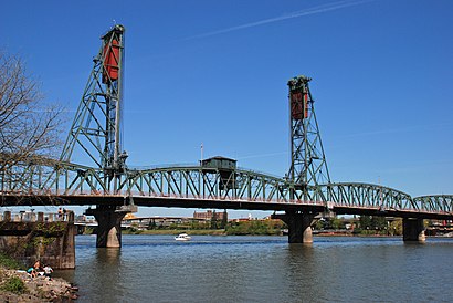
Directions to Hawthorne Bridge (Portland) with public transportation
The following transit lines have routes that pass near Hawthorne Bridge
How to get to Hawthorne Bridge by bus?
Click on the bus route to see step by step directions with maps, line arrival times and updated time schedules.
Streetcar stations near Hawthorne Bridge in Portland
- SE M L King & Hawthorne (South), 1 min walk,
- SE Grand & Hawthorne (North), 22 min walk,
Bus stops near Hawthorne Bridge in Portland
- Hawthorne Bridge Ramp & SE M L King (East), 1 min walk,
- SE Hawthorne & 6th (East), 2 min walk,
- OMSI/SE Water (East), 6 min walk,
- Morrison Bridge/Belmont & Grand (East), 7 min walk,
Bus lines to Hawthorne Bridge in Portland
- 6, Jantzen Beach Main Stop (South),
- 10, SE Foster & 94th (I-205 Overpass) (West),
- 14, SW Madison & 4th (East),
- ORANGE, SE Jackson & 21st (East),
- FX2, Cleveland Ave Park & Ride (East),
- 9, NW 6th & Flanders (North),
- 17, 2500 Block NE Saratoga (West),
- 19, SW 6th & Taylor (North),
- 15, SW Washington & 5th Ave (West),
What are the closest stations to Hawthorne Bridge?
The closest stations to Hawthorne Bridge are:
- SE M L King & Hawthorne (South) is 15 yards away, 1 min walk.
- Hawthorne Bridge Ramp & SE M L King (East) is 32 yards away, 1 min walk.
- SE Hawthorne & 6th (East) is 141 yards away, 2 min walk.
- OMSI/SE Water (East) is 479 yards away, 6 min walk.
- Morrison Bridge/Belmont & Grand (East) is 579 yards away, 7 min walk.
- SE Grand & Hawthorne (North) is 1788 yards away, 22 min walk.
Which bus lines stop near Hawthorne Bridge?
These bus lines stop near Hawthorne Bridge: 10, 14, 17, 6.
What’s the nearest bus stop to Hawthorne Bridge in Portland?
The nearest bus stop to Hawthorne Bridge in Portland is Hawthorne Bridge Ramp & SE M L King (East). It’s a 1 min walk away.
What’s the nearest Streetcar station to Hawthorne Bridge in Portland?
The nearest Streetcar station to Hawthorne Bridge in Portland is SE M L King & Hawthorne (South). It’s a 1 min walk away.
What time is the first bus to Hawthorne Bridge in Portland?
The FX2 is the first bus that goes to Hawthorne Bridge in Portland. It stops nearby at 4:45 AM.
What time is the last bus to Hawthorne Bridge in Portland?
The FX2 is the last bus that goes to Hawthorne Bridge in Portland. It stops nearby at 1:55 AM.
What time is the first Streetcar to Hawthorne Bridge in Portland?
The B is the first Streetcar that goes to Hawthorne Bridge in Portland. It stops nearby at 6:31 AM.
What time is the last Streetcar to Hawthorne Bridge in Portland?
The B is the last Streetcar that goes to Hawthorne Bridge in Portland. It stops nearby at 10:48 PM.
See Hawthorne Bridge, Portland, on the map
Public Transit to Hawthorne Bridge in Portland
Wondering how to get to Hawthorne Bridge in Portland, United States? Moovit helps you find the best way to get to Hawthorne Bridge with step-by-step directions from the nearest public transit station.
Moovit provides free maps and live directions to help you navigate through your city. View schedules, routes, timetables, and find out how long does it take to get to Hawthorne Bridge in real time.
Looking for the nearest stop or station to Hawthorne Bridge? Check out this list of stops closest to your destination: SE M L King & Hawthorne (South); Hawthorne Bridge Ramp & SE M L King (East); SE Hawthorne & 6th (East); OMSI/SE Water (East); Morrison Bridge/Belmont & Grand (East); SE Grand & Hawthorne (North).
Bus: 10, 14, 17, 6, ORANGE, FX2, 9, 19, 15.Streetcar: A, B.
Want to see if there’s another route that gets you there at an earlier time? Moovit helps you find alternative routes or times. Get directions from and directions to Hawthorne Bridge easily from the Moovit App or Website.
We make riding to Hawthorne Bridge easy, which is why over 1.5 million users, including users in Portland, trust Moovit as the best app for public transit. You don’t need to download an individual bus app or train app, Moovit is your all-in-one transit app that helps you find the best bus time or train time available.
For information on prices of bus and light rail, costs and ride fares to Hawthorne Bridge, please check the Moovit app.
Use the app to navigate to popular places including to the airport, hospital, stadium, grocery store, mall, coffee shop, school, college, and university.
Hawthorne Bridge Address: Hawthorne Bridge street in Portland
Attractions near Hawthorne Bridge
How to get to popular places in Portland, OR with public transit
Get around Portland by public transit!
Traveling around Portland has never been so easy. See step by step directions as you travel to any attraction, street or major public transit station. View bus and train schedules, arrival times, service alerts and detailed routes on a map, so you know exactly how to get to anywhere in Portland.
When traveling to any destination around Portland use Moovit's Live Directions with Get Off Notifications to know exactly where and how far to walk, how long to wait for your line, and how many stops are left. Moovit will alert you when it's time to get off — no need to constantly re-check whether yours is the next stop.
Wondering how to use public transit in Portland or how to pay for public transit in Portland? Moovit public transit app can help you navigate your way with public transit easily, and at minimum cost. It includes public transit fees, ticket prices, and costs. Looking for a map of Portland public transit lines? Moovit public transit app shows all public transit maps in Portland with all bus or light rail routes and stops on an interactive map.
Portland has 2 transit type(s), including: bus or light rail, operated by several transit agencies, including Mount Adams Transportation Service, RiverCities Transit, TriMet , TriMet , TriMet, Portland Streetcar, Portland Aerial Tram, C-TRAN, Multnomah County Job Connector Shuttles, Washington Park Shuttle, SMART, Canby Area Transit, South Clackamas Transportation District, The Wave and Lincoln County Transit