Directions to Health Science And Technology Academy (Boston) with public transportation
The following transit lines have routes that pass near Health Science And Technology Academy
 Bus: 1, 6, R.
- Train: PROVIDENCE/STOUGHTON, ACELA, NORTHEAST REGIONAL, PROVIDENCE LINE SHUTTLE, PROVIDENCE LINE SHUTTLE.
How to get to Health Science And Technology Academy by bus?
Click on the bus route to see step by step directions with maps, line arrival times and updated time schedules.
How to get to Health Science And Technology Academy by train?
Click on the train route to see step by step directions with maps, line arrival times and updated time schedules.
Bus stops near Health Science And Technology Academy in Boston
Train stations near Health Science And Technology Academy in Boston
- Providence, 35 min walk,VIEW
Bus lines to Health Science And Technology Academy in Boston
What are the closest stations to Health Science And Technology Academy?
The closest stations to Health Science And Technology Academy are:
- Prairie at Roger Williams Homes is 212 yards away, 3 min walk.
- Eddy Opposite Applegate is 229 yards away, 4 min walk.
- Early Street is 360 yards away, 5 min walk.
- Providence is 2909 yards away, 35 min walk.
Which bus lines stop near Health Science And Technology Academy?
These bus lines stop near Health Science And Technology Academy: 1, 6, R.
Which train line stops near Health Science And Technology Academy?
PROVIDENCE/STOUGHTON (#819 | Providence)
What’s the nearest bus station to Health Science And Technology Academy in Boston?
The nearest bus station to Health Science And Technology Academy in Boston is Prairie at Roger Williams Homes. It’s a 3 min walk away.
What time is the first train to Health Science And Technology Academy in Boston?
The PROVIDENCE/STOUGHTON is the first train that goes to Health Science And Technology Academy in Boston. It stops nearby at 4:10 AM.
What time is the last train to Health Science And Technology Academy in Boston?
The NORTHEAST REGIONAL is the last train that goes to Health Science And Technology Academy in Boston. It stops nearby at 9:17 AM.
What time is the first bus to Health Science And Technology Academy in Boston?
The R is the first bus that goes to Health Science And Technology Academy in Boston. It stops nearby at 5:23 AM.
What time is the last bus to Health Science And Technology Academy in Boston?
The R is the last bus that goes to Health Science And Technology Academy in Boston. It stops nearby at 12:28 AM.
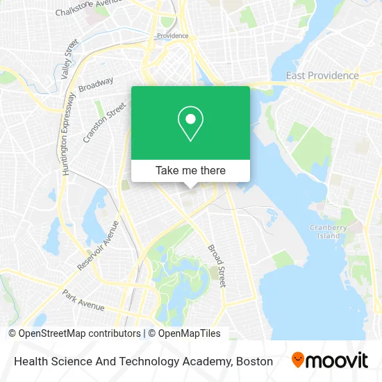
See Health Science And Technology Academy, Boston, on the map
Public Transit to Health Science And Technology Academy in Boston
Wondering how to get to Health Science And Technology Academy in Boston? Moovit helps you find the best way to get to Health Science And Technology Academy with step-by-step directions from the nearest public transit station.
Moovit provides free maps and live directions to help you navigate through your city. View schedules, routes, timetables, and find out how long does it take to get to Health Science And Technology Academy in real time.
Looking for the nearest stop or station to Health Science And Technology Academy? Check out this list of stops closest to your destination: Prairie at Roger Williams Homes; Eddy Opposite Applegate; Early Street; Providence.
Bus: 1, 6, R.Train: PROVIDENCE/STOUGHTON, ACELA, NORTHEAST REGIONAL, PROVIDENCE LINE SHUTTLE, PROVIDENCE LINE SHUTTLE, PROVIDENCE LINE SHUTTLE, FOXBORO EVENT SERVICE.
Want to see if there’s another route that gets you there at an earlier time? Moovit helps you find alternative routes or times. Get directions from and directions to Health Science And Technology Academy easily from the Moovit App or Website.
We make riding to Health Science And Technology Academy easy, which is why over 1.7 million users, including users in Boston, trust Moovit as the best app for public transit. You don’t need to download an individual bus app or train app, Moovit is your all-in-one transit app that helps you find the best bus time or train time available.
For information on prices of bus and train, costs and ride fares to Health Science And Technology Academy, please check the Moovit app.
Use the app to navigate to popular places including to the airport, hospital, stadium, grocery store, mall, coffee shop, school, college, and university.
Health Science And Technology Academy Address: 182 Thurbers Ave street in Boston
- Roger Williams Daycare Center,
- Asadero Grille,
- Kingdom Hall of Jehovahs Witnesses,
- Thurbers Ave Service,
- A Towing,
- Curtis-Troupe Janie,
- Young Woods Elementary School,
- Law Office of Kenneth D'Aloisio,
- Cynthia Dewhurst, SLP,
- Rhode Island Early Hearing Detection Intervention Program,
- Women and Infants Audiology,
- Ania Kowalik, MD,
- Next Street Driver Rehab Services,
- Leo Stylo Barbershop,
- Adeusa Rhode Island,
- International Multi Service,
- Dominion Locksmith,
- Guzman, Dalisa,
- Laotino,
- Peluche Carwash & Auto Repair
Places Near Health Science And Technology Academy (Boston)
- North End, Boston,
- Cheers, Boston,
- Quincy Market, Boston,
- Wang Theater, Boston,
- Isabella Stewart Gardner Museum, Boston,
- House Of Blues, Boston,
- Leader Bank Pavilion (Leader Bank Pavillion), Boston,
- Boston Medical Center, Boston,
- Massachusetts General Hospital, Boston,
- Boston Common, Boston,
- Td Garden, Boston,
- Wilbur Theatre, Boston,
- Mgm Music Hall, Boston,
- Boston Children's Hospital, Boston,
- Castle Island, Boston,
- Museum Of Science, Boston,
- Faneuil Hall, Boston,
- Prudential Center, Boston,
- Seaport District, Boston,
- Boston Convention & Exhibition Center, Boston
How to get to popular places in Boston with public transit
Get around Boston by public transit!
Traveling around Boston has never been so easy. See step by step directions as you travel to any attraction, street or major public transit station. View bus and train schedules, arrival times, service alerts and detailed routes on a map, so you know exactly how to get to anywhere in Boston.
When traveling to any destination around Boston use Moovit's Live Directions with Get Off Notifications to know exactly where and how far to walk, how long to wait for your line, and how many stops are left. Moovit will alert you when it's time to get off — no need to constantly re-check whether yours is the next stop.
Wondering how to use public transit in Boston or how to pay for public transit in Boston? Moovit public transit app can help you navigate your way with public transit easily, and at minimum cost. It includes public transit fees, ticket prices, and costs. Looking for a map of Boston public transit lines? Moovit public transit app shows all public transit maps in Boston with all Bus, Train, Subway and Ferry routes and stops on an interactive map.
Boston has 4 transit type(s), including: Bus, Train, Subway and Ferry, operated by several transit agencies, including MBTA, Southeastern Regional Transit Authority, MetroWest Regional Transit Authority, Rhode Island Public Transit Authority, WRTA, Lowell Regional Transit Authority, Merrimack Valley Transit, Montachusett Regional Transit Authority, Cape Cod Regional Transit Authority, Brockton Area Transit Authority, Martha's Vineyard Transit Authority, the WAVE - Nantucket Regional Transit Authority, GATRA, Cape Ann Transportation Authority and Massport