How to get to Healthcare Unity Group by bus?
Click on the bus route to see step by step directions with maps, line arrival times and updated time schedules.
From Virgin Hotels New York City, Manhattan
57 minFrom East 85th Street, Manhattan
74 minFrom Mercer Street, Manhattan
81 minFrom Long Island City, Queens
93 minFrom General Consulate Honduras, Manhattan
40 minFrom 520 E 70th St, Manhattan
76 minFrom Guggenheim Museum, Manhattan
77 minFrom Ross Dress For Less, Manhattan
43 min
How to get to Healthcare Unity Group by train?
Click on the train route to see step by step directions with maps, line arrival times and updated time schedules.
Bus stops near Healthcare Unity Group in Jersey City
Light Rail stations near Healthcare Unity Group in Jersey City
- Newport Light Rail Station, 8 min walk,VIEW
Train station near Healthcare Unity Group in Jersey City
- Grove Street, 21 min walk,VIEW
Bus lines to Healthcare Unity Group in Jersey City
- 83, Jersey City Journal Sq,VIEW
- 87, Journal Sq,VIEW
- 88, C North Bergen 91st Street Via Central,VIEW
- 119, New York,VIEW
- 80, Gates Ave Via Journal Sq,VIEW
- 84, 91st Street Via Bergenline,VIEW
- 10, Bayonne,VIEW
- 6, Bayonne 55th Street Via Ocean Ave,VIEW
- 16, Newport Centre Mall,VIEW
- 125, New York,VIEW
- 319, Atlantic City Via Toms Rvr,VIEW
- 1, Newark 6th St,VIEW
- 2, Secaucus Via NJ Intl & Bulk Mail Ctr Via Secaucus Plaza,VIEW
- 8, Bergen Ave Bayonne 55th St,VIEW
- 14, Hudson Mall Stadium Plaza Via Duncan & Mallory Aves,VIEW
- 82, Union City Summit & Hague St,VIEW
What are the closest stations to Healthcare Unity Group?
The closest stations to Healthcare Unity Group are:
- Summit Ave at Pavonia Ave is 56 yards away, 1 min walk.
- Central Ave at Pavonia Ave is 86 yards away, 2 min walk.
- Journal Square Transportation Center is 266 yards away, 4 min walk.
- Newark Ave at Oakland Ave County Building is 329 yards away, 5 min walk.
- Newport Light Rail Station is 627 yards away, 8 min walk.
- Grove Street is 1706 yards away, 21 min walk.
Which bus lines stop near Healthcare Unity Group?
These bus lines stop near Healthcare Unity Group: 119, 125, 87.
Which train lines stop near Healthcare Unity Group?
These train lines stop near Healthcare Unity Group: RED, YEL.
What’s the nearest light rail station to Healthcare Unity Group in Jersey City?
The nearest light rail station to Healthcare Unity Group in Jersey City is Newport Light Rail Station. It’s a 8 min walk away.
What’s the nearest train station to Healthcare Unity Group in Jersey City?
The nearest train station to Healthcare Unity Group in Jersey City is Grove Street. It’s a 21 min walk away.
What’s the nearest bus station to Healthcare Unity Group in Jersey City?
The nearest bus station to Healthcare Unity Group in Jersey City is Summit Ave at Pavonia Ave. It’s a 1 min walk away.
What time is the first light rail to Healthcare Unity Group in Jersey City?
The HBLR is the first light rail that goes to Healthcare Unity Group in Jersey City. It stops nearby at 4:40 AM.
What time is the last light rail to Healthcare Unity Group in Jersey City?
The HBLR is the last light rail that goes to Healthcare Unity Group in Jersey City. It stops nearby at 2:19 AM.
What time is the first train to Healthcare Unity Group in Jersey City?
The ATW is the first train that goes to Healthcare Unity Group in Jersey City. It stops nearby at 3:14 AM.
What time is the last train to Healthcare Unity Group in Jersey City?
The ATW is the last train that goes to Healthcare Unity Group in Jersey City. It stops nearby at 3:19 AM.
What time is the first bus to Healthcare Unity Group in Jersey City?
The 1 is the first bus that goes to Healthcare Unity Group in Jersey City. It stops nearby at 3:00 AM.
What time is the last bus to Healthcare Unity Group in Jersey City?
The 1 is the last bus that goes to Healthcare Unity Group in Jersey City. It stops nearby at 2:52 AM.
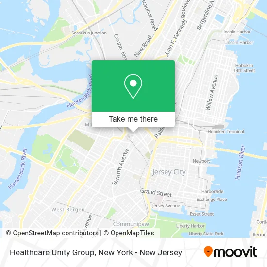
See Healthcare Unity Group, Jersey City, on the map
Public Transit to Healthcare Unity Group in Jersey City
Wondering how to get to Healthcare Unity Group in Jersey City? Moovit helps you find the best way to get to Healthcare Unity Group with step-by-step directions from the nearest public transit station.
Moovit provides free maps and live directions to help you navigate through your city. View schedules, routes, timetables, and find out how long does it take to get to Healthcare Unity Group in real time.
Looking for the nearest stop or station to Healthcare Unity Group? Check out this list of stops closest to your destination: Summit Ave at Pavonia Ave; Central Ave at Pavonia Ave; Journal Square Transportation Center; Newark Ave at Oakland Ave County Building; Newport Light Rail Station; Grove Street.
Bus: 119, 125, 87, 83, 88, 80, 84, 6, 16, 319, 10, 1, 2.Train: RED, YEL, ATW.
Want to see if there’s another route that gets you there at an earlier time? Moovit helps you find alternative routes or times. Get directions from and directions to Healthcare Unity Group easily from the Moovit App or Website.
We make riding to Healthcare Unity Group easy, which is why over 1.5 million users, including users in Jersey City, trust Moovit as the best app for public transit. You don’t need to download an individual bus app or train app, Moovit is your all-in-one transit app that helps you find the best bus time or train time available.
For information on prices of train, bus and subway, costs and ride fares to Healthcare Unity Group, please check the Moovit app.
Use the app to navigate to popular places including to the airport, hospital, stadium, grocery store, mall, coffee shop, school, college, and university.
Healthcare Unity Group Address: 405 Kearny Ave street in Jersey City
- Dr. Susan Phung,
- Labcorp,
- Heart Center Of Jersey Pa,
- Jersey City Garage Door Repair,
- 3d Rendering Services,
- Rabia N. Malik, Md,
- Chalapathy Narisety,
- Retina Consultants, Pa II,
- Neurology Partners: Vinod Kapoor Md,
- Rubas Law Offices,
- Therapro Corp,
- Eco IV Therapy,
- Dr. Ravinder Tikoo,
- Heritage Veins & Aesthetics,
- Nicholas Scarpa, Md,
- Anthony R. Gualano,
- Ups Access Point Location,
- Priority Std Testing Jersey City,
- Chanese Associates,
- Ansetti and Associates
Places Near Healthcare Unity Group (Jersey City)
- 66 John Street, Manhattan,
- Bellevue Hospital, Manhattan,
- Hudson Yards, Manhattan,
- 111 Centre New York City Supreme Court, Manhattan,
- 1 Police Plaza, Manhattan,
- qqqq, Manhattan,
- Queens Center Mall, Queens,
- San Gennaro Feast, Manhattan,
- Pier 83, Manhattan,
- 3 Stone St, Manhattan,
- Katz's Deli, Manhattan,
- Wall Street, Manhattan,
- 376 Hudson Street, Manhattan,
- Mountainside Hospital, Glen Ridge,
- SoHo, Manhattan,
- Chinatown, Manhattan,
- 911 Memorial, Manhattan,
- Times Square, Manhattan,
- Rockefeller Center, Manhattan,
- 26 Federal Plaza, Manhattan
How to get to popular places in New York - New Jersey with public transit
Get around Jersey City by public transit!
Traveling around Jersey City has never been so easy. See step by step directions as you travel to any attraction, street or major public transit station. View bus and train schedules, arrival times, service alerts and detailed routes on a map, so you know exactly how to get to anywhere in Jersey City.
When traveling to any destination around Jersey City use Moovit's Live Directions with Get Off Notifications to know exactly where and how far to walk, how long to wait for your line, and how many stops are left. Moovit will alert you when it's time to get off — no need to constantly re-check whether yours is the next stop.
Wondering how to use public transit in Jersey City or how to pay for public transit in Jersey City? Moovit public transit app can help you navigate your way with public transit easily, and at minimum cost. It includes public transit fees, ticket prices, and costs. Looking for a map of Jersey City public transit lines? Moovit public transit app shows all public transit maps in Jersey City with all Bus, Train, Subway, Light Rail, Ferry and Cable Car routes and stops on an interactive map.
New York - New Jersey has 6 transit type(s), including: Bus, Train, Subway, Light Rail, Ferry and Cable Car, operated by several transit agencies, including MTA Subway, Metro-North Railroad, LIRR, PATH, MTA New York City Transit - Express routes, MTA Bus, NJ Transit, NYC Ferry, NICE bus, Bee-Line Bus, NJ Transit Rail, Norwalk Transit District, Hartford Line, River Valley Transit and HART