Directions to Hedgehog Belly Designs (Boston) with public transportation
The following transit lines have routes that pass near Hedgehog Belly Designs
 Bus: 11, NCS, 10, MWES.
- Train: FRAMINGHAM/WORCESTER.
How to get to Hedgehog Belly Designs by bus?
Click on the bus route to see step by step directions with maps, line arrival times and updated time schedules.
From Bose Corp, Framingham
86 minFrom Wellesley, MA, Wellesley
85 minFrom Lasell College, Newton
104 minFrom Framingham, MA, Framingham
48 minFrom Newton Wellesley Hospital Green Building, Newton
91 minFrom Boston Marriott Newton, Newton
113 minFrom Babson College, Wellesley
82 minFrom Newton-Wellesley Hospital, Newton
91 min
How to get to Hedgehog Belly Designs by train?
Click on the train route to see step by step directions with maps, line arrival times and updated time schedules.
Bus stops near Hedgehog Belly Designs in Boston
Train station near Hedgehog Belly Designs in Boston
- West Natick, 30 min walk,VIEW
Bus lines to Hedgehog Belly Designs in Boston
What are the closest stations to Hedgehog Belly Designs?
The closest stations to Hedgehog Belly Designs are:
- Coolidge Gardens is 469 yards away, 6 min walk.
- Natick Center Mbta is 1041 yards away, 13 min walk.
- West Natick is 2481 yards away, 30 min walk.
Which bus lines stop near Hedgehog Belly Designs?
These bus lines stop near Hedgehog Belly Designs: 11, NCS.
Which train line stops near Hedgehog Belly Designs?
FRAMINGHAM/WORCESTER (#521 | Worcester)
What’s the nearest train station to Hedgehog Belly Designs in Boston?
The nearest train station to Hedgehog Belly Designs in Boston is West Natick. It’s a 30 min walk away.
What’s the nearest bus station to Hedgehog Belly Designs in Boston?
The nearest bus station to Hedgehog Belly Designs in Boston is Coolidge Gardens. It’s a 6 min walk away.
What time is the first train to Hedgehog Belly Designs in Boston?
The FRAMINGHAM/WORCESTER is the first train that goes to Hedgehog Belly Designs in Boston. It stops nearby at 4:59 AM.
What time is the last train to Hedgehog Belly Designs in Boston?
The FRAMINGHAM/WORCESTER is the last train that goes to Hedgehog Belly Designs in Boston. It stops nearby at 12:41 AM.
What time is the first bus to Hedgehog Belly Designs in Boston?
The NCS is the first bus that goes to Hedgehog Belly Designs in Boston. It stops nearby at 6:50 AM.
What time is the last bus to Hedgehog Belly Designs in Boston?
The 11 is the last bus that goes to Hedgehog Belly Designs in Boston. It stops nearby at 8:15 PM.
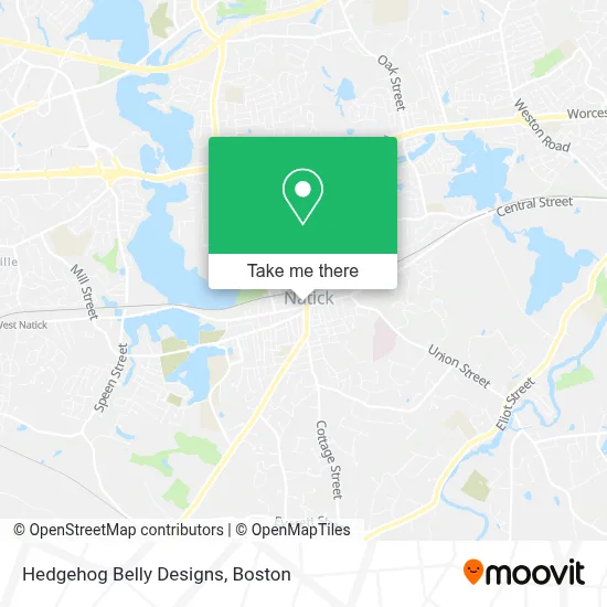
See Hedgehog Belly Designs, Boston, on the map
Public Transit to Hedgehog Belly Designs in Boston
Wondering how to get to Hedgehog Belly Designs in Boston? Moovit helps you find the best way to get to Hedgehog Belly Designs with step-by-step directions from the nearest public transit station.
Moovit provides free maps and live directions to help you navigate through your city. View schedules, routes, timetables, and find out how long does it take to get to Hedgehog Belly Designs in real time.
Looking for the nearest stop or station to Hedgehog Belly Designs? Check out this list of stops closest to your destination: Coolidge Gardens; Natick Center Mbta; West Natick.
Bus: 11, NCS, 10, MWES.Train: FRAMINGHAM/WORCESTER.
Want to see if there’s another route that gets you there at an earlier time? Moovit helps you find alternative routes or times. Get directions from and directions to Hedgehog Belly Designs easily from the Moovit App or Website.
We make riding to Hedgehog Belly Designs easy, which is why over 1.7 million users, including users in Boston, trust Moovit as the best app for public transit. You don’t need to download an individual bus app or train app, Moovit is your all-in-one transit app that helps you find the best bus time or train time available.
For information on prices of bus and train, costs and ride fares to Hedgehog Belly Designs, please check the Moovit app.
Use the app to navigate to popular places including to the airport, hospital, stadium, grocery store, mall, coffee shop, school, college, and university.
Hedgehog Belly Designs Address: 1 Main St street in Boston
- Lowtide Development,
- Purchasing Services,
- The Futon Shop,
- Natick Center,
- Natick Family Eye Care,
- Ameriprise Financial,
- George the Painter,
- MVS Pet Care,
- Barbershop Laboratories,
- Bombard Law Office, PC,
- Pretty Esthetics,
- Precoma Law LLC,
- Blinn Plumbing and Heating,
- Charter Cable,
- Sound & Spirit,
- Sasa's Tree Care and Landscaping,
- Gross Kenneth N,
- Smith Mechanical,
- Law Offices of David B. Zirlen,
- Edumetrics
Places Near Hedgehog Belly Designs (Boston)
- Leader Bank Pavilion (Leader Bank Pavillion), Boston,
- Castle Island, Boston,
- Quincy Market, Boston,
- House Of Blues, Boston,
- Wang Theater, Boston,
- Faneuil Hall, Boston,
- Td Garden, Boston,
- Cheers, Boston,
- Seaport District, Boston,
- Wilbur Theatre, Boston,
- Isabella Stewart Gardner Museum, Boston,
- Boston Common, Boston,
- Museum Of Science, Boston,
- Boston Medical Center, Boston,
- Boston Children's Hospital, Boston,
- Massachusetts General Hospital, Boston,
- North End, Boston,
- Boston Convention & Exhibition Center, Boston,
- Prudential Center, Boston,
- Mgm Music Hall, Boston
How to get to popular places in Boston with public transit
Get around Boston by public transit!
Traveling around Boston has never been so easy. See step by step directions as you travel to any attraction, street or major public transit station. View bus and train schedules, arrival times, service alerts and detailed routes on a map, so you know exactly how to get to anywhere in Boston.
When traveling to any destination around Boston use Moovit's Live Directions with Get Off Notifications to know exactly where and how far to walk, how long to wait for your line, and how many stops are left. Moovit will alert you when it's time to get off — no need to constantly re-check whether yours is the next stop.
Wondering how to use public transit in Boston or how to pay for public transit in Boston? Moovit public transit app can help you navigate your way with public transit easily, and at minimum cost. It includes public transit fees, ticket prices, and costs. Looking for a map of Boston public transit lines? Moovit public transit app shows all public transit maps in Boston with all Bus, Train, Subway and Ferry routes and stops on an interactive map.
Boston has 4 transit type(s), including: Bus, Train, Subway and Ferry, operated by several transit agencies, including MBTA, Southeastern Regional Transit Authority, MetroWest Regional Transit Authority, Rhode Island Public Transit Authority, WRTA, Lowell Regional Transit Authority, Merrimack Valley Transit, Montachusett Regional Transit Authority, Cape Cod Regional Transit Authority, Brockton Area Transit Authority, Martha's Vineyard Transit Authority, the WAVE - Nantucket Regional Transit Authority, GATRA, Cape Ann Transportation Authority and Massport