See Heineken Experience, Amsterdam, on the map
Directions to Heineken Experience (Amsterdam) with public transportation
The following transit lines have routes that pass near Heineken Experience
 Bus:
Bus: - Train:
- Metro:
- Light Rail:
How to get to Heineken Experience by bus?
Click on the bus route to see step by step directions with maps, line arrival times and updated time schedules.
How to get to Heineken Experience by train?
Click on the train route to see step by step directions with maps, line arrival times and updated time schedules.
How to get to Heineken Experience by metro?
Click on the metro route to see step by step directions with maps, line arrival times and updated time schedules.
Bus stations near Heineken Experience in Amsterdam
- Vijzelgracht,2 min walk,
- Ruysdaelkade,7 min walk,
- Van Woustraat,8 min walk,
- 2e Van Der Helststraat,9 min walk,
- Museumplein,12 min walk,
- Prinsengracht,13 min walk,
Light Rail stations near Heineken Experience in Amsterdam
- Marie Heinekenplein,3 min walk,
- Vijzelgracht,4 min walk,
Bus lines to Heineken Experience in Amsterdam
- N82,Geuzenveld,
- N83,Osdorp De Aker,
- N88,Centraal Station,
- N84,A'Veen Busstation,
- N85,Gein,
- 3,Westergasfabriek,
- 246,Schiphol Zuid,
- N47,Uithoorn Busstation - Amsterdam CS,
- N57,Aalsmeer Busstation - Amsterdam CS,
- N97,Nieuw-Vennep P+R Getsewoud Zuid - Amsterdam CS,
- 347,Uithoorn Busstation - Amsterdam Elandsgracht,
- 357,Kudelstaart/Aalsmeer - Amsterdam Elandsgracht,
- 397,Nieuw-Vennep P+R Getsew - Amsterdam Elandsgracht,
- 4,Station Rai,
What are the closest stations to Heineken Experience?
The closest stations to Heineken Experience are:
- Vijzelgracht is 120 meters away, 2 min walk.
- Marie Heinekenplein is 150 meters away, 3 min walk.
- Ruysdaelkade is 463 meters away, 7 min walk.
- Van Woustraat is 547 meters away, 8 min walk.
- 2e Van Der Helststraat is 656 meters away, 9 min walk.
- Museumplein is 855 meters away, 12 min walk.
- Prinsengracht is 977 meters away, 13 min walk.
Which bus lines stop near Heineken Experience?
These bus lines stop near Heineken Experience: 320, 321, 347, 357, 37, 397.
Which train lines stop near Heineken Experience?
These train lines stop near Heineken Experience: IC, SPR.
Which metro line stops near Heineken Experience?
52
Which light rail lines stop near Heineken Experience?
These light rail lines stop near Heineken Experience: 1, 19, 7.
What’s the nearest light rail station to Heineken Experience in Amsterdam?
The nearest light rail station to Heineken Experience in Amsterdam is Marie Heinekenplein. It’s a 3 min walk away.
What’s the nearest bus stop to Heineken Experience in Amsterdam?
The nearest bus stop to Heineken Experience in Amsterdam is Vijzelgracht. It’s a 2 min walk away.
What time is the first light rail to Heineken Experience in Amsterdam?
The 1 is the first light rail that goes to Heineken Experience in Amsterdam. It stops nearby at 5:34 AM.
What time is the last light rail to Heineken Experience in Amsterdam?
The 4 is the last light rail that goes to Heineken Experience in Amsterdam. It stops nearby at 12:43 AM.
What time is the first bus to Heineken Experience in Amsterdam?
The N97 is the first bus that goes to Heineken Experience in Amsterdam. It stops nearby at 3:36 AM.
What time is the last bus to Heineken Experience in Amsterdam?
The N97 is the last bus that goes to Heineken Experience in Amsterdam. It stops nearby at 3:37 AM.
See Heineken Experience, Amsterdam, on the map
Public Transit to Heineken Experience in Amsterdam
Wondering how to get to Heineken Experience in Amsterdam, Netherlands? Moovit helps you find the best way to get to Heineken Experience with step-by-step directions from the nearest public transit station.
Moovit provides free maps and live directions to help you navigate through your city. View schedules, routes, timetables, and find out how long does it take to get to Heineken Experience in real time.
Looking for the nearest stop or station to Heineken Experience? Check out this list of stops closest to your destination: Vijzelgracht; Marie Heinekenplein; Ruysdaelkade; Van Woustraat; 2e Van Der Helststraat; Museumplein; Prinsengracht.
Bus:Train:Metro:Light Rail:
Want to see if there’s another route that gets you there at an earlier time? Moovit helps you find alternative routes or times. Get directions from and directions to Heineken Experience easily from the Moovit App or Website.
We make riding to Heineken Experience easy, which is why over 1.5 million users, including users in Amsterdam, trust Moovit as the best app for public transit. You don’t need to download an individual bus app or train app, Moovit is your all-in-one transit app that helps you find the best bus time or train time available.
For information on prices of bus, train, metro and light rail, costs and ride fares to Heineken Experience, please check the Moovit app.
Use the app to navigate to popular places including to the airport, hospital, stadium, grocery store, mall, coffee shop, school, college, and university.
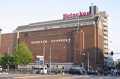
Heineken Experience Address: Stadhouderskade street in Amsterdam
The Heineken Experience, located in Amsterdam, is a historic brewery and corporate visitor center for the internationally distributed Dutch pilsner, Heineken beer.Wiki
Popular routes to Heineken Experience, Amsterdam
Popular routes from Heineken Experience, Amsterdam
Attractions near Heineken Experience
Heineken Brouwerij,Heineken Global Commerce University,Amsterdam, Ferdinand Bolstraat,Heineken Experience,Amsterdam Ferdinand Bolstraat,Amsterdam Canal Cruises,Stadhouderskade 550,Stadhouderskade,Marie,Heineken International B.V.,Nam Kee,Vegan Junkfood Bar (Vegan Junk Food Bar),Heinekenplein,Hotel Blossoms City Amsterdam,Ferdinand Eerste Jacob van Campenstraat,Amsterdam, Marie Heinekenplein,Marie Heinekenplein,Hotel Notting Hill Amsterdam,UJ Klaren,Tweede Weteringplantsoen 21How to get to popular attractions in Amsterdam with public transit
The Bulldog Palace, Amsterdam,Station Baarn, Baarn,Pathé, Breda,Martinus Nijhoffbrug, Zaltbommel,Euromast, Rotterdam,Westerpark, Amsterdam,IKEA, Amersfoort,Madurodam, 'S-Gravenhage,Station Meppel, Meppel,Stadion Galgenwaard, Utrecht,IKEA, Groningen,Burgers' Zoo, Arnhem,High Tech Campus, Eindhoven,'s-Hertogenbosch, 'S-Hertogenbosch,Station Hengelo, Hengelo,Alexandrium Shopping Center, Rotterdam,Deventer, Deventer,Winkelcentrum In de Bogaard, Rijswijk,MartiniPlaza, Groningen,Station Geldermalsen, GeldermalsenGet around Amsterdam by public transit!
Traveling around Amsterdam has never been so easy. See step by step directions as you travel to any attraction, street or major public transit station. View bus and train schedules, arrival times, service alerts and detailed routes on a map, so you know exactly how to get to anywhere in Amsterdam.
When traveling to any destination around Amsterdam use Moovit's Live Directions with Get Off Notifications to know exactly where and how far to walk, how long to wait for your line, and how many stops are left. Moovit will alert you when it's time to get off — no need to constantly re-check whether yours is the next stop.
Wondering how to use public transit in Amsterdam or how to pay for public transit in Amsterdam? Moovit public transit app can help you navigate your way with public transit easily, and at minimum cost. It includes public transit fees, ticket prices, and costs. Looking for a map of Amsterdam public transit lines? Moovit public transit app shows all public transit maps in Amsterdam with all bus, train, metro or light rail routes and stops on an interactive map.
Amsterdam has 4 transit type(s), including: bus, train, metro or light rail, operated by several transit agencies, including NS, NS International, GVB, GVB, GVB, GVB, U-OV, U-OV, Overal, HTM, R-net, RET, RET, De Lijn and Connexxion