Directions to Help To Move (Waltham) with public transportation
The following transit lines have routes that pass near Help To Move
 Bus: 505, 553, 554, 556.
- Train: FITCHBURG, FRAMINGHAM/WORCESTER.
- Subway: GREEN LINE D.
How to get to Help To Move by bus?
Click on the bus route to see step by step directions with maps, line arrival times and updated time schedules.
From Hilton Garden Inn Boston Brookline, Brookline
57 minFrom Hilton Garden Inn, Brookline
57 minFrom West Roxbury, Boston
65 minFrom Conte Forum, Boston
59 minFrom The Mall At Chestnut Hill, Newton
66 minFrom 1 Brookline Place, Brookline
58 minFrom Courtyard by Marriott Brookline, Brookline
61 minFrom Harvard Upper Busway, Cambridge
61 minFrom Beth Israel Deaconess Medical Center, Brookline
58 minFrom Hampton Inn & Suites-Hampton Watertown Boston (Hampton Inn & Suites Watertown Boston), Watertown Town
49 min
How to get to Help To Move by train?
Click on the train route to see step by step directions with maps, line arrival times and updated time schedules.
How to get to Help To Move by subway?
Click on the subway route to see step by step directions with maps, line arrival times and updated time schedules.
Bus stops near Help To Move in Waltham
Train stations near Help To Move in Waltham
Bus lines to Help To Move in Waltham
What are the closest stations to Help To Move?
The closest stations to Help To Move are:
- High St @ Gardner St is 161 yards away, 2 min walk.
- Moody St @ Orange St is 399 yards away, 5 min walk.
- Auburndale is 3073 yards away, 37 min walk.
- Brandeis/Roberts is 3547 yards away, 42 min walk.
Which bus lines stop near Help To Move?
These bus lines stop near Help To Move: 505, 553, 554.
Which train lines stop near Help To Move?
These train lines stop near Help To Move: FITCHBURG, FRAMINGHAM/WORCESTER.
Which subway line stops near Help To Move?
GREEN LINE D (Riverside)
What’s the nearest bus station to Help To Move in Waltham?
The nearest bus station to Help To Move in Waltham is High St @ Gardner St. It’s a 2 min walk away.
What time is the first train to Help To Move in Waltham?
The FRAMINGHAM/WORCESTER is the first train that goes to Help To Move in Waltham. It stops nearby at 5:19 AM.
What time is the last train to Help To Move in Waltham?
The FRAMINGHAM/WORCESTER is the last train that goes to Help To Move in Waltham. It stops nearby at 12:22 AM.
What time is the first bus to Help To Move in Waltham?
The 505 is the first bus that goes to Help To Move in Waltham. It stops nearby at 5:57 AM.
What time is the last bus to Help To Move in Waltham?
The 553 is the last bus that goes to Help To Move in Waltham. It stops nearby at 8:55 PM.
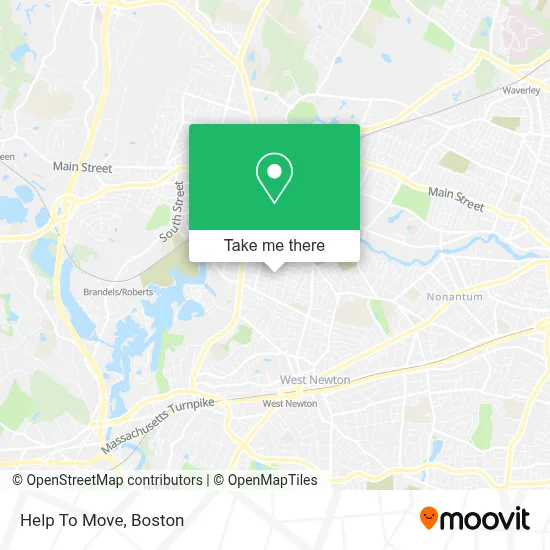
See Help To Move, Waltham, on the map
Public Transit to Help To Move in Waltham
Wondering how to get to Help To Move in Waltham? Moovit helps you find the best way to get to Help To Move with step-by-step directions from the nearest public transit station.
Moovit provides free maps and live directions to help you navigate through your city. View schedules, routes, timetables, and find out how long does it take to get to Help To Move in real time.
Looking for the nearest stop or station to Help To Move? Check out this list of stops closest to your destination: High St @ Gardner St; Moody St @ Orange St; Auburndale; Brandeis/Roberts.
Bus: 505, 553, 554, 556.Train: FITCHBURG, FRAMINGHAM/WORCESTER.Subway: GREEN LINE D.
Want to see if there’s another route that gets you there at an earlier time? Moovit helps you find alternative routes or times. Get directions from and directions to Help To Move easily from the Moovit App or Website.
We make riding to Help To Move easy, which is why over 1.7 million users, including users in Waltham, trust Moovit as the best app for public transit. You don’t need to download an individual bus app or train app, Moovit is your all-in-one transit app that helps you find the best bus time or train time available.
For information on prices of bus, train and subway, costs and ride fares to Help To Move, please check the Moovit app.
Use the app to navigate to popular places including to the airport, hospital, stadium, grocery store, mall, coffee shop, school, college, and university.
Help To Move Address: 58 Fuller St street in Waltham
- N.A. Tran,
- Italian Bakery,
- Salgueros Market,
- Crossfire Locksmith,
- Panco Group,
- Michelle Densmore Fitness,
- Kelly's Property Services,
- TP Nails & Waxing,
- Renee Tracy, L.Ac., Nutritionist, Maom,
- KD Colour,
- Local Locksmiths,
- Santangelo Landscaping,
- Perez Gardini,
- Tita's Kitchen,
- Level Up Fitness Waltham,
- Koko Dental Care,
- Dale Lawrence at Guaranteed Rate Affinity ,
- Jen Pintos at Guaranteed Rate Affinity (NMLS #1596923),
- ATM,
- 591 Moody St Parking
Places Near Help To Move (Waltham)
- Prudential Center, Boston,
- Boston Medical Center, Boston,
- Massachusetts General Hospital, Boston,
- Faneuil Hall, Boston,
- Quincy Market, Boston,
- Boston Common, Boston,
- House Of Blues, Boston,
- Td Garden, Boston,
- Museum Of Science, Boston,
- Cheers, Boston,
- Mgm Music Hall, Boston,
- Isabella Stewart Gardner Museum, Boston,
- Wilbur Theatre, Boston,
- Castle Island, Boston,
- North End, Boston,
- Wang Theater, Boston,
- Boston Convention & Exhibition Center, Boston,
- Boston Children's Hospital, Boston,
- Seaport District, Boston,
- Leader Bank Pavilion (Leader Bank Pavillion), Boston
How to get to popular places in Boston with public transit
Get around Waltham by public transit!
Traveling around Waltham has never been so easy. See step by step directions as you travel to any attraction, street or major public transit station. View bus and train schedules, arrival times, service alerts and detailed routes on a map, so you know exactly how to get to anywhere in Waltham.
When traveling to any destination around Waltham use Moovit's Live Directions with Get Off Notifications to know exactly where and how far to walk, how long to wait for your line, and how many stops are left. Moovit will alert you when it's time to get off — no need to constantly re-check whether yours is the next stop.
Wondering how to use public transit in Waltham or how to pay for public transit in Waltham? Moovit public transit app can help you navigate your way with public transit easily, and at minimum cost. It includes public transit fees, ticket prices, and costs. Looking for a map of Waltham public transit lines? Moovit public transit app shows all public transit maps in Waltham with all Bus, Train, Subway and Ferry routes and stops on an interactive map.
Boston has 4 transit type(s), including: Bus, Train, Subway and Ferry, operated by several transit agencies, including MBTA, Southeastern Regional Transit Authority, MetroWest Regional Transit Authority, Rhode Island Public Transit Authority, WRTA, Lowell Regional Transit Authority, Merrimack Valley Transit, Montachusett Regional Transit Authority, Cape Cod Regional Transit Authority, Brockton Area Transit Authority, Martha's Vineyard Transit Authority, the WAVE - Nantucket Regional Transit Authority, GATRA, Cape Ann Transportation Authority and Massport