Directions to Helping Hands Program (Olathe) with public transportation
The following transit lines have routes that pass near Helping Hands Program
 Bus: 403.
How to get to Helping Hands Program by bus?
Click on the bus route to see step by step directions with maps, line arrival times and updated time schedules.
From Cosmoprof, Lenexa
81 minFrom Bank of the West, Lenexa
82 minFrom ATM, Lenexa
82 minFrom Direct Tools Factory Outlet, Lenexa
38 minFrom Canyon Creek Lawn and Landscape, Lenexa
97 minFrom Lenexa, KS, Lenexa
49 minFrom Rosana Square, Overland Park
62 minFrom Overland Park Regional Medical Center, Overland Park
33 minFrom Appliance Repair Overland Park, Overland Park
63 minFrom Rick Chambers Marketing, Lenexa
86 min
Bus stop near Helping Hands Program in Olathe
- On E Santa Fe at Lindenwood Eastbound, 6 min walk,VIEW
Bus lines to Helping Hands Program in Olathe
- 403, Ku Medical Center,VIEW
What are the closest stations to Helping Hands Program?
The closest stations to Helping Hands Program are:
- On E Santa Fe at Lindenwood Eastbound is 464 yards away, 6 min walk.
Which bus line stops near Helping Hands Program?
403 (Walmart Park N Ride)
What’s the nearest bus station to Helping Hands Program in Olathe?
The nearest bus station to Helping Hands Program in Olathe is On E Santa Fe at Lindenwood Eastbound. It’s a 6 min walk away.
What time is the first bus to Helping Hands Program in Olathe?
The 403 is the first bus that goes to Helping Hands Program in Olathe. It stops nearby at 5:08 AM.
What time is the last bus to Helping Hands Program in Olathe?
The 403 is the last bus that goes to Helping Hands Program in Olathe. It stops nearby at 9:06 PM.
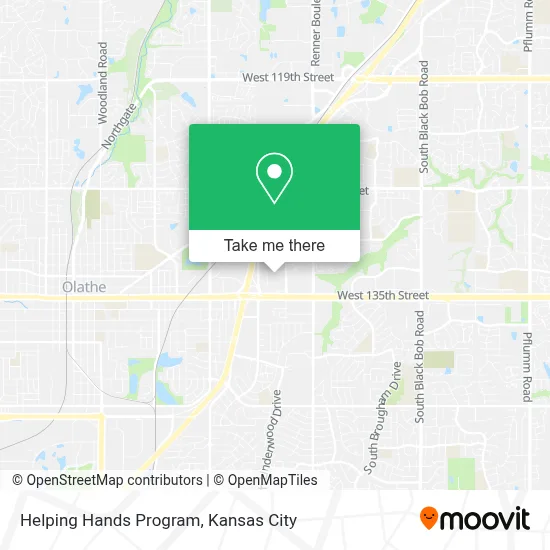
See Helping Hands Program, Olathe, on the map
Public Transit to Helping Hands Program in Olathe
Wondering how to get to Helping Hands Program in Olathe? Moovit helps you find the best way to get to Helping Hands Program with step-by-step directions from the nearest public transit station.
Moovit provides free maps and live directions to help you navigate through your city. View schedules, routes, timetables, and find out how long does it take to get to Helping Hands Program in real time.
Looking for the nearest stop or station to Helping Hands Program? Check out this list of stops closest to your destination: On E Santa Fe at Lindenwood Eastbound.
Bus: 403.
Want to see if there’s another route that gets you there at an earlier time? Moovit helps you find alternative routes or times. Get directions from and directions to Helping Hands Program easily from the Moovit App or Website.
We make riding to Helping Hands Program easy, which is why over 1.5 million users, including users in Olathe, trust Moovit as the best app for public transit. You don’t need to download an individual bus app or train app, Moovit is your all-in-one transit app that helps you find the best bus time or train time available.
For information on prices of bus, costs and ride fares to Helping Hands Program, please check the Moovit app.
Use the app to navigate to popular places including to the airport, hospital, stadium, grocery store, mall, coffee shop, school, college, and university.
Helping Hands Program Address: 1919 E Spruce St Olathe, KS 66062 street in Olathe
- NL Wilson,
- Bug Boys Pest Control,
- Kansas City Countertop Repair,
- Kansas City Youth Ballroom,
- X Out Junk,
- Brooke Johnson Hair and Makeup,
- Reumagine,
- Delta Demolition,
- Amy Bamaca - Worth Clark Realty,
- Bumblebee Lawn Care & Stone Solution,
- Chimney Restoration of Kansas City,
- Spartan Mechanical KC,
- Limerick Properties,
- Templo Cristiano Aposento Alto,
- Pivot Technology Resources,
- Unopenedpackman Sports Cards,
- Decorative Glass & Mirror,
- Celebrate Dental & Braces- Olathe,
- KC Pest Experts,
- Olathe Recycling Center
Places Near Helping Hands Program (Olathe)
- Kansas City Zoo,
- Truman Medical Center,
- Walmart, Kansas City,
- Kauffman Stadium,
- Kansas City International Airport (MCI) (Kansas City International Airport),
- St. Luke's Hospital - Medical Plaza I,
- Liberty, MO, Liberty,
- GEHA Field at Arrowhead Stadium,
- Amazon Fulfilment Center-MKC6, Kansas City,
- Stans Glory Hole,
- Legends Outlets Kansas City, Kansas City,
- Country Club Plaza,
- Worlds of Fun,
- Grandview, MO, Grandview,
- The Glory Hole,
- Ku Medical Center, Kansas City,
- Harrah's Casino, North Kansas City,
- T-Mobile Center,
- Arrowhead Stadium,
- Walmart Supercenter
How to get to popular places in Kansas City with public transit
Get around Olathe by public transit!
Traveling around Olathe has never been so easy. See step by step directions as you travel to any attraction, street or major public transit station. View bus and train schedules, arrival times, service alerts and detailed routes on a map, so you know exactly how to get to anywhere in Olathe.
When traveling to any destination around Olathe use Moovit's Live Directions with Get Off Notifications to know exactly where and how far to walk, how long to wait for your line, and how many stops are left. Moovit will alert you when it's time to get off — no need to constantly re-check whether yours is the next stop.
Wondering how to use public transit in Olathe or how to pay for public transit in Olathe? Moovit public transit app can help you navigate your way with public transit easily, and at minimum cost. It includes public transit fees, ticket prices, and costs. Looking for a map of Olathe public transit lines? Moovit public transit app shows all public transit maps in Olathe with all Bus, Train and Light Rail routes and stops on an interactive map.
Kansas City has 3 transit type(s), including: Bus, Train and Light Rail, operated by several transit agencies, including Kansas City Area Transportation Authority, Lawrence Transit, Topeka Metro, RideKC Johnson County, Amtrak, Greyhound-us and FlixBus-us