See Hempstead SDA, Hempstead, Ny, on the map
Directions to Hempstead SDA (Hempstead, Ny) with public transportation
The following transit lines have routes that pass near Hempstead SDA
 Bus:
Bus: - Train:
How to get to Hempstead SDA by bus?
Click on the bus route to see step by step directions with maps, line arrival times and updated time schedules.
How to get to Hempstead SDA by train?
Click on the train route to see step by step directions with maps, line arrival times and updated time schedules.
Bus stations near Hempstead SDA in Hempstead, Ny
- Greenwich St + Maplewood Ave,1 min walk,
Bus lines to Hempstead SDA in Hempstead, Ny
- N40/41,Hempstead,
What are the closest stations to Hempstead SDA?
The closest stations to Hempstead SDA are:
- Greenwich St + Maplewood Ave is 33 yards away, 1 min walk.
Which bus line stops near Hempstead SDA?
N40/41
Which train line stops near Hempstead SDA?
HEMPSTEAD
What’s the nearest bus stop to Hempstead SDA in Hempstead, Ny?
The nearest bus stop to Hempstead SDA in Hempstead, Ny is Greenwich St + Maplewood Ave. It’s a 1 min walk away.
See Hempstead SDA, Hempstead, Ny, on the map
Public Transit to Hempstead SDA in Hempstead, Ny
Wondering how to get to Hempstead SDA in Hempstead, Ny, United States? Moovit helps you find the best way to get to Hempstead SDA with step-by-step directions from the nearest public transit station.
Moovit provides free maps and live directions to help you navigate through your city. View schedules, routes, timetables, and find out how long does it take to get to Hempstead SDA in real time.
Looking for the nearest stop or station to Hempstead SDA? Check out this list of stops closest to your destination: Greenwich St + Maplewood Ave.
Bus:Train:
Want to see if there’s another route that gets you there at an earlier time? Moovit helps you find alternative routes or times. Get directions from and directions to Hempstead SDA easily from the Moovit App or Website.
We make riding to Hempstead SDA easy, which is why over 1.5 million users, including users in Hempstead, Ny, trust Moovit as the best app for public transit. You don’t need to download an individual bus app or train app, Moovit is your all-in-one transit app that helps you find the best bus time or train time available.
For information on prices of bus and train, costs and ride fares to Hempstead SDA, please check the Moovit app.
Use the app to navigate to popular places including to the airport, hospital, stadium, grocery store, mall, coffee shop, school, college, and university.
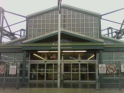
Hempstead SDA Address: Greenwich St street in Hempstead, Ny
Attractions near Hempstead SDA
265 Belmont Parkway,Guiding Light Early Childhood Day Care Center,Hempstead Pentecostal Church,Greenwich St (greenwich street brown),Greenwich Brown,Greenwich Belmont,Belmont Greenwich,178 Maplewood Ave,280 Belmont Pkwy,482 Greenwich St,Greenwich St & Belmont Pkwy,Greenwich St,Maplewood / Greenwich,Greenwich Maplewood,Greenwich St (maplewood ave / greenwich),Way Out Travel,Greenwich St and Flint,Hempstead Electricians,El Dorado Bakery,Greenwich ClydeHow to get to popular attractions in Hempstead, Ny with public transit
Hill Country Chicken, Manhattan,Barrage, Manhattan,Great Lawn, Manhattan,MTA Subway - 30th Ave (N/W), Queens,Stamford Transportation Center : Bus / Train (STM) Metro North & Amtrak, Stamford, Ct,Hair of the Dog, Manhattan,The Plaza Hotel, Manhattan,Atlantic City, NJ, Atlantic City, Nj,Caesars Atlantic City Hotel and Casino, Atlantic City, Nj,Café Habana, Manhattan,Stamford, CT, Stamford, Ct,Brass Monkey, Manhattan,Ulysses Folk House, Manhattan,Rubirosa Ristorante, Manhattan,The Grey Dog, Manhattan,Lombardi's Coal Oven Pizza, Manhattan,Peter Luger Steak House,MTA Subway - 42nd St / Bryant Park (B / D/F / M/7), Manhattan,LIRR - Babylon Station, Babylon, Ny,Planet Fitness, QueensGet around Hempstead, Ny by public transit!
Traveling around Hempstead, Ny has never been so easy. See step by step directions as you travel to any attraction, street or major public transit station. View bus and train schedules, arrival times, service alerts and detailed routes on a map, so you know exactly how to get to anywhere in Hempstead, Ny.
When traveling to any destination around Hempstead, Ny use Moovit's Live Directions with Get Off Notifications to know exactly where and how far to walk, how long to wait for your line, and how many stops are left. Moovit will alert you when it's time to get off — no need to constantly re-check whether yours is the next stop.
Wondering how to use public transit in Hempstead, Ny or how to pay for public transit in Hempstead, Ny? Moovit public transit app can help you navigate your way with public transit easily, and at minimum cost. It includes public transit fees, ticket prices, and costs. Looking for a map of Hempstead, Ny public transit lines? Moovit public transit app shows all public transit maps in Hempstead, Ny with all bus or train routes and stops on an interactive map.
Hempstead, Ny has 2 transit type(s), including: bus or train, operated by several transit agencies, including MTA Subway, Metro-North Railroad, LIRR, PATH, Shore Line East, MTA Bus Company, MTA New York City Transit - Express routes, MTA Bus, NJ Transit, NYC Ferry, NICE bus, Bee-Line Bus, NJ Transit Rail, NJ Transit Rail and Norwalk Transit District