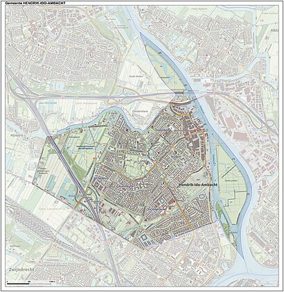
See Hendrik-Ido-Ambacht, Ridderkerk, on the map
Directions to Hendrik-Ido-Ambacht (Ridderkerk) with public transportation
The following transit lines have routes that pass near Hendrik-Ido-Ambacht
 Bus:
Bus: - Train:
- Ferry:
How to get to Hendrik-Ido-Ambacht by bus?
Click on the bus route to see step by step directions with maps, line arrival times and updated time schedules.
Bus stations near Hendrik-Ido-Ambacht in Ridderkerk
- Ridderkerk, Vlasstraat,11 min walk,
- Hendrik-Ido-Ambacht, Begraafplaats Achterambacht,12 min walk,
- Ridderkerk, Staringlaan,21 min walk,
Train stations near Hendrik-Ido-Ambacht in Ridderkerk
- Barendrecht,57 min walk,
Ferry stations near Hendrik-Ido-Ambacht in Ridderkerk
- Ridderkerk, De Schans,62 min walk,
Bus lines to Hendrik-Ido-Ambacht in Ridderkerk
- 609,Station Barendrecht,
- 608,Station Barendrecht,
- 144,Zuidplein Via Slikkervee,
- 146,Ridderkerk Drievliet,
What are the closest stations to Hendrik-Ido-Ambacht?
The closest stations to Hendrik-Ido-Ambacht are:
- Ridderkerk, Vlasstraat is 756 meters away, 11 min walk.
- Hendrik-Ido-Ambacht, Begraafplaats Achterambacht is 882 meters away, 12 min walk.
- Ridderkerk, Staringlaan is 1610 meters away, 21 min walk.
- Barendrecht is 4366 meters away, 57 min walk.
- Ridderkerk, De Schans is 4813 meters away, 62 min walk.
Which bus lines stop near Hendrik-Ido-Ambacht?
These bus lines stop near Hendrik-Ido-Ambacht: 145, 146, 608, 609.
What’s the nearest bus stop to Hendrik-Ido-Ambacht in Ridderkerk?
The nearest bus stop to Hendrik-Ido-Ambacht in Ridderkerk is Ridderkerk, Vlasstraat. It’s a 11 min walk away.
What time is the first train to Hendrik-Ido-Ambacht in Ridderkerk?
The SPR is the first train that goes to Hendrik-Ido-Ambacht in Ridderkerk. It stops nearby at 4:51 AM.
What time is the last train to Hendrik-Ido-Ambacht in Ridderkerk?
The SPR is the last train that goes to Hendrik-Ido-Ambacht in Ridderkerk. It stops nearby at 1:14 AM.
What time is the first bus to Hendrik-Ido-Ambacht in Ridderkerk?
The 146 is the first bus that goes to Hendrik-Ido-Ambacht in Ridderkerk. It stops nearby at 5:51 AM.
What time is the last bus to Hendrik-Ido-Ambacht in Ridderkerk?
The 146 is the last bus that goes to Hendrik-Ido-Ambacht in Ridderkerk. It stops nearby at 12:51 AM.
What time is the first ferry to Hendrik-Ido-Ambacht in Ridderkerk?
The 20 is the first ferry that goes to Hendrik-Ido-Ambacht in Ridderkerk. It stops nearby at 6:26 AM.
What time is the last ferry to Hendrik-Ido-Ambacht in Ridderkerk?
The 20 is the last ferry that goes to Hendrik-Ido-Ambacht in Ridderkerk. It stops nearby at 10:00 PM.
See Hendrik-Ido-Ambacht, Ridderkerk, on the map
Public Transit to Hendrik-Ido-Ambacht in Ridderkerk
Wondering how to get to Hendrik-Ido-Ambacht in Ridderkerk, Netherlands? Moovit helps you find the best way to get to Hendrik-Ido-Ambacht with step-by-step directions from the nearest public transit station.
Moovit provides free maps and live directions to help you navigate through your city. View schedules, routes, timetables, and find out how long does it take to get to Hendrik-Ido-Ambacht in real time.
Looking for the nearest stop or station to Hendrik-Ido-Ambacht? Check out this list of stops closest to your destination: Ridderkerk, Vlasstraat; Hendrik-Ido-Ambacht; Ridderkerk, Staringlaan; Barendrecht; Ridderkerk, De Schans.
Bus:Train:Ferry:
Want to see if there’s another route that gets you there at an earlier time? Moovit helps you find alternative routes or times. Get directions from and directions to Hendrik-Ido-Ambacht easily from the Moovit App or Website.
We make riding to Hendrik-Ido-Ambacht easy, which is why over 1.5 million users, including users in Ridderkerk, trust Moovit as the best app for public transit. You don’t need to download an individual bus app or train app, Moovit is your all-in-one transit app that helps you find the best bus time or train time available.
For information on prices of bus, train, metro and light rail, costs and ride fares to Hendrik-Ido-Ambacht, please check the Moovit app.
Use the app to navigate to popular places including to the airport, hospital, stadium, grocery store, mall, coffee shop, school, college, and university.
Hendrik-Ido-Ambacht Address: Middle Of Nowhere street in Ridderkerk
Attractions near Hendrik-Ido-Ambacht
Hengelsportvereniging E.R.H.V. De Waal,IJsclub Rijsoord en Omstreken,G.P. van Ooijen Pensioen B.V.,Listesso,De Theetuin Rijsoord,Fort Marketing,Blaak Rijsoord,Raycords,Stichting Eve,EQUANS,Ridderkerk-Rijsoord,K. Koster Computer,Rijsoord,Rijksstraatweg Rijsoordsestraat,Helimex,Riolering Ser,Mussig Vastgoe,Heuvel Service en Onderhoudsbedrijf H vd,Reijerwaard Glassservice en Slotenservice,Marianne?S BreiboeHow to get to popular attractions in Ridderkerk with public transit
Station Amersfoort Schothorst, Amersfoort,Stenden Hogeschool, Leeuwarden,Aegon, 'S-Gravenhage,'s-Hertogenbosch, 'S-Hertogenbosch,Stadion Feijenoord, Rotterdam,Heineken Nederland B.V, Zoeterwoude,IKEA, Utrecht,Vrijthof, Maastricht,Pathé Schouwburgplein, Rotterdam,Pacific Parc, Amsterdam,Den Haag Centrum, 'S-Gravenhage,Beneluxtunnel, Rotterdam,Station Zwijndrecht, Zwijndrecht,Scheveningse Strand, 'S-Gravenhage,Poppodium 013, Tilburg,IKEA, Heerlen,Station Bergen op Zoom, Bergen Op Zoom,Knooppunt Kleinpolderplein, Rotterdam,Breda, Breda,Technische Universiteit Eindhoven (TU / e), EindhovenGet around Ridderkerk by public transit!
Traveling around Ridderkerk has never been so easy. See step by step directions as you travel to any attraction, street or major public transit station. View bus and train schedules, arrival times, service alerts and detailed routes on a map, so you know exactly how to get to anywhere in Ridderkerk.
When traveling to any destination around Ridderkerk use Moovit's Live Directions with Get Off Notifications to know exactly where and how far to walk, how long to wait for your line, and how many stops are left. Moovit will alert you when it's time to get off — no need to constantly re-check whether yours is the next stop.
Wondering how to use public transit in Ridderkerk or how to pay for public transit in Ridderkerk? Moovit public transit app can help you navigate your way with public transit easily, and at minimum cost. It includes public transit fees, ticket prices, and costs. Looking for a map of Ridderkerk public transit lines? Moovit public transit app shows all public transit maps in Ridderkerk with all bus, train, metro or light rail routes and stops on an interactive map.
Ridderkerk has 4 transit type(s), including: bus, train, metro or light rail, operated by several transit agencies, including NS, NS International, GVB, GVB, GVB, GVB, U-OV, U-OV, Overal, HTM, R-net, RET, RET, De Lijn and Connexxion