See Henry H Houston School, Philadelphia, on the map
Directions to Henry H Houston School (Philadelphia) with public transportation
The following transit lines have routes that pass near Henry H Houston School
 Bus:
Bus: - Train:
How to get to Henry H Houston School by bus?
Click on the bus route to see step by step directions with maps, line arrival times and updated time schedules.
How to get to Henry H Houston School by train?
Click on the train route to see step by step directions with maps, line arrival times and updated time schedules.
Train stations near Henry H Houston School in Philadelphia
- Allen Lane,3 min walk,
Bus stations near Henry H Houston School in Philadelphia
- Germantown Av & Allens Ln,5 min walk,
- Mt Pleasant Av & Cresheim Rd ,7 min walk,
Bus lines to Henry H Houston School in Philadelphia
- 23,Chestnut Hill,
- H,Broad-Erie,
What are the closest stations to Henry H Houston School?
The closest stations to Henry H Houston School are:
- Allen Lane is 186 yards away, 3 min walk.
- Germantown Av & Allens Ln is 379 yards away, 5 min walk.
- Mt Pleasant Av & Cresheim Rd is 577 yards away, 7 min walk.
Which bus line stops near Henry H Houston School?
23
Which train lines stop near Henry H Houston School?
These train lines stop near Henry H Houston School: CHESTNUT HILL EAST LINE, CHESTNUT HILL WEST LINE.
What’s the nearest train station to Henry H Houston School in Philadelphia?
The nearest train station to Henry H Houston School in Philadelphia is Allen Lane. It’s a 3 min walk away.
What’s the nearest bus stop to Henry H Houston School in Philadelphia?
The nearest bus stop to Henry H Houston School in Philadelphia is Germantown Av & Allens Ln. It’s a 5 min walk away.
See Henry H Houston School, Philadelphia, on the map
Public Transit to Henry H Houston School in Philadelphia
Wondering how to get to Henry H Houston School in Philadelphia, United States? Moovit helps you find the best way to get to Henry H Houston School with step-by-step directions from the nearest public transit station.
Moovit provides free maps and live directions to help you navigate through your city. View schedules, routes, timetables, and find out how long does it take to get to Henry H Houston School in real time.
Looking for the nearest stop or station to Henry H Houston School? Check out this list of stops closest to your destination: Allen Lane; Germantown Av & Allens Ln; Mt Pleasant Av & Cresheim Rd .
Bus:Train:
Want to see if there’s another route that gets you there at an earlier time? Moovit helps you find alternative routes or times. Get directions from and directions to Henry H Houston School easily from the Moovit App or Website.
We make riding to Henry H Houston School easy, which is why over 1.5 million users, including users in Philadelphia, trust Moovit as the best app for public transit. You don’t need to download an individual bus app or train app, Moovit is your all-in-one transit app that helps you find the best bus time or train time available.
For information on prices of bus, train and subway, costs and ride fares to Henry H Houston School, please check the Moovit app.
Use the app to navigate to popular places including to the airport, hospital, stadium, grocery store, mall, coffee shop, school, college, and university.
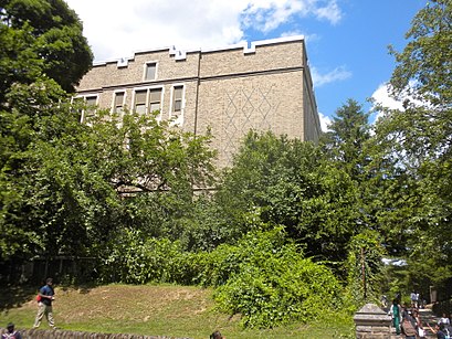
Henry H Houston School Address: 7300 Rural Lane (Allens Lane) street in Philadelphia
Attractions near Henry H Houston School
Houston School,Under My Desk,The Backyard,SEPTA Allen Lane Station,High Point Cafe,CVS,Club 27,Coffee Junction,Wayne Enterprises,Lutheran Seminary,Hare Krishna Temple,Iskcon temple,Childspace,Geniusville,7318 Germantown,New Covenant Manor,Maclens Collision Repair Professionals,Bundesgarten,7318 Germantown Ave,TCore FitnessHow to get to popular attractions in Philadelphia with public transit
SEPTA Torresdale Station, Philadelphia,Sharon Hill, PA, Collingdale,McCormick & Schmick's Seafood and Steaks, Philadelphia,Target, Middletown,Continental Restaurant & Martini Bar, Philadelphia,ShopRite, Hamilton Square,Havertown, PA, Haverford,Hyatt Regency Princeton,Bristol Borough, Bristol,Target,Williamstown, NJ, Williamstown,Three Monkeys Café, Philadelphia,Wayne, PA, Radnor,Our Lady of Lourdes Hospital, Camden,Mantua, NJ,The Cheesecake Factory, Golden Triangle,Collegeville, PA, Collegeville,Princeton Theological Seminary, Princeton,Philadelphia Mills, Philadelphia,NJT - Princeton Junction Station (NEC), Princeton JunctionGet around Philadelphia by public transit!
Traveling around Philadelphia has never been so easy. See step by step directions as you travel to any attraction, street or major public transit station. View bus and train schedules, arrival times, service alerts and detailed routes on a map, so you know exactly how to get to anywhere in Philadelphia.
When traveling to any destination around Philadelphia use Moovit's Live Directions with Get Off Notifications to know exactly where and how far to walk, how long to wait for your line, and how many stops are left. Moovit will alert you when it's time to get off — no need to constantly re-check whether yours is the next stop.
Wondering how to use public transit in Philadelphia or how to pay for public transit in Philadelphia? Moovit public transit app can help you navigate your way with public transit easily, and at minimum cost. It includes public transit fees, ticket prices, and costs. Looking for a map of Philadelphia public transit lines? Moovit public transit app shows all public transit maps in Philadelphia with all bus, train or subway routes and stops on an interactive map.
Philadelphia has 3 transit type(s), including: bus, train or subway, operated by several transit agencies, including SEPTA Subway, SEPTA Trolley, SEPTA Rail, SEPTA, SEPTA, NJ TRANSIT RAIL-Rail, NJ TRANSIT RAIL-Tram, NJ TRANSIT BUS, Port Authority Transit Corporation, Navy Yard, Penn Transit, Drexel University, Pottstown Area Rapid Transit (PART), Fullington Tours and Chescobus