Directions to Hertz (Newton) with public transportation
The following transit lines have routes that pass near Hertz
 Bus: 505, 558, MBRS.
- Train: FRAMINGHAM/WORCESTER, FITCHBURG.
- Subway: GREEN LINE D.
How to get to Hertz by bus?
Click on the bus route to see step by step directions with maps, line arrival times and updated time schedules.
From Boston Landing Station, Boston
52 minFrom Skating Club Of Boston, Boston
74 minFrom Allston, Boston
48 minFrom Boston College (BC), Boston
81 minFrom West Roxbury, Boston
70 minFrom Studio Allston, Boston
74 minFrom Takeda, Lexington
48 minFrom The Westin Waltham Boston, Waltham
33 minFrom Arsenal Yards, Watertown Town
69 min
How to get to Hertz by train?
Click on the train route to see step by step directions with maps, line arrival times and updated time schedules.
How to get to Hertz by subway?
Click on the subway route to see step by step directions with maps, line arrival times and updated time schedules.
Bus stops near Hertz in Newton
Subway station near Hertz in Newton
- Riverside, 16 min walk,VIEW
What are the closest stations to Hertz?
The closest stations to Hertz are:
- Commonwealth Ave @ Melrose St is 741 yards away, 9 min walk.
- Commonwealth Ave Opp Pamela Ct is 758 yards away, 9 min walk.
- Riverside is 1320 yards away, 16 min walk.
- Brandeis/Roberts is 1978 yards away, 24 min walk.
- West Newton is 4383 yards away, 52 min walk.
Which bus lines stop near Hertz?
These bus lines stop near Hertz: 505, 558, MBRS.
Which train line stops near Hertz?
FRAMINGHAM/WORCESTER (#521 | Worcester)
Which subway line stops near Hertz?
GREEN LINE D (Riverside)
What’s the nearest subway station to Hertz in Newton?
The nearest subway station to Hertz in Newton is Riverside. It’s a 16 min walk away.
What’s the nearest train station to Hertz in Newton?
The nearest train station to Hertz in Newton is Brandeis/Roberts. It’s a 24 min walk away.
What’s the nearest bus station to Hertz in Newton?
The nearest bus stations to Hertz in Newton are Commonwealth Ave @ Melrose St and Commonwealth Ave Opp Pamela Ct. The closest one is a 9 min walk away.
What time is the first subway to Hertz in Newton?
The GREEN LINE D is the first subway that goes to Hertz in Newton. It stops nearby at 4:45 AM.
What time is the last subway to Hertz in Newton?
The GREEN LINE D is the last subway that goes to Hertz in Newton. It stops nearby at 2:48 AM.
What time is the first train to Hertz in Newton?
The FRAMINGHAM/WORCESTER is the first train that goes to Hertz in Newton. It stops nearby at 5:19 AM.
What time is the last train to Hertz in Newton?
The FRAMINGHAM/WORCESTER is the last train that goes to Hertz in Newton. It stops nearby at 12:22 AM.
What time is the first bus to Hertz in Newton?
The 505 is the first bus that goes to Hertz in Newton. It stops nearby at 6:01 AM.
What time is the last bus to Hertz in Newton?
The 505 is the last bus that goes to Hertz in Newton. It stops nearby at 7:42 PM.
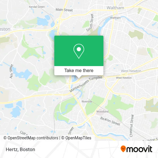
See Hertz, Newton, on the map
Public Transit to Hertz in Newton
Wondering how to get to Hertz in Newton? Moovit helps you find the best way to get to Hertz with step-by-step directions from the nearest public transit station.
Moovit provides free maps and live directions to help you navigate through your city. View schedules, routes, timetables, and find out how long does it take to get to Hertz in real time.
Looking for the nearest stop or station to Hertz? Check out this list of stops closest to your destination: Commonwealth Ave @ Melrose St; Commonwealth Ave Opp Pamela Ct; Riverside; Brandeis/Roberts; West Newton.
Bus: 505, 558, MBRS.Train: FRAMINGHAM/WORCESTER, FITCHBURG.Subway: GREEN LINE D.
Want to see if there’s another route that gets you there at an earlier time? Moovit helps you find alternative routes or times. Get directions from and directions to Hertz easily from the Moovit App or Website.
We make riding to Hertz easy, which is why over 1.7 million users, including users in Newton, trust Moovit as the best app for public transit. You don’t need to download an individual bus app or train app, Moovit is your all-in-one transit app that helps you find the best bus time or train time available.
For information on prices of bus, train and subway, costs and ride fares to Hertz, please check the Moovit app.
Use the app to navigate to popular places including to the airport, hospital, stadium, grocery store, mall, coffee shop, school, college, and university.
Hertz Address: 2345 Commonwealth Ave street in Newton
- Boston Marriott Newton Hotel Newton,
- Boston Marriott Newton,
- Wakeskater Studio,
- Cutter Chase Association,
- Leo Locksmith Services,
- Mako Associates,
- Blue Cross and Blue Shield of Massachusetts,
- Islington Oval,
- Auburndale Commuter Rail Station,
- WR Builders,
- Oram Advisors,
- Ariana Bain,
- Auburndale Station,
- Rufus Estabrook House (Private Home),
- Pigeon Hill Park,
- Auburndale, MA,
- Future Plan Investment,
- Maplewood at Weston,
- Elite Personal Fitness,
- Regis Boudreau DPM
Places Near Hertz (Newton)
- Museum Of Science, Boston,
- Massachusetts General Hospital, Boston,
- Td Garden, Boston,
- Cheers, Boston,
- House Of Blues, Boston,
- Leader Bank Pavilion (Leader Bank Pavillion), Boston,
- Isabella Stewart Gardner Museum, Boston,
- Boston Children's Hospital, Boston,
- North End, Boston,
- Wilbur Theatre, Boston,
- Seaport District, Boston,
- Boston Medical Center, Boston,
- Boston Common, Boston,
- Wang Theater, Boston,
- Castle Island, Boston,
- Mgm Music Hall, Boston,
- Boston Convention & Exhibition Center, Boston,
- Prudential Center, Boston,
- Faneuil Hall, Boston,
- Quincy Market, Boston
How to get to popular places in Boston with public transit
Get around Newton by public transit!
Traveling around Newton has never been so easy. See step by step directions as you travel to any attraction, street or major public transit station. View bus and train schedules, arrival times, service alerts and detailed routes on a map, so you know exactly how to get to anywhere in Newton.
When traveling to any destination around Newton use Moovit's Live Directions with Get Off Notifications to know exactly where and how far to walk, how long to wait for your line, and how many stops are left. Moovit will alert you when it's time to get off — no need to constantly re-check whether yours is the next stop.
Wondering how to use public transit in Newton or how to pay for public transit in Newton? Moovit public transit app can help you navigate your way with public transit easily, and at minimum cost. It includes public transit fees, ticket prices, and costs. Looking for a map of Newton public transit lines? Moovit public transit app shows all public transit maps in Newton with all Bus, Train, Subway and Ferry routes and stops on an interactive map.
Boston has 4 transit type(s), including: Bus, Train, Subway and Ferry, operated by several transit agencies, including MBTA, Southeastern Regional Transit Authority, MetroWest Regional Transit Authority, Rhode Island Public Transit Authority, WRTA, Lowell Regional Transit Authority, Merrimack Valley Transit, Montachusett Regional Transit Authority, Cape Cod Regional Transit Authority, Brockton Area Transit Authority, Martha's Vineyard Transit Authority, the WAVE - Nantucket Regional Transit Authority, GATRA, Cape Ann Transportation Authority and Massport