See Hialeah on the map
Directions to Hialeah with public transportation
The following transit lines have routes that pass near Hialeah
 Bus:
Bus: - Subway:
How to get to Hialeah by bus?
Click on the bus route to see step by step directions with maps, line arrival times and updated time schedules.
How to get to Hialeah by subway?
Click on the subway route to see step by step directions with maps, line arrival times and updated time schedules.
Bus stations near Hialeah
- E 21 St & E 1 Av,1 min walk,
Bus lines to Hialeah
- 37,37 - South Miami Station,
- 54,54 - H. Gardens NW 87 Ct/114 St,
- 79,79 - Hialeah Station,
- HIAFLA,City Of Hialeah Transit (Flamingo),
- HIAMAR,City Of Hialeah Transit (Marlin),
- MIASPG,City Of Miami Springs Free-Bee,
What are the closest stations to Hialeah?
The closest stations to Hialeah are:
- E 21 St & E 1 Av is 84 yards away, 1 min walk.
Which bus lines stop near Hialeah?
These bus lines stop near Hialeah: 112, 37.
Which subway line stops near Hialeah?
GREEN
What’s the nearest bus stop to Hialeah?
The nearest bus stop to Hialeah is E 21 St & E 1 Av. It’s a 1 min walk away.
See Hialeah on the map
Public Transportation to Hialeah
Wondering how to get to Hialeah, United States? Moovit helps you find the best way to get to Hialeah with step-by-step directions from the nearest public transit station.
Moovit provides free maps and live directions to help you navigate through your city. View schedules, routes, timetables, and find out how long does it take to get to Hialeah in real time.
Looking for the nearest stop or station to Hialeah? Check out this list of stops closest to your destination: E 21 St & E 1 Av.
Bus:Subway:
Want to see if there’s another route that gets you there at an earlier time? Moovit helps you find alternative routes or times. Get directions from and directions to Hialeah easily from the Moovit App or Website.
We make riding to Hialeah easy, which is why over 1.5 million users, including users in Hialeah, trust Moovit as the best app for public transit. You don’t need to download an individual bus app or train app, Moovit is your all-in-one transit app that helps you find the best bus time or train time available.
For information on prices of bus and subway, costs and ride fares to Hialeah, please check the Moovit app.
Use the app to navigate to popular places including to the airport, hospital, stadium, grocery store, mall, coffee shop, school, college, and university.
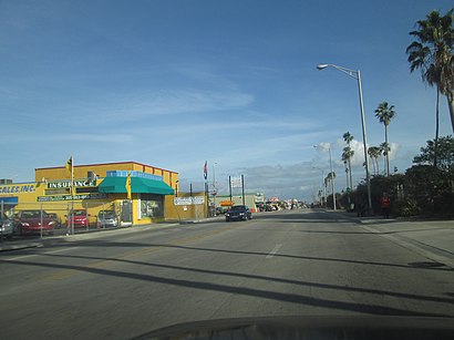
Hialeah Address: East 21st Street street in Hialeah
Attractions near Hialeah
115 E 21st St,MDT Metrorail - Hialeah Station,Hialeah a metro station,E 21 St@E 1 Av,Hialeah Station,METRORail-Hialeah (Hialeah Station),Hialeah Metrorail Station,2030 Curtiss Dr,Hialeah Race Course,Fairway View Associates Ltd,FL 3,FL 330,METRORail-Hialeah,E 21st St,Braman Cadillac Parts,2100 E 1st Ave,ASAP Rent A Car,Fairhavens Center,South Machine Transport Inc,E 20th StHow to get to popular attractions in Hialeah with public transit
Venetian Pool, Miami,Cinemark Boynton Beach, Boynton Beach-Delray Beach,Red Lobster, Kendall-Palmetto Bay,Claude Pepper Federal Building, Miami,Lauderdale-By-The-Sea, Fort Lauderdale,Blue Martini, Fort Lauderdale,Buffalo Wild Wings, North Westside,IHOP, Miami,BB&T Center, Plantation,Apple The Galleria, Fort Lauderdale,Costco Wholesale, Davie,Deerfield Beach Boardwalk@A1A, Deerfield Beach,Holiday Inn Express Miami Airport Doral Area, North Westside,West Palm Beach, West Palm Beach,Lauderdale-By-The-Sea Beach, Fort Lauderdale,Palm Beach Gardens, Jupiter,Novecento, Miami,The Galleria, Fort Lauderdale,Target, Deerfield Beach,Coconut Creek, FL, Pompano BeachGet around Hialeah by public transit!
Traveling around Hialeah has never been so easy. See step by step directions as you travel to any attraction, street or major public transit station. View bus and train schedules, arrival times, service alerts and detailed routes on a map, so you know exactly how to get to anywhere in Hialeah.
When traveling to any destination around Hialeah use Moovit's Live Directions with Get Off Notifications to know exactly where and how far to walk, how long to wait for your line, and how many stops are left. Moovit will alert you when it's time to get off — no need to constantly re-check whether yours is the next stop.
Wondering how to use public transit in Hialeah or how to pay for public transit in Hialeah? Moovit public transit app can help you navigate your way with public transit easily, and at minimum cost. It includes public transit fees, ticket prices, and costs. Looking for a map of Hialeah public transit lines? Moovit public transit app shows all public transit maps in Hialeah with all bus or subway routes and stops on an interactive map.
Hialeah has 2 transit type(s), including: bus or subway, operated by several transit agencies, including Miami-Dade Transit, Miami-Dade Transit, Miami Dade Transit-Rail, Tri-Rail, Miami-Dade Transit, Broward County Transit, Palm Tran, Brightline, Brightline, MARTY, City of Homestead Trolley, Key West Transit, Treasure Coast Connector, GoLine IRT and Amtrak