Directions to Hillaby (Saint Thomas) with public transportation
The following transit lines have routes that pass near Hillaby
How to get to Hillaby by bus?
Click on the bus route to see step by step directions with maps, line arrival times and updated time schedules.
Bus stops near Hillaby in Saint Thomas
- Mount Hillaby, 13 min walk,
- Farmers, 14 min walk,
- Airy Cot, 44 min walk,
Bus lines to Hillaby in Saint Thomas
- 3A, White Hill To Princess Alice Terminal,
- 3, Princess Alice Terminal To St. Andrew's Church,
- 32, White Hill To Silver Sands,
- 1D, Princess Alice Terminal To Airy Cot / District D,
What are the closest stations to Hillaby?
The closest stations to Hillaby are:
- Mount Hillaby is 1012 meters away, 13 min walk.
- Farmers is 1054 meters away, 14 min walk.
- Airy Cot is 3429 meters away, 44 min walk.
Which bus line stops near Hillaby?
3
What’s the nearest bus stop to Hillaby in Saint Thomas?
The nearest bus stop to Hillaby in Saint Thomas is Mount Hillaby. It’s a 13 min walk away.
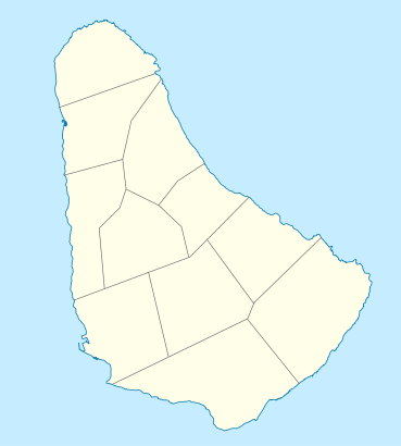
See Hillaby, Saint Thomas, on the map
Own work, using
- OpenStreetMap Data for the form of the island
- File:Barbados parishes numbered.png by Golbez for the borders of the parishes
Public Transit to Hillaby in Saint Thomas
Wondering how to get to Hillaby in Saint Thomas, Barbados? Moovit helps you find the best way to get to Hillaby with step-by-step directions from the nearest public transit station.
Moovit provides free maps and live directions to help you navigate through your city. View schedules, routes, timetables, and find out how long does it take to get to Hillaby in real time.
Looking for the nearest stop or station to Hillaby? Check out this list of stops closest to your destination: Mount Hillaby; Farmers; Airy Cot.
Bus: 3, 3A, 32, 1D.
Want to see if there’s another route that gets you there at an earlier time? Moovit helps you find alternative routes or times. Get directions from and directions to Hillaby easily from the Moovit App or Website.
We make riding to Hillaby easy, which is why over 1.5 million users, including users in Saint Thomas, trust Moovit as the best app for public transit. You don’t need to download an individual bus app or train app, Moovit is your all-in-one transit app that helps you find the best bus time or train time available.
For information on prices of bus, costs and ride fares to Hillaby, please check the Moovit app.
Use the app to navigate to popular places including to the airport, hospital, stadium, grocery store, mall, coffee shop, school, college, and university.
Hillaby Address: Saint Thomas street in Saint Thomas
Own work, using
- OpenStreetMap Data for the form of the island
- File:Barbados parishes numbered.png by Golbez for the borders of the parishes
Attractions near Hillaby
Mount Hillaby,Church of God World Wide Mission,Mount Hillaby,Mose Bottom,Blunts,Mount Hillaby,Highland Adventure Center,Highway 2,Boiling Spring,Orange Hill,Dunscombe,Dunscombe Hill,The Bushes,Big Leg's Bar,Dunscombe Moravian Church,Pure Style,Orange Hill Church Of God,Orange Hill,Bethel New Covenant Pentecostal Assemblies Of God,ChapmanHow to get to popular attractions in Saint Thomas with public transit
East Point Light House, Saint Philip,1st Avenue Free Hill, Bridgetown,Rock Hall, Saint George,Upper Collymore Rock, Bridgetown,Maurice Byer Polyclinic, Saint Peter,Wanstead Gardens, Saint James,The Fish Pot, Saint James,St Lucy District Hospital, Saint Lucy,Blenman Bar, Saint John,Fort George Heights Boulevard, Bridgetown,Prescod Boulevard, Bridgetown,Oistins, Christ Church,Rascals of Barbados, Bridgetown,Freshwater Bay, Barbados, Bridgetown,Edgecliff, Saint John,Pricesmart Barbados, Saint Michael,Barbados Crop over Festival, Bridgetown,Saanma Learning Centre, Bridgetown,Grazettes, Bridgetown,Bequest, Saint PhilipGet around Barbados by public transit!
Traveling around Barbados has never been so easy. See step by step directions as you travel to any attraction, street or major public transit station. View bus and train schedules, arrival times, service alerts and detailed routes on a map, so you know exactly how to get to anywhere in Barbados.
When traveling to any destination around Barbados use Moovit's Live Directions with Get Off Notifications to know exactly where and how far to walk, how long to wait for your line, and how many stops are left. Moovit will alert you when it's time to get off — no need to constantly re-check whether yours is the next stop.
Wondering how to use public transit in Barbados or how to pay for public transit in Barbados? Moovit public transit app can help you navigate your way with public transit easily, and at minimum cost. It includes public transit fees, ticket prices, and costs. Looking for a map of Barbados public transit lines? Moovit public transit app shows all public transit maps in Barbados with all bus routes and stops on an interactive map.
Barbados has 1 transit type(s), including: bus, operated by several transit agencies, including Transport Board