How to get to Hitler's Cross by bus?
Click on the bus route to see step by step directions with maps, line arrival times and updated time schedules.
From Rajiv Gandhi Infotech Park Phase-1, Paud
54 minFrom Baner Pashan Link road, Pune & Velhe
72 minFrom Wipro Phase 2, Paud
58 minFrom Old Sangvi Bus Stand, Pune & Velhe
50 minFrom National Centre for Cell Science (NCCS), Pune & Velhe
67 minFrom Symbiosis Institute Of Management Studies (Sims), Pune & Velhe
57 minFrom Dhanori, Pune & Velhe
74 minFrom Amar Madhuban the Park, Pune & Velhe
63 minFrom Baner, Pune & Velhe
50 minFrom Kamar Ali Durvesh Auto Garage, Pune & Velhe
35 min
How to get to Hitler's Cross by train?
Click on the train route to see step by step directions with maps, line arrival times and updated time schedules.
How to get to Hitler's Cross by metro?
Click on the metro route to see step by step directions with maps, line arrival times and updated time schedules.
Bus stops near Hitler's Cross in Pune & Velhe
Train station near Hitler's Cross in Pune & Velhe
- Pimpri, 22 min walk,VIEW
Metro station near Hitler's Cross in Pune & Velhe
- PCMC, 26 min walk,VIEW
Bus lines to Hitler's Cross in Pune & Velhe
- 311, Pune Station Depot - Pimpri Gaon,VIEW
- 376, Pimpri Gaon - Ma.Na.Pa Bhavan,VIEW
- 302A, Alandi Darshan - Pimpri Gaon,VIEW
- 276C, Masulkar Colony To NDA Gate No.10,VIEW
- METRO SHUTTLE 32, Nigdi Bhakti Shakti Terminal - Nashik Phata Metro Station,VIEW
- 276B, Masulkar Colony,VIEW
- 326, Pimpri Gaon,VIEW
- 334, Pimpri Gaon,VIEW
- 326A, Chikhali Nageshwar Vidyalaya,VIEW
- 42, Gujarwadi Phata Pmt Bus Stand - Nigdi Bhakti Shakti Terminal,VIEW
- 122, Chinchwadgaon - Ma.Na.Pa Bhavan,VIEW
- 123, Ma.Na.Pa Bhavan - Nigdi Bhakti Shakti Terminal,VIEW
- 139, Nigdi Bhakti Shakti Terminal - Shewalewadi Depot,VIEW
- 262, Pune Station - Dehu Gaon Krida Sankul,VIEW
- 281, Ganpati Matha - Nigdi Bhakti Shakti Terminal,VIEW
- 312, Pune Station Depot - Chinchwadgaon,VIEW
- 317, Pune Station Depot - Sambhajinagar,VIEW
- 319, Mukai Chowk Terminal (Kiwale) - Pimplegurav,VIEW
- 329, Sudumbre Siddhant College - Pimpri Road,VIEW
- 336, Nigdi Bhakti Shakti Terminal - Kesnand Phata Wagholi,VIEW
What are the closest stations to Hitler's Cross?
The closest stations to Hitler's Cross are:
- Masulkar Colony is 103 meters away, 2 min walk.
- Mhada Colony is 488 meters away, 7 min walk.
- Finolex Morwadi is 1031 meters away, 14 min walk.
- Mahindra Company Pimpri Road is 1643 meters away, 22 min walk.
- Pimpri is 1651 meters away, 22 min walk.
- PCMC is 1993 meters away, 26 min walk.
Which bus lines stop near Hitler's Cross?
These bus lines stop near Hitler's Cross: 311, 326A, 376.
Which train line stops near Hitler's Cross?
99904 (Talegaon)
Which metro line stops near Hitler's Cross?
PURPLE (Towards PCMC)
What’s the nearest metro station to Hitler's Cross in Pune & Velhe?
The nearest metro station to Hitler's Cross in Pune & Velhe is PCMC. It’s a 26 min walk away.
What’s the nearest train station to Hitler's Cross in Pune & Velhe?
The nearest train station to Hitler's Cross in Pune & Velhe is Pimpri. It’s a 22 min walk away.
What’s the nearest bus station to Hitler's Cross in Pune & Velhe?
The nearest bus station to Hitler's Cross in Pune & Velhe is Masulkar Colony. It’s a 2 min walk away.
What time is the first metro to Hitler's Cross in Pune & Velhe?
The PURPLE is the first metro that goes to Hitler's Cross in Pune & Velhe. It stops nearby at 6:00 AM.
What time is the last metro to Hitler's Cross in Pune & Velhe?
The PURPLE is the last metro that goes to Hitler's Cross in Pune & Velhe. It stops nearby at 11:33 PM.
What time is the first train to Hitler's Cross in Pune & Velhe?
The 99804 is the first train that goes to Hitler's Cross in Pune & Velhe. It stops nearby at 5:05 AM.
What time is the last train to Hitler's Cross in Pune & Velhe?
The 99901 is the last train that goes to Hitler's Cross in Pune & Velhe. It stops nearby at 12:58 AM.
What time is the first bus to Hitler's Cross in Pune & Velhe?
The RATRANI 6 is the first bus that goes to Hitler's Cross in Pune & Velhe. It stops nearby at 3:42 AM.
What time is the last bus to Hitler's Cross in Pune & Velhe?
The RATRANI 6 is the last bus that goes to Hitler's Cross in Pune & Velhe. It stops nearby at 1:42 AM.
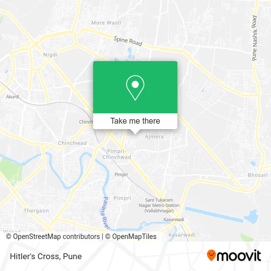
See Hitler's Cross, Pune & Velhe, on the map
Public Transit to Hitler's Cross in Pune & Velhe
Wondering how to get to Hitler's Cross in Pune & Velhe? Moovit helps you find the best way to get to Hitler's Cross with step-by-step directions from the nearest public transit station.
Moovit provides free maps and live directions to help you navigate through your city. View schedules, routes, timetables, and find out how long does it take to get to Hitler's Cross in real time.
Looking for the nearest stop or station to Hitler's Cross? Check out this list of stops closest to your destination: Masulkar Colony; Mhada Colony; Finolex Morwadi; Mahindra Company Pimpri Road; Pimpri; PCMC.
Bus: 311, 326A, 376, 302A, 276C, METRO SHUTTLE 32, 276B, 326, 334, 42, 122, 123, 139, 262.Train: 99904, 99801, 99802, 99803, 99804, 99805.Metro: PURPLE.
Want to see if there’s another route that gets you there at an earlier time? Moovit helps you find alternative routes or times. Get directions from and directions to Hitler's Cross easily from the Moovit App or Website.
We make riding to Hitler's Cross easy, which is why over 1.5 million users, including users in Pune & Velhe, trust Moovit as the best app for public transit. You don’t need to download an individual bus app or train app, Moovit is your all-in-one transit app that helps you find the best bus time or train time available.
For information on prices of bus, metro and train, costs and ride fares to Hitler's Cross, please check the Moovit app.
Use the app to navigate to popular places including to the airport, hospital, stadium, grocery store, mall, coffee shop, school, college, and university.
Hitler's Cross Address: No. 1 Path चिंचवाड 411017 MH street in Pune & Velhe
- Amritsari Kulcha,Pimpri,
- Sahyadri Misal House & Snacks Centre,
- Ajmera Housing Complex,
- Kharalwadi,
- Om Shanti Footwear,
- The weed garage,
- Trade Syndicate-Loctite,
- SSB Kids Pre-School,
- Ambika Hotel,
- Patanjali Arogya Kendra & Store,
- Yashoda Dairy Farm,
- Saraswati General Stores,
- Ajmera Housing Society,
- Saraswati Tours and Travels,
- Takshashila Housing Society,
- Sunshine Enterprises,
- Rock Garden,
- Ajmera Complex,
- Hum Hain na-Day Care Centre,
- King's Park
Places Near Hitler's Cross (Pune & Velhe)
- Symbiosis Lavale Bus Stop, Pune & Velhe,
- Vishwakarma Institute Of Technology (Vit), Pune & Velhe,
- Fc Road, Pune & Velhe,
- Laxmi Road, Pune & Velhe,
- Cognizant Deccan Campus (CDC), Paud,
- Pvr Icon - Pavilion Mall, Pune & Velhe,
- ISKCON Nvcc Temple, Pune & Velhe,
- Pune Okayama Friendship Garden, Pune & Velhe,
- Tulshibaug, Pune & Velhe,
- M G Road, Pune & Velhe,
- BAPS Shri Swaminarayan Mandir, Pune & Velhe,
- Dagadusheth Halwai Ganapati Temple, Pune & Velhe,
- ISKCON Pune, Pune & Velhe,
- Dagdusheth Halwai Ganpati Mandir, Pune & Velhe,
- Sarasbaug, Pune & Velhe,
- Senapati Bapat Road, Pune & Velhe,
- Westend Mall, Pune & Velhe,
- Ion Digital Zone, Pune & Velhe,
- Swaminarayan Mandir, Pune & Velhe,
- Chaturshringi Temple, Pune & Velhe
How to get to popular places in Pune with public transit
Get around Pune & Velhe by public transit!
Traveling around Pune & Velhe has never been so easy. See step by step directions as you travel to any attraction, street or major public transit station. View bus and train schedules, arrival times, service alerts and detailed routes on a map, so you know exactly how to get to anywhere in Pune & Velhe.
When traveling to any destination around Pune & Velhe use Moovit's Live Directions with Get Off Notifications to know exactly where and how far to walk, how long to wait for your line, and how many stops are left. Moovit will alert you when it's time to get off — no need to constantly re-check whether yours is the next stop.
Wondering how to use public transit in Pune & Velhe or how to pay for public transit in Pune & Velhe? Moovit public transit app can help you navigate your way with public transit easily, and at minimum cost. It includes public transit fees, ticket prices, and costs. Looking for a map of Pune & Velhe public transit lines? Moovit public transit app shows all public transit maps in Pune & Velhe with all Bus, Train and Metro routes and stops on an interactive map.
Pune has 3 transit type(s), including: Bus, Train and Metro, operated by several transit agencies, including Pune Metro (Maha Metro), PMPML, PMPML Night Bus Service (Ratrani) and Central Railways (Indian Railways)