Directions to Hl Auto Service (Waltham) with public transportation
The following transit lines have routes that pass near Hl Auto Service
 Bus: 558, 70.
- Train: FITCHBURG, FRAMINGHAM/WORCESTER.
How to get to Hl Auto Service by bus?
Click on the bus route to see step by step directions with maps, line arrival times and updated time schedules.
From Boston College (BC), Boston
64 minFrom Cambridge, MA, Cambridge
61 minFrom Micro Center (Micro Elecronics), Cambridge
55 minFrom Cambridge Hospital, Cambridge
68 minFrom Spaulding Hospital, Cambridge
62 minFrom Cambridge Health Alliance (CHA), Cambridge
65 minFrom Cambria Hotel Boston Somerville, Somerville
73 minFrom Harvard Business School, Boston
45 minFrom Spaulding Rehabilitation Center, Boston
42 minFrom Homewood Suites by Hilton Boston Brookline-Longwood Medical, Brookline
73 min
How to get to Hl Auto Service by train?
Click on the train route to see step by step directions with maps, line arrival times and updated time schedules.
Bus stops near Hl Auto Service in Waltham
Train stations near Hl Auto Service in Waltham
What are the closest stations to Hl Auto Service?
The closest stations to Hl Auto Service are:
- River St @ Jackson St is 167 yards away, 3 min walk.
- Main St @ Appleton St is 455 yards away, 6 min walk.
- Waverley is 2194 yards away, 26 min walk.
- West Newton is 2966 yards away, 35 min walk.
Which bus lines stop near Hl Auto Service?
These bus lines stop near Hl Auto Service: 558, 70.
Which train lines stop near Hl Auto Service?
These train lines stop near Hl Auto Service: FITCHBURG, FRAMINGHAM/WORCESTER.
What’s the nearest train station to Hl Auto Service in Waltham?
The nearest train station to Hl Auto Service in Waltham is Waverley. It’s a 26 min walk away.
What’s the nearest bus station to Hl Auto Service in Waltham?
The nearest bus station to Hl Auto Service in Waltham is River St @ Jackson St. It’s a 3 min walk away.
What time is the first train to Hl Auto Service in Waltham?
The FRAMINGHAM/WORCESTER is the first train that goes to Hl Auto Service in Waltham. It stops nearby at 5:22 AM.
What time is the last train to Hl Auto Service in Waltham?
The FRAMINGHAM/WORCESTER is the last train that goes to Hl Auto Service in Waltham. It stops nearby at 12:20 AM.
What time is the first bus to Hl Auto Service in Waltham?
The 70 is the first bus that goes to Hl Auto Service in Waltham. It stops nearby at 4:49 AM.
What time is the last bus to Hl Auto Service in Waltham?
The 70 is the last bus that goes to Hl Auto Service in Waltham. It stops nearby at 12:42 AM.
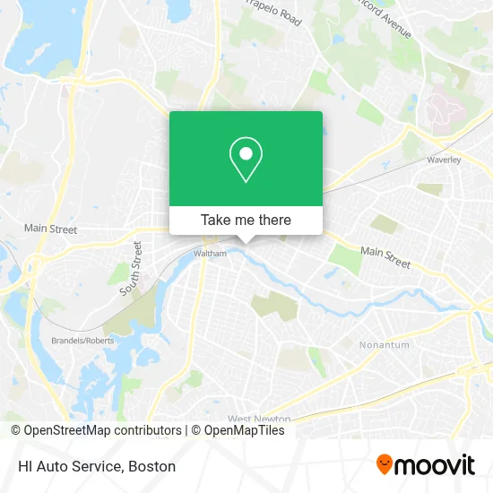
See Hl Auto Service, Waltham, on the map
Public Transit to Hl Auto Service in Waltham
Wondering how to get to Hl Auto Service in Waltham? Moovit helps you find the best way to get to Hl Auto Service with step-by-step directions from the nearest public transit station.
Moovit provides free maps and live directions to help you navigate through your city. View schedules, routes, timetables, and find out how long does it take to get to Hl Auto Service in real time.
Looking for the nearest stop or station to Hl Auto Service? Check out this list of stops closest to your destination: River St @ Jackson St; Main St @ Appleton St; Waverley; West Newton.
Bus: 558, 70.Train: FITCHBURG, FRAMINGHAM/WORCESTER.
Want to see if there’s another route that gets you there at an earlier time? Moovit helps you find alternative routes or times. Get directions from and directions to Hl Auto Service easily from the Moovit App or Website.
We make riding to Hl Auto Service easy, which is why over 1.7 million users, including users in Waltham, trust Moovit as the best app for public transit. You don’t need to download an individual bus app or train app, Moovit is your all-in-one transit app that helps you find the best bus time or train time available.
For information on prices of bus, train and subway, costs and ride fares to Hl Auto Service, please check the Moovit app.
Use the app to navigate to popular places including to the airport, hospital, stadium, grocery store, mall, coffee shop, school, college, and university.
Hl Auto Service Address: 99 Newton St street in Waltham
- Chiropractic,
- Rich History,
- Sacred Heart Church, Waltham,
- Dogpound,
- Gilbrae Inn,
- Jr Custom Shower Doors Glass Services,
- Reliable Locksmith,
- AJ's Automotive,
- Locks & Locksmiths,
- Anytime Anywhere Emergency Locksmith,
- United States Associations & Affiliations Online Portal,
- Waltham Community Services,
- Mbta Bus Stop Route 70/70A,
- Nova Locksmith of Waltham,
- Nails by Reflections,
- Locksmith 24 Hours,
- ATM,
- Lamacchia Realty - Waltham,
- GPS South Shore,
- Kathleen Keaveney Law
Places Near Hl Auto Service (Waltham)
- Boston Convention & Exhibition Center, Boston,
- Castle Island, Boston,
- House Of Blues, Boston,
- Boston Medical Center, Boston,
- Cheers, Boston,
- Museum Of Science, Boston,
- Boston Common, Boston,
- Massachusetts General Hospital, Boston,
- Td Garden, Boston,
- Mgm Music Hall, Boston,
- Isabella Stewart Gardner Museum, Boston,
- Leader Bank Pavilion (Leader Bank Pavillion), Boston,
- Wang Theater, Boston,
- Seaport District, Boston,
- Prudential Center, Boston,
- Faneuil Hall, Boston,
- Quincy Market, Boston,
- Boston Children's Hospital, Boston,
- Wilbur Theatre, Boston,
- North End, Boston
How to get to popular places in Boston with public transit
Get around Waltham by public transit!
Traveling around Waltham has never been so easy. See step by step directions as you travel to any attraction, street or major public transit station. View bus and train schedules, arrival times, service alerts and detailed routes on a map, so you know exactly how to get to anywhere in Waltham.
When traveling to any destination around Waltham use Moovit's Live Directions with Get Off Notifications to know exactly where and how far to walk, how long to wait for your line, and how many stops are left. Moovit will alert you when it's time to get off — no need to constantly re-check whether yours is the next stop.
Wondering how to use public transit in Waltham or how to pay for public transit in Waltham? Moovit public transit app can help you navigate your way with public transit easily, and at minimum cost. It includes public transit fees, ticket prices, and costs. Looking for a map of Waltham public transit lines? Moovit public transit app shows all public transit maps in Waltham with all Bus, Train, Subway and Ferry routes and stops on an interactive map.
Boston has 4 transit type(s), including: Bus, Train, Subway and Ferry, operated by several transit agencies, including MBTA, Southeastern Regional Transit Authority, MetroWest Regional Transit Authority, Rhode Island Public Transit Authority, WRTA, Lowell Regional Transit Authority, Merrimack Valley Transit, Montachusett Regional Transit Authority, Cape Cod Regional Transit Authority, Brockton Area Transit Authority, Martha's Vineyard Transit Authority, the WAVE - Nantucket Regional Transit Authority, GATRA, Cape Ann Transportation Authority and Massport