How to get to Hogar Jsp by bus?
Click on the bus route to see step by step directions with maps, line arrival times and updated time schedules.
From Poligono Industrial Aimayr, San Martín De La Vega
63 minFrom Loranca, Área Metropolitana De Madrid Y Corredor Del Henares
103 minFrom Nassica, Área Metropolitana De Madrid Y Corredor Del Henares
49 minFrom Balneario Thermas De Griñón, Comarca Sur
136 minFrom Cobo Calleja, Fuenlabrada
99 minFrom Costco, Área Metropolitana De Madrid Y Corredor Del Henares
83 minFrom Desguaces La Torre, Comarca Sur
113 minFrom Tanatorio Getafe, Getafe
106 minFrom The Style Outlets Getafe, Getafe
47 minFrom Hospital Infanta Cristina., Área Metropolitana De Madrid Y Corredor Del Henares
101 min
How to get to Hogar Jsp by train?
Click on the train route to see step by step directions with maps, line arrival times and updated time schedules.
Bus stops near Hogar Jsp in Valdemoro
Bus lines to Hogar Jsp in Valdemoro
- 7, Hospital - El Restón - Estación FF.CC.,VIEW
- 422, P.º Delicias - Plaza De Legazpi,VIEW
- 466, Real - Est. La Ballena,VIEW
- N401, Pza. Emperador Carlos V - Atocha,VIEW
- 3, Circular (El Restón - Av. de Andalucía - El Restón),VIEW
- 1, Circular (FF.CC. - Ambulatorio - FF.CC.),VIEW
- C3, Pinto,VIEW
- C3, Madrid-Atocha Cercanías,VIEW
What are the closest stations to Hogar Jsp?
The closest stations to Hogar Jsp are:
- Av. España - Jamaica is 305 meters away, 5 min walk.
- Av. España - Aguado is 397 meters away, 6 min walk.
- Aguado - Av. Hispanoamérica is 640 meters away, 9 min walk.
- Cuba - Colegio is 785 meters away, 11 min walk.
- Valdemoro is 3355 meters away, 43 min walk.
Which bus lines stop near Hogar Jsp?
These bus lines stop near Hogar Jsp: 422, 428, 7.
Which train line stops near Hogar Jsp?
C3 (Aranjuez)
What’s the nearest bus station to Hogar Jsp in Valdemoro?
The nearest bus station to Hogar Jsp in Valdemoro is Av. España - Jamaica. It’s a 5 min walk away.
What time is the first train to Hogar Jsp in Valdemoro?
The C3 is the first train that goes to Hogar Jsp in Valdemoro. It stops nearby at 5:29 AM.
What time is the last train to Hogar Jsp in Valdemoro?
The C3 is the last train that goes to Hogar Jsp in Valdemoro. It stops nearby at 12:23 AM.
What time is the first bus to Hogar Jsp in Valdemoro?
The N401 is the first bus that goes to Hogar Jsp in Valdemoro. It stops nearby at 3:48 AM.
What time is the last bus to Hogar Jsp in Valdemoro?
The N401 is the last bus that goes to Hogar Jsp in Valdemoro. It stops nearby at 2:34 AM.
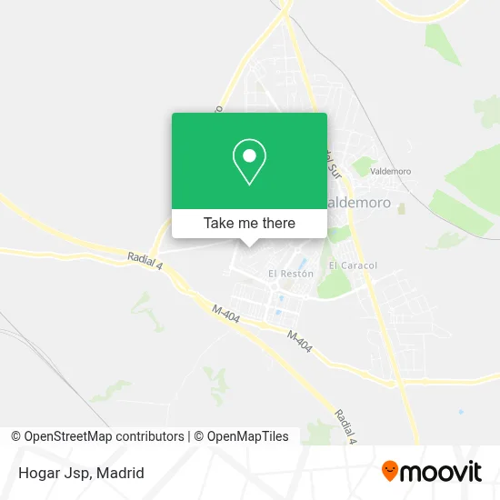
See Hogar Jsp, Valdemoro, on the map
Public Transit to Hogar Jsp in Valdemoro
Wondering how to get to Hogar Jsp in Valdemoro? Moovit helps you find the best way to get to Hogar Jsp with step-by-step directions from the nearest public transit station.
Moovit provides free maps and live directions to help you navigate through your city. View schedules, routes, timetables, and find out how long does it take to get to Hogar Jsp in real time.
Looking for the nearest stop or station to Hogar Jsp? Check out this list of stops closest to your destination: Av. España - Jamaica; Av. España - Aguado; Aguado - Av. Hispanoamérica; Cuba - Colegio; Valdemoro.
Bus: 422, 428, 7, 466, N401, 3, 1, C3, C3.Train: C3.
Want to see if there’s another route that gets you there at an earlier time? Moovit helps you find alternative routes or times. Get directions from and directions to Hogar Jsp easily from the Moovit App or Website.
We make riding to Hogar Jsp easy, which is why over 1.5 million users, including users in Valdemoro, trust Moovit as the best app for public transit. You don’t need to download an individual bus app or train app, Moovit is your all-in-one transit app that helps you find the best bus time or train time available.
For information on prices of bus, train and metro, costs and ride fares to Hogar Jsp, please check the Moovit app.
Use the app to navigate to popular places including to the airport, hospital, stadium, grocery store, mall, coffee shop, school, college, and university.
Hogar Jsp Address: Calle Honduras, 28341 Valdemoro street in Valdemoro
- Doctor Lazarraga, s.L,
- Mc Estética,
- Manuel Lorden Núñez,
- Calle República Dominicana,
- Clinica Podológica Arr,
- Calle Honduras 19,
- Art-Studios S.Coop.Mad,
- Dismamateriales,
- Centro Ozone Bowling V,
- Sacsalud,
- Calle Bolivia, 40,
- Calle Bahamas 4,
- Ideal Home,
- Reypal Perforaciones y Ayudas,
- Tránsitos Logísticos Pem S.L,
- Restaurante Peruano la Cuspide Valdemoro,
- Tienda de Chinos,
- Spar Express,
- Avenida de España 117,
- Juzgados 4,5,6 Valdemoro
Places Near Hogar Jsp (Valdemoro)
- Plaza Mayor, Madrid,
- Plenilunio, Área Metropolitana De Madrid Y Corredor Del Henares,
- Sala La Riviera, Madrid,
- Centro Comercial Islazul, Área Metropolitana De Madrid Y Corredor Del Henares,
- Hospital Clínico Universitario San Carlos, Madrid,
- Centro Comercial Oasiz Madrid, Área Metropolitana De Madrid Y Corredor Del Henares,
- Mercadillo de Majadahonda, Majadahonda,
- Wizink Center, Madrid,
- Centro Comercial La Gavia, Área Metropolitana De Madrid Y Corredor Del Henares,
- Nassica, Área Metropolitana De Madrid Y Corredor Del Henares,
- Estadio Wanda Metropolitano, Área Metropolitana De Madrid Y Corredor Del Henares,
- Hospital Universitario Ramón y Cajal, Madrid,
- Palacio De Vistalegre, Área Metropolitana De Madrid Y Corredor Del Henares,
- Centro Comercial La Vaguada, Área Metropolitana De Madrid Y Corredor Del Henares,
- Rastro De Madrid, Área Metropolitana De Madrid Y Corredor Del Henares,
- Estacion de Chamartin, Madrid,
- Calle de López de Hoyos 169, Madrid,
- Hospital Universitario La Paz, Madrid,
- Mendez Alvaro, Madrid,
- Tres Aguas, Alcorcón
How to get to popular places in Madrid with public transit
Get around Valdemoro by public transit!
Traveling around Valdemoro has never been so easy. See step by step directions as you travel to any attraction, street or major public transit station. View bus and train schedules, arrival times, service alerts and detailed routes on a map, so you know exactly how to get to anywhere in Valdemoro.
When traveling to any destination around Valdemoro use Moovit's Live Directions with Get Off Notifications to know exactly where and how far to walk, how long to wait for your line, and how many stops are left. Moovit will alert you when it's time to get off — no need to constantly re-check whether yours is the next stop.
Wondering how to use public transit in Valdemoro or how to pay for public transit in Valdemoro? Moovit public transit app can help you navigate your way with public transit easily, and at minimum cost. It includes public transit fees, ticket prices, and costs. Looking for a map of Valdemoro public transit lines? Moovit public transit app shows all public transit maps in Valdemoro with all Bus, Train, Metro and Light Rail routes and stops on an interactive map.
Madrid has 4 transit type(s), including: Bus, Train, Metro and Light Rail, operated by several transit agencies, including Metro de Madrid, Metro Ligero, Tranvía de Parla, Renfe Cercanías - Servicios de Autobús especiales, Renfe Cercanias, Renfe Cercanías, EMT, Interurbanos, Urbanos de Alcalá de Henares, Urbanos de Alcobendas, Urbanos de Alcorcón, Urbanos de Algete, Urbanos de Aranjuez, Urbanos de Arganda del Rey and Urbanos de Arroyomolinos