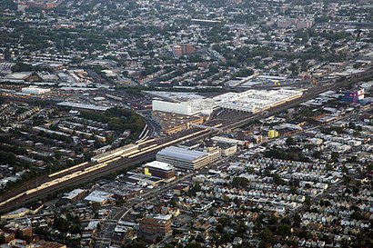
See Holban Yards, Queens, on the map
Directions to Holban Yards (Queens) with public transportation
The following transit lines have routes that pass near Holban Yards
 Bus:
Bus: - Train:
- Subway:
How to get to Holban Yards by bus?
Click on the bus route to see step by step directions with maps, line arrival times and updated time schedules.
How to get to Holban Yards by train?
Click on the train route to see step by step directions with maps, line arrival times and updated time schedules.
How to get to Holban Yards by subway?
Click on the subway route to see step by step directions with maps, line arrival times and updated time schedules.
Bus stations near Holban Yards in Queens
- Liberty Av/Camden Av,5 min walk,
- Polhemas Av/Watson Pl,18 min walk,
Bus lines to Holban Yards in Queens
- Q83,Cambria Hts 227 St Via Liberty Via Mrdck,
- Q42,Addesleigh Park Sayres Av,
What are the closest stations to Holban Yards?
The closest stations to Holban Yards are:
- Liberty Av/Camden Av is 361 yards away, 5 min walk.
- Polhemas Av/Watson Pl is 1444 yards away, 18 min walk.
Which bus line stops near Holban Yards?
Q83
Which train line stops near Holban Yards?
BABYLON
Which subway line stops near Holban Yards?
F
What’s the nearest bus stop to Holban Yards in Queens?
The nearest bus stop to Holban Yards in Queens is Liberty Av/Camden Av. It’s a 5 min walk away.
See Holban Yards, Queens, on the map
Public Transit to Holban Yards in Queens
Wondering how to get to Holban Yards in Queens, United States? Moovit helps you find the best way to get to Holban Yards with step-by-step directions from the nearest public transit station.
Moovit provides free maps and live directions to help you navigate through your city. View schedules, routes, timetables, and find out how long does it take to get to Holban Yards in real time.
Looking for the nearest stop or station to Holban Yards? Check out this list of stops closest to your destination: Liberty Av/Camden Av; Polhemas Av/Watson Pl.
Bus:Train:Subway:
Want to see if there’s another route that gets you there at an earlier time? Moovit helps you find alternative routes or times. Get directions from and directions to Holban Yards easily from the Moovit App or Website.
We make riding to Holban Yards easy, which is why over 1.5 million users, including users in Queens, trust Moovit as the best app for public transit. You don’t need to download an individual bus app or train app, Moovit is your all-in-one transit app that helps you find the best bus time or train time available.
For information on prices of bus, subway and train, costs and ride fares to Holban Yards, please check the Moovit app.
Use the app to navigate to popular places including to the airport, hospital, stadium, grocery store, mall, coffee shop, school, college, and university.
Location: Queens, New York - New Jersey
Attractions near Holban Yards
Camden at Dunkirk,106-20 Dunkirk St,G & S Orginals,Dunkirk Dunlop,Prime Storage,109-03 180th St,Dunkirk St (dunkirk street arcade),Dunkirk St,10505 Dunkirk St,Treasure Island of Jamaica,Randy's Auto Brokerage,183-16 Dunlop Avenue,10777 180th St,Babylon Ave,107-33 180th Street,J. Sussman, Inc.,Lock & Safe,183-41 Dunlop Ave,Camden Avenue,110th Ave (110th 180th)How to get to popular attractions in Queens with public transit
The Dutch, Manhattan,Rubirosa Ristorante, Manhattan,Stout, Manhattan,Burger Joint, Manhattan,New Jersey, Nutley, Nj,Ulysses Folk House, Manhattan,Gregory's Coffee, Manhattan,The Tippler, Manhattan,Boat Basin Cafe, Manhattan,Mission Dolores,Culture Espresso, Manhattan,Ritz Bar & Lounge, Manhattan,Joe's Shanghai 鹿嗚春, Manhattan,The Standard Grill, Manhattan,Stamford Transportation Center : Bus / Train (STM) Metro North & Amtrak, Stamford, Ct,LIRR - Babylon Station, Babylon, Ny,Top of The Standard, Manhattan,The Stanton Social, Manhattan,Doughnut Plant, Manhattan,5 Napkin Burger, ManhattanGet around Queens by public transit!
Traveling around Queens has never been so easy. See step by step directions as you travel to any attraction, street or major public transit station. View bus and train schedules, arrival times, service alerts and detailed routes on a map, so you know exactly how to get to anywhere in Queens.
When traveling to any destination around Queens use Moovit's Live Directions with Get Off Notifications to know exactly where and how far to walk, how long to wait for your line, and how many stops are left. Moovit will alert you when it's time to get off — no need to constantly re-check whether yours is the next stop.
Wondering how to use public transit in Queens or how to pay for public transit in Queens? Moovit public transit app can help you navigate your way with public transit easily, and at minimum cost. It includes public transit fees, ticket prices, and costs. Looking for a map of Queens public transit lines? Moovit public transit app shows all public transit maps in Queens with all bus, subway or train routes and stops on an interactive map.
Queens has 3 transit type(s), including: bus, subway or train, operated by several transit agencies, including MTA Subway, Metro-North Railroad, LIRR, PATH, Shore Line East, MTA Bus Company, MTA New York City Transit - Express routes, MTA Bus, NJ Transit, NYC Ferry, NICE bus, Bee-Line Bus, NJ Transit Rail, NJ Transit Rail and Norwalk Transit District