Directions to Holladay Park (Portland) with public transportation
The following transit lines have routes that pass near Holladay Park
How to get to Holladay Park by bus?
Click on the bus route to see step by step directions with maps, line arrival times and updated time schedules.
Light Rail stations near Holladay Park in Portland
- Lloyd Center/Ne 11th Ave,2 min walk,
- Interstate/Rose Quarter,16 min walk,
Bus stations near Holladay Park in Portland
- NE 11th & Holladay (South),2 min walk,
- NE 11th & Holladay (North),3 min walk,
- NE Multnomah & 3rd [Eb],11 min walk,
Bus lines to Holladay Park in Portland
- 70,NE Sunderland & Columbia River Corr Inst (South),
- BLUE,Blue Eastside Bus,
- RED,Red Bus,
- 8,SW 5th & Morrison (South),
- 77,NW Wilson & 27th (West),
What are the closest stations to Holladay Park?
The closest stations to Holladay Park are:
- Lloyd Center/Ne 11th Ave is 127 yards away, 2 min walk.
- NE 11th & Holladay (South) is 145 yards away, 2 min walk.
- NE 11th & Holladay (North) is 170 yards away, 3 min walk.
- NE Multnomah & 3rd [Eb] is 852 yards away, 11 min walk.
- Interstate/Rose Quarter is 1261 yards away, 16 min walk.
Which bus lines stop near Holladay Park?
These bus lines stop near Holladay Park: 20, 70, 8.
Which light rail lines stop near Holladay Park?
These light rail lines stop near Holladay Park: MAX BLUE LINE, MAX GREEN LINE.
What’s the nearest light rail station to Holladay Park in Portland?
The nearest light rail station to Holladay Park in Portland is Lloyd Center/Ne 11th Ave. It’s a 2 min walk away.
What’s the nearest bus stop to Holladay Park in Portland?
The nearest bus stop to Holladay Park in Portland is NE 11th & Holladay (South). It’s a 2 min walk away.
See Holladay Park, Portland, on the map
Public Transit to Holladay Park in Portland
Wondering how to get to Holladay Park in Portland, United States? Moovit helps you find the best way to get to Holladay Park with step-by-step directions from the nearest public transit station.
Moovit provides free maps and live directions to help you navigate through your city. View schedules, routes, timetables, and find out how long does it take to get to Holladay Park in real time.
Looking for the nearest stop or station to Holladay Park? Check out this list of stops closest to your destination: Lloyd Center/Ne 11th Ave; NE 11th & Holladay (South); NE 11th & Holladay (North); NE Multnomah & 3rd [Eb]; Interstate/Rose Quarter.
Bus:20708BLUERED77Light Rail:MAX BLUE LINEMAX GREEN LINE
Want to see if there’s another route that gets you there at an earlier time? Moovit helps you find alternative routes or times. Get directions from and directions to Holladay Park easily from the Moovit App or Website.
We make riding to Holladay Park easy, which is why over 1.5 million users, including users in Portland, trust Moovit as the best app for public transit. You don’t need to download an individual bus app or train app, Moovit is your all-in-one transit app that helps you find the best bus time or train time available.
For information on prices of bus and light rail, costs and ride fares to Holladay Park, please check the Moovit app.
Use the app to navigate to popular places including to the airport, hospital, stadium, grocery store, mall, coffee shop, school, college, and university.
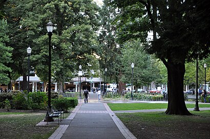
Holladay Park Address: Northeast 11th Avenue street in Portland
Attractions near Holladay Park
Lloyd Center / Northeast 11th Avenue,Trimet Lloyd Center 8343,TriMet Lloyd Center / NE 11th Ave MAX Station,Temptations Cafe,1007 NE 13th Ave,Biketown NE 11th at Holladay Park,Macy's,Macy's,Apollo College,Carrington College,Schranz Jeff,1201 NE Lloyd Blvd,Gap Kids,business center doubletree hotel,Joyful Noise - East Child Development,Shiekh Shoes,Bath & Body Works,All American Ice Cream & Frozen Yogurt,Tech Zone,GameStopHow to get to popular attractions in Portland with public transit
Pok Pok Noi, Portland,Hwy 26 at Cornelius Pass Rd, Hillsboro,TriMet Gresham City Hall MAX Station, Gresham,Kells Irish Restaurant & Pub, Portland,Breakside Brewery Slabtown, Portland,Mt. Tabor Neighborhood, Portland,Oregon, Milwaukie,Residence Inn Portland Airport at Cascade Station, Portland,Lloyd Center / Northeast 11th Avenue, Portland,Portland Japanese Garden, Portland,City of Battle Ground, Battle Ground,TriMet SE Flavel St MAX Station, Portland,TriMet Cascades MAX Station, Portland,Fred Meyer Gas Station - Cornelius, Cornelius,10 Barrel Brewing, Portland,Downtown Lake Oswego, Lake Oswego,First Tech Federal Credit Union, Portland,Bob's Red Mill Whole Grain Store, Milwaukie,TriMet Lents Town Center / Foster Rd MAX Station, Portland,Washington Square Transit Center, TigardGet around Portland by public transit!
Traveling around Portland has never been so easy. See step by step directions as you travel to any attraction, street or major public transit station. View bus and train schedules, arrival times, service alerts and detailed routes on a map, so you know exactly how to get to anywhere in Portland.
When traveling to any destination around Portland use Moovit's Live Directions with Get Off Notifications to know exactly where and how far to walk, how long to wait for your line, and how many stops are left. Moovit will alert you when it's time to get off — no need to constantly re-check whether yours is the next stop.
Wondering how to use public transit in Portland or how to pay for public transit in Portland? Moovit public transit app can help you navigate your way with public transit easily, and at minimum cost. It includes public transit fees, ticket prices, and costs. Looking for a map of Portland public transit lines? Moovit public transit app shows all public transit maps in Portland with all bus or light rail routes and stops on an interactive map.
Portland has 2 transit type(s), including: bus or light rail, operated by several transit agencies, including Mount Adams Transportation Service, RiverCities Transit, TriMet , TriMet , TriMet, Portland Streetcar, Portland Aerial Tram, C-TRAN, Multnomah County Job Connector Shuttles, Washington Park Shuttle, SMART, Canby Area Transit, South Clackamas Transportation District, The Wave and Lincoln County Transit