See Hollandsche Schouwburg, Amsterdam, on the map
Directions to Hollandsche Schouwburg (Amsterdam) with public transportation
The following transit lines have routes that pass near Hollandsche Schouwburg
 Bus:
Bus: - Train:
- Metro:
- Light Rail:
How to get to Hollandsche Schouwburg by bus?
Click on the bus route to see step by step directions with maps, line arrival times and updated time schedules.
How to get to Hollandsche Schouwburg by train?
Click on the train route to see step by step directions with maps, line arrival times and updated time schedules.
How to get to Hollandsche Schouwburg by metro?
Click on the metro route to see step by step directions with maps, line arrival times and updated time schedules.
Bus stations near Hollandsche Schouwburg in Amsterdam
- Artis,1 min walk,
- Waterlooplein,8 min walk,
- Wittenburgergracht,12 min walk,
- Ij Tunnel,12 min walk,
Light Rail stations near Hollandsche Schouwburg in Amsterdam
- Weesperplein,10 min walk,
Bus lines to Hollandsche Schouwburg in Amsterdam
- 14,Javaplein,
- N87,Station Bijlmer Arena,
- N86,Centraal Station,
- N89,Ijburg,
- N91,Nieuwendam,
- N93,Molenwijk,
- 246,Schiphol Airport/Plaza,
- N85,Centraal Station,
- 22,Station Sloterdijk,
- N06,Amsterdam Centraal - Purmerend Overwhere,
- N07,Amsterdam Centraal - Purmerend De Purmer,
- N11,Amsterdam Centraal - Marken,
- N14,Amsterdam - Broek in Waterland - Edam - Scharwoude - Hoorn,
- N19,Amsterdam Centraal via Oostzaan - Zaandam,
- N94,Amsterdam Centraal via Zaandam - Krommenie,
What are the closest stations to Hollandsche Schouwburg?
The closest stations to Hollandsche Schouwburg are:
- Artis is 3 meters away, 1 min walk.
- Waterlooplein is 586 meters away, 8 min walk.
- Weesperplein is 687 meters away, 10 min walk.
- Wittenburgergracht is 881 meters away, 12 min walk.
- Ij Tunnel is 900 meters away, 12 min walk.
Which bus lines stop near Hollandsche Schouwburg?
These bus lines stop near Hollandsche Schouwburg: 22, 320, 357, 37, 397.
Which train lines stop near Hollandsche Schouwburg?
These train lines stop near Hollandsche Schouwburg: IC, ICD, SPR.
Which metro line stops near Hollandsche Schouwburg?
54
Which light rail line stops near Hollandsche Schouwburg?
14
What’s the nearest light rail station to Hollandsche Schouwburg in Amsterdam?
The nearest light rail station to Hollandsche Schouwburg in Amsterdam is Weesperplein. It’s a 10 min walk away.
What’s the nearest bus stop to Hollandsche Schouwburg in Amsterdam?
The nearest bus stop to Hollandsche Schouwburg in Amsterdam is Artis. It’s a 1 min walk away.
What time is the first light rail to Hollandsche Schouwburg in Amsterdam?
The 19 is the first light rail that goes to Hollandsche Schouwburg in Amsterdam. It stops nearby at 5:30 AM.
What time is the last light rail to Hollandsche Schouwburg in Amsterdam?
The 19 is the last light rail that goes to Hollandsche Schouwburg in Amsterdam. It stops nearby at 12:45 AM.
What time is the first bus to Hollandsche Schouwburg in Amsterdam?
The N85 is the first bus that goes to Hollandsche Schouwburg in Amsterdam. It stops nearby at 3:03 AM.
What time is the last bus to Hollandsche Schouwburg in Amsterdam?
The N14 is the last bus that goes to Hollandsche Schouwburg in Amsterdam. It stops nearby at 3:22 AM.
See Hollandsche Schouwburg, Amsterdam, on the map
Public Transit to Hollandsche Schouwburg in Amsterdam
Wondering how to get to Hollandsche Schouwburg in Amsterdam, Netherlands? Moovit helps you find the best way to get to Hollandsche Schouwburg with step-by-step directions from the nearest public transit station.
Moovit provides free maps and live directions to help you navigate through your city. View schedules, routes, timetables, and find out how long does it take to get to Hollandsche Schouwburg in real time.
Looking for the nearest stop or station to Hollandsche Schouwburg? Check out this list of stops closest to your destination: Artis; Waterlooplein; Weesperplein; Wittenburgergracht; Ij Tunnel.
Bus:Train:Metro:Light Rail:
Want to see if there’s another route that gets you there at an earlier time? Moovit helps you find alternative routes or times. Get directions from and directions to Hollandsche Schouwburg easily from the Moovit App or Website.
We make riding to Hollandsche Schouwburg easy, which is why over 1.5 million users, including users in Amsterdam, trust Moovit as the best app for public transit. You don’t need to download an individual bus app or train app, Moovit is your all-in-one transit app that helps you find the best bus time or train time available.
For information on prices of bus, train, light rail and metro, costs and ride fares to Hollandsche Schouwburg, please check the Moovit app.
Use the app to navigate to popular places including to the airport, hospital, stadium, grocery store, mall, coffee shop, school, college, and university.
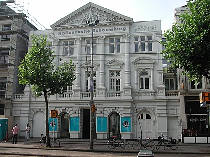
Hollandsche Schouwburg Address: Plantage Middenlaan street in Amsterdam
Hollandsche Schouwburg (Dutch pronunciation: [ˈɦɔlɑntsə ˈsxʌubʏr(ə)x]; English: Hollandic Theatre) is a museum in Amsterdam in the Netherlands.Wiki
Attractions near Hollandsche Schouwburg
Hollandsche Schouwburg,Hotel Park Plantage Amsterdam,Artis,Quentin Zoo Hotel,Hotel Plantage Amsterdam,Plantage Middenlaan,Micropia,Zoo Artis,Powned,Café Restaurant De Plantage,Artis,Micropia,Plantage Kerklaan 38-40,plantage muidergracht 6,Amsterdam Zoo Artis,Koningszaal, Artis,Artis,The Lancaster Hotel Amsterdam,Henri Polaklaan 31,University of Amsterdam - Amsterdam Business SchoolHow to get to popular attractions in Amsterdam with public transit
Pacific Parc, Amsterdam,Poppodium 013, Tilburg,Heineken Nederland B.V, Zoeterwoude,Stadion Feijenoord, Rotterdam,Venlo, Venlo,TESO-Veerboot Den Helder → Texel, Den Helder,Station Delft Zuid, Delft,Knooppunt Kleinpolderplein, Rotterdam,Beneluxtunnel, Rotterdam,Pathé Schouwburgplein, Rotterdam,The Bulldog Palace, Amsterdam,Amstelveen, Amstelveen,Ministerie van Buitenlandse Zaken, 'S-Gravenhage,Safaripark Beekse Bergen, Hilvarenbeek,Pathé, Breda,Station Geldermalsen, Geldermalsen,Station Assen, Assen,Station Ede-Wageningen, Ede,Albert Heijn XL, Eindhoven,Winkelcentrum In de Bogaard, RijswijkGet around Amsterdam by public transit!
Traveling around Amsterdam has never been so easy. See step by step directions as you travel to any attraction, street or major public transit station. View bus and train schedules, arrival times, service alerts and detailed routes on a map, so you know exactly how to get to anywhere in Amsterdam.
When traveling to any destination around Amsterdam use Moovit's Live Directions with Get Off Notifications to know exactly where and how far to walk, how long to wait for your line, and how many stops are left. Moovit will alert you when it's time to get off — no need to constantly re-check whether yours is the next stop.
Wondering how to use public transit in Amsterdam or how to pay for public transit in Amsterdam? Moovit public transit app can help you navigate your way with public transit easily, and at minimum cost. It includes public transit fees, ticket prices, and costs. Looking for a map of Amsterdam public transit lines? Moovit public transit app shows all public transit maps in Amsterdam with all bus, train, light rail or metro routes and stops on an interactive map.
Amsterdam has 4 transit type(s), including: bus, train, light rail or metro, operated by several transit agencies, including NS, NS International, GVB, GVB, GVB, GVB, U-OV, U-OV, Overal, HTM, R-net, RET, RET, De Lijn and Connexxion