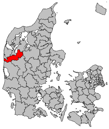
See Holstebro Kommune on the map
Directions to Holstebro Kommune with public transportation
The following transit lines have routes that pass near Holstebro Kommune
 Bus:
Bus: - Train:
How to get to Holstebro Kommune by bus?
Click on the bus route to see step by step directions with maps, line arrival times and updated time schedules.
How to get to Holstebro Kommune by train?
Click on the train route to see step by step directions with maps, line arrival times and updated time schedules.
Bus stations near Holstebro Kommune
- Frøjkvej/Nørrebrogade (Holstebro Kom),5 min walk,
- Slotsgade (Holstebro Kom),5 min walk,
Bus lines to Holstebro Kommune
- 24,Lemvig St. (Lemvig Kom) - Holstebro Trafikterminal,
- 270,UCH Døesvej (Holstebro Kom) - Thorsminde (Holstebro Kom),
- 283,Holstebro Trafikterminal - Ryde (Holstebro Kom),
- 296,Holstebro Trafikterminal - UCH Døesvej (Holstebro Kom),
- 298,Holstebro Trafikterminal - Holstebro Trafikterminal,
- 297,Holstebro Trafikterminal,
What are the closest stations to Holstebro Kommune?
The closest stations to Holstebro Kommune are:
- Frøjkvej/Nørrebrogade (Holstebro Kom) is 312 meters away, 5 min walk.
- Slotsgade (Holstebro Kom) is 324 meters away, 5 min walk.
Which bus lines stop near Holstebro Kommune?
These bus lines stop near Holstebro Kommune: 12, 28.
Which train lines stop near Holstebro Kommune?
These train lines stop near Holstebro Kommune: ICL, RE.
What’s the nearest bus stop to Holstebro Kommune?
The nearest bus stops to Holstebro Kommune are Frøjkvej/Nørrebrogade (Holstebro Kom) and Slotsgade (Holstebro Kom). The closest one is a 5 min walk away.
See Holstebro Kommune on the map
Public Transportation to Holstebro Kommune
Wondering how to get to Holstebro Kommune, Denmark? Moovit helps you find the best way to get to Holstebro Kommune with step-by-step directions from the nearest public transit station.
Moovit provides free maps and live directions to help you navigate through your city. View schedules, routes, timetables, and find out how long does it take to get to Holstebro Kommune in real time.
Looking for the nearest stop or station to Holstebro Kommune? Check out this list of stops closest to your destination: Frøjkvej/Nørrebrogade (Holstebro Kom); Slotsgade (Holstebro Kom).
Bus:Train:
Want to see if there’s another route that gets you there at an earlier time? Moovit helps you find alternative routes or times. Get directions from and directions to Holstebro Kommune easily from the Moovit App or Website.
We make riding to Holstebro Kommune easy, which is why over 1.5 million users, including users in Holstebro, trust Moovit as the best app for public transit. You don’t need to download an individual bus app or train app, Moovit is your all-in-one transit app that helps you find the best bus time or train time available.
For information on prices of bus and train, costs and ride fares to Holstebro Kommune, please check the Moovit app.
Use the app to navigate to popular places including to the airport, hospital, stadium, grocery store, mall, coffee shop, school, college, and university.
Location: Holstebro, Denmark
Attractions near Holstebro Kommune
Holstebro Bibliotek,Jobcenter Holstebro,Холтесбро,QWO,7500,霍爾斯特布羅,Холстебро,ჰოლსტებრო,Kirkepladsen,Rådhuskælderen,Divas And Gents,Miami Pizza,Rådhusstræde 4,Bianca Pure Skin,Platanvej, Vuggestuen,Holstebro Kirke,Kirkestræde 15,Vuggestuen Platanvej,Bog & Idé, Holstebro,TopdanmarkHow to get to popular attractions in Holstebro with public transit
FMI Kapacitetsansvarlig Koncern IT (KAKI), Hvidovre,Slagelse, Slagelse,Aarhus Rutebilstation, Århus,Jernbanebo, Nyborg,Greve Station, Greve,Silvan Skejby, Århus,Diakonhøjskolen, Århus,Sæby, Frederikshavn,Marselisborg Dyrehave, Århus,COWI A/S, Lyngby-Taarbæk,Nonnesøen, Rudersdal,Givskud Zoo - Løveparken, Vejle,Haslev Station, Faxe,Finsensvej, Frederiksberg,Ørsted Kantine, Gentofte,Albertslund Bibliotek, Hovedbiblioteket, Albertslund,Høje Taastrup Station, Busholdepladsen, Høje Taastrup,LEGO System A/S, Billund,Vejle Transportcenter, Vejle,Memphis Mansion, RandersGet around Holstebro by public transit!
Traveling around Holstebro has never been so easy. See step by step directions as you travel to any attraction, street or major public transit station. View bus and train schedules, arrival times, service alerts and detailed routes on a map, so you know exactly how to get to anywhere in Holstebro.
When traveling to any destination around Holstebro use Moovit's Live Directions with Get Off Notifications to know exactly where and how far to walk, how long to wait for your line, and how many stops are left. Moovit will alert you when it's time to get off — no need to constantly re-check whether yours is the next stop.
Wondering how to use public transit in Holstebro or how to pay for public transit in Holstebro? Moovit public transit app can help you navigate your way with public transit easily, and at minimum cost. It includes public transit fees, ticket prices, and costs. Looking for a map of Holstebro public transit lines? Moovit public transit app shows all public transit maps in Holstebro with all bus or train routes and stops on an interactive map.
Holstebro has 2 transit type(s), including: bus or train, operated by several transit agencies, including Metroselskabet, DSB S-tog, Lokaltog A/S, DSB S-tog, Midttrafik, Odense Letbane, DSB, NT, GoCollective, Midttrafik, Skånetrafiken, Metroselskabet, Movia, NT and Midttrafik