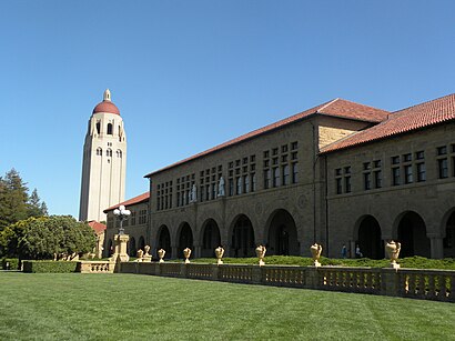
Directions to Hoover Digest (Stanford) with public transportation
The following transit lines have routes that pass near Hoover Digest
How to get to Hoover Digest by bus?
Click on the bus route to see step by step directions with maps, line arrival times and updated time schedules.
How to get to Hoover Digest by train?
Click on the train route to see step by step directions with maps, line arrival times and updated time schedules.
Bus stations near Hoover Digest in Stanford
- On Jane Stanford Way @ Hoover Tower,4 min walk,
- Stanford Oval,7 min walk,
- Campus Oval,7 min walk,
- On Campus Drive @ Munger Graduate Residence,8 min walk,
- Tresidder Union (Island),10 min walk,
Train stations near Hoover Digest in Stanford
- Palo Alto,17 min walk,
Bus lines to Hoover Digest in Stanford
- C LINE,On Clark Way @ VI at Palo Alto,
- C LINE LIMITED AM/PM,Stock Farm Garage,
- 281,Stanford Oval,
- U,Fremont BART,
- DB,To Stanford University,
- AE-F,On Quarry Road @ Psychiatry Building,
- P LINE,University Circle @ Platform South,
- SE,Shopping Express,
- SE,Shopping Express - Weekend,
- Y,Y Line,
- YL-AM,Y Limited AM,
- X,Tresidder Union (Island),
What are the closest stations to Hoover Digest?
The closest stations to Hoover Digest are:
- On Jane Stanford Way @ Hoover Tower is 270 yards away, 4 min walk.
- Stanford Oval is 545 yards away, 7 min walk.
- Campus Oval is 573 yards away, 7 min walk.
- On Campus Drive @ Munger Graduate Residence is 666 yards away, 8 min walk.
- Tresidder Union (Island) is 830 yards away, 10 min walk.
- Palo Alto is 1447 yards away, 17 min walk.
Which bus lines stop near Hoover Digest?
These bus lines stop near Hoover Digest: 22, DB, P LINE, Y, YL-AM.
Which train lines stop near Hoover Digest?
These train lines stop near Hoover Digest: LOCAL, LTD 4.
What’s the nearest train station to Hoover Digest in Stanford?
The nearest train station to Hoover Digest in Stanford is Palo Alto. It’s a 17 min walk away.
What’s the nearest bus stop to Hoover Digest in Stanford?
The nearest bus stop to Hoover Digest in Stanford is On Jane Stanford Way @ Hoover Tower. It’s a 4 min walk away.
What time is the first train to Hoover Digest in Stanford?
The LOCAL is the first train that goes to Hoover Digest in Stanford. It stops nearby at 4:55 AM.
What time is the last train to Hoover Digest in Stanford?
The LOCAL is the last train that goes to Hoover Digest in Stanford. It stops nearby at 1:07 AM.
What time is the first bus to Hoover Digest in Stanford?
The EB is the first bus that goes to Hoover Digest in Stanford. It stops nearby at 5:48 AM.
What time is the last bus to Hoover Digest in Stanford?
The OCA is the last bus that goes to Hoover Digest in Stanford. It stops nearby at 12:56 AM.
How much is the train fare to Hoover Digest?
The train fare to Hoover Digest costs about $3.20 - $14.45.
See Hoover Digest, Stanford, on the map
Public Transit to Hoover Digest in Stanford
Wondering how to get to Hoover Digest in Stanford, United States? Moovit helps you find the best way to get to Hoover Digest with step-by-step directions from the nearest public transit station.
Moovit provides free maps and live directions to help you navigate through your city. View schedules, routes, timetables, and find out how long does it take to get to Hoover Digest in real time.
Looking for the nearest stop or station to Hoover Digest? Check out this list of stops closest to your destination: On Jane Stanford Way @ Hoover Tower; Stanford Oval; Campus Oval; On Campus Drive @ Munger Graduate Residence; Tresidder Union (Island); Palo Alto.
Bus:22DBP LINEYYL-AMC LINEC LINE LIMITED AM/PMU281AE-FSESETrain:LOCALLTD 4BULLETLTD 3LTD 5
Want to see if there’s another route that gets you there at an earlier time? Moovit helps you find alternative routes or times. Get directions from and directions to Hoover Digest easily from the Moovit App or Website.
We make riding to Hoover Digest easy, which is why over 1.5 million users, including users in Stanford, trust Moovit as the best app for public transit. You don’t need to download an individual bus app or train app, Moovit is your all-in-one transit app that helps you find the best bus time or train time available.
For information on prices of bus, train and light rail, costs and ride fares to Hoover Digest, please check the Moovit app.
Use the app to navigate to popular places including to the airport, hospital, stadium, grocery store, mall, coffee shop, school, college, and university.
Hoover Digest Address: 434 Galvez Mall Stanford, CA 94305 street in Stanford
Attractions near Hoover Digest
Shumway Fountain,Stanford Libraries,Stanford Historical Society,Shumway Fountain - Red Hoop,Stanford Bing Overseas Studies Program,Stanford Redlab: Research in Education and Design,Challenge Success,Vanguard,Barnum Center,Mark Taper Student Center,Ram's Head Theatrical Society,Jesse Gaynor L Posture Fitness Coach,Escondido Turnaround,Stanford University,Stanford University,Stanford Tree Crew,Dilan Cleaning,Connie's Advertising Agency,Aysha Gomez-Kureishi, Harpist,Stanford Soccer Summer CampsHow to get to popular attractions in Stanford with public transit
San Francisco-Oakland Bay Bridge, Treasure Island, Sf,Nordstrom Stoneridge Mall in Pleasanton, Pleasanton,IKEA, East Palo Alto,Jelly Belly Factory, Fairfield,Fremont BART Station, Fremont,Walmart Supercenter, Milpitas,Golden Gate Park, Golden Gate Park, Sf,Alcatraz Cruises, North Beach, Sf,Safeway, Rohnert Park,Costco Wholesale, Antioch,Nordstrom Broadway Plaza in Walnut Creek, Walnut Creek,I-680 / US-101 / I-280 Interchange, San Jose,Sam's Club,Norman Y. Mineta San José International Airport (SJC), San Jose,Sfo, Sfo,Mountain View VTA Light Rail Station,Union City BART Station, Union City,Googleplex,LinkedIn,Nordstrom Valley Fair, San JoseGet around Stanford by public transit!
Traveling around Stanford has never been so easy. See step by step directions as you travel to any attraction, street or major public transit station. View bus and train schedules, arrival times, service alerts and detailed routes on a map, so you know exactly how to get to anywhere in Stanford.
When traveling to any destination around Stanford use Moovit's Live Directions with Get Off Notifications to know exactly where and how far to walk, how long to wait for your line, and how many stops are left. Moovit will alert you when it's time to get off — no need to constantly re-check whether yours is the next stop.
Wondering how to use public transit in Stanford or how to pay for public transit in Stanford? Moovit public transit app can help you navigate your way with public transit easily, and at minimum cost. It includes public transit fees, ticket prices, and costs. Looking for a map of Stanford public transit lines? Moovit public transit app shows all public transit maps in Stanford with all bus, train or light rail routes and stops on an interactive map.
Stanford has 3 transit type(s), including: bus, train or light rail, operated by several transit agencies, including BART, Bay Area Rapid Transit, Muni Metro, Caltrain, VTA, Capitol Corridor, Sonoma Marin Area Rail Transit, MUNI, VTA, SF Cable Car, AC Transit, Dumbarton Express, Golden Gate Transit, County Connection and SamTrans