Directions to Hope Block and Cheapside (Boston) with public transportation
The following transit lines have routes that pass near Hope Block and Cheapside
How to get to Hope Block and Cheapside by bus?
Click on the bus route to see step by step directions with maps, line arrival times and updated time schedules.
How to get to Hope Block and Cheapside by train?
Click on the train route to see step by step directions with maps, line arrival times and updated time schedules.
Bus stations near Hope Block and Cheapside in Boston
- Memorial After Westminster, 2 min walk,
- S Main Ns Washington, 2 min walk,
- Turks Head (Weybosset Before Post Office), 4 min walk,
- Roger Williams National Memorial, 4 min walk,
- Kennedy Plaza (Stop J), 5 min walk,
- Kennedy Plaza (Stop D), 5 min walk,
- Kennedy Plaza (Stop I), 5 min walk,
- Kennedy Plaza (Stop C), 5 min walk,
- Kennedy Plaza (Stop Z), 5 min walk,
- Kennedy Plaza (Stop Y), 6 min walk,
Train stations near Hope Block and Cheapside in Boston
- Providence, 53 min walk,
Bus lines to Hope Block and Cheapside in Boston
- 35, Kennedy Plaza,
- 60, Newport Via W Main Rd,
- 78, Kennedy Plaza Via Beverage Hill Ave,
- 92, Kennedy Plaza Then Brewery Parkade,
- 1, South Attleboro Station Via Hope St,
- 32, Seekonk Sq (Mass) Via Martin St,
- 33, Kennedy Plaza,
- 34, Kennedy Plaza Via Wampanoag Plaza,
- 40, Hope & Chace,
- 61X, Providence,
- 6, Prairie Ave/Roger Williams Park Zoo,
- 9X, Pascoag Express,
- 10X, North Scituate Express,
- 12X, Arctic/RI-117 Express,
- 20, Elmwood Ave/Airport,
- 22, Pontiac Ave,
- 59X, North Smithfield/Lincoln Express,
- 65X, Narragansett/Wakefield Express,
- 95X, Westerly Express,
- R, Broad Street Terminal (Providence),
What are the closest stations to Hope Block and Cheapside?
The closest stations to Hope Block and Cheapside are:
- Memorial After Westminster is 108 yards away, 2 min walk.
- S Main Ns Washington is 141 yards away, 2 min walk.
- Turks Head (Weybosset Before Post Office) is 252 yards away, 4 min walk.
- Roger Williams National Memorial is 302 yards away, 4 min walk.
- Kennedy Plaza (Stop J) is 339 yards away, 5 min walk.
- Kennedy Plaza (Stop D) is 348 yards away, 5 min walk.
- Kennedy Plaza (Stop I) is 363 yards away, 5 min walk.
- Kennedy Plaza (Stop C) is 389 yards away, 5 min walk.
- Kennedy Plaza (Stop Z) is 395 yards away, 5 min walk.
- Kennedy Plaza (Stop Y) is 429 yards away, 6 min walk.
- Providence is 4525 yards away, 53 min walk.
Which bus lines stop near Hope Block and Cheapside?
These bus lines stop near Hope Block and Cheapside: 21, 28, 3, 30, 35, 54, 60, QX.
Which train line stops near Hope Block and Cheapside?
PROVIDENCE/STOUGHTON
What’s the nearest bus stop to Hope Block and Cheapside in Boston?
The nearest bus stops to Hope Block and Cheapside in Boston are Memorial After Westminster and S Main Ns Washington. The closest one is a 2 min walk away.
What time is the first train to Hope Block and Cheapside in Boston?
The PROVIDENCE/STOUGHTON is the first train that goes to Hope Block and Cheapside in Boston. It stops nearby at 4:15 AM.
What time is the last train to Hope Block and Cheapside in Boston?
The NORTHEAST REGIONAL is the last train that goes to Hope Block and Cheapside in Boston. It stops nearby at 8:59 AM.
What time is the first bus to Hope Block and Cheapside in Boston?
The 20 is the first bus that goes to Hope Block and Cheapside in Boston. It stops nearby at 4:54 AM.
What time is the last bus to Hope Block and Cheapside in Boston?
The 60 is the last bus that goes to Hope Block and Cheapside in Boston. It stops nearby at 2:08 AM.
How much is the bus fare to Hope Block and Cheapside?
The bus fare to Hope Block and Cheapside costs about $2.00.
See Hope Block and Cheapside, Boston, on the map
Public Transit to Hope Block and Cheapside in Boston
Wondering how to get to Hope Block and Cheapside in Boston, United States? Moovit helps you find the best way to get to Hope Block and Cheapside with step-by-step directions from the nearest public transit station.
Moovit provides free maps and live directions to help you navigate through your city. View schedules, routes, timetables, and find out how long does it take to get to Hope Block and Cheapside in real time.
Looking for the nearest stop or station to Hope Block and Cheapside? Check out this list of stops closest to your destination: Memorial After Westminster; S Main Ns Washington; Turks Head (Weybosset Before Post Office); Roger Williams National Memorial; Kennedy Plaza (Stop J); Kennedy Plaza (Stop D); Kennedy Plaza (Stop I); Kennedy Plaza (Stop C); Kennedy Plaza (Stop Z); Kennedy Plaza (Stop Y); Providence.
Bus: 21, 28, 3, 30, 35, 54, 60, QX, 78, 92, 1, 32, 33, 34, 40, 6, 9X, 10X, 12X, 20, R, 51, 58, 72, 50.Train: PROVIDENCE/STOUGHTON, ACELA, NORTHEAST REGIONAL.
Want to see if there’s another route that gets you there at an earlier time? Moovit helps you find alternative routes or times. Get directions from and directions to Hope Block and Cheapside easily from the Moovit App or Website.
We make riding to Hope Block and Cheapside easy, which is why over 1.5 million users, including users in Boston, trust Moovit as the best app for public transit. You don’t need to download an individual bus app or train app, Moovit is your all-in-one transit app that helps you find the best bus time or train time available.
For information on prices of bus and train, costs and ride fares to Hope Block and Cheapside, please check the Moovit app.
Use the app to navigate to popular places including to the airport, hospital, stadium, grocery store, mall, coffee shop, school, college, and university.
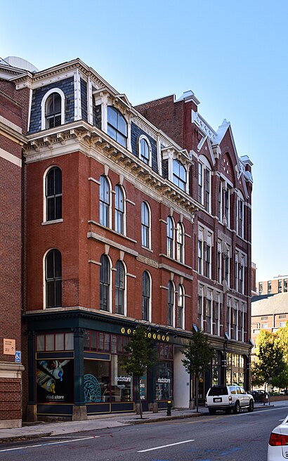
Hope Block and Cheapside Address: Washington Pl street in Boston
Attractions near Hope Block and Cheapside
Mac,Greater Kennedy Plaza,Canal St,Ghosts of Providence by US Ghost Adventures,Waterfire,Andrew B Prescott Attorney (Joseph B White Attorney),Morgan Stanley,Risd-College Annual Fund,Rhode Island School of Design Msm (Museum of Art),Korean War Memorial,Marriage Equality Ri (Rhode Islanders United for Marriage),RISD Museum,College Building,Textron Building Garage,White Rabbit Studio,Lynch & Pine (Patrick Lynch Law Firm),The Law Office of Attorney,Ocean State Business Development (St of Ri-Ri Pub Defender Office),Rhode Island Supreme Court (Supreme Ct-Fugitive Task Force),Court AdministratorHow to get to popular attractions in Boston with public transit
Wrentham Village Premium Outlets,Kendall Square, Cambridge,Fire & Ice (Fire Ice Restaurant), Boston,Commonwealth Ave, Boston,Amazon Robotics,60 Fenwood Road, Boston,Boston Convention & Exhibition Center, Boston,Logan Airport Employee Parking Garage, Chelsea,Patriots Train To Gillette Stadium, Boston,Jamaica Pond, Boston,Boch Center, Boston,Terminal E- Logan International Airport, Boston,Mashpee,Quinsigamond Community College, Worcester,500 Boylston Street, Boston,12 Channel Street, Boston,Envoy Hotel, Boston,Dudley Station, Boston,DoubleTree Suites by Hilton Hotel Boston - Cambridge, Boston,Education First / Ef, CambridgeGet around Boston by public transit!
Traveling around Boston has never been so easy. See step by step directions as you travel to any attraction, street or major public transit station. View bus and train schedules, arrival times, service alerts and detailed routes on a map, so you know exactly how to get to anywhere in Boston.
When traveling to any destination around Boston use Moovit's Live Directions with Get Off Notifications to know exactly where and how far to walk, how long to wait for your line, and how many stops are left. Moovit will alert you when it's time to get off — no need to constantly re-check whether yours is the next stop.
Wondering how to use public transit in Boston or how to pay for public transit in Boston? Moovit public transit app can help you navigate your way with public transit easily, and at minimum cost. It includes public transit fees, ticket prices, and costs. Looking for a map of Boston public transit lines? Moovit public transit app shows all public transit maps in Boston with all Bus, Train, Subway and Ferry routes and stops on an interactive map.
Boston has 4 transit type(s), including: Bus, Train, Subway and Ferry, operated by several transit agencies, including MBTA, Southeastern Regional Transit Authority, MetroWest Regional Transit Authority, Rhode Island Public Transit Authority, WRTA, Lowell Regional Transit Authority, Merrimack Valley Transit, Montachusett Regional Transit Authority, Cape Cod Regional Transit Authority, Brockton Area Transit Authority, Martha's Vineyard Transit Authority, the WAVE - Nantucket Regional Transit Authority, GATRA, Cape Ann Transportation Authority, Massport