How to get to Hope Northampton Sda Church by bus?
Click on the bus route to see step by step directions with maps, line arrival times and updated time schedules.
From Gardner, MA, Gardner
202 minFrom Worcester, MA, Worcester
142 minFrom South High Community School, Worcester
238 minFrom Quinsigamond Community College, Worcester
160 minFrom Registry Of Motor Vehicles (Rmv) Branch Office, Worcester
146 minFrom Foxwoods, Worcester
171 minFrom Palladium, Worcester
147 min
How to get to Hope Northampton Sda Church by train?
Click on the train route to see step by step directions with maps, line arrival times and updated time schedules.
Bus stops near Hope Northampton Sda Church in Boston
Train station near Hope Northampton Sda Church in Boston
- Northampton, 9 min walk,VIEW
What are the closest stations to Hope Northampton Sda Church?
The closest stations to Hope Northampton Sda Church are:
- Locust / Prospect (1) is 58 yards away, 1 min walk.
- Elm / Franklin is 603 yards away, 8 min walk.
- Northampton is 744 yards away, 9 min walk.
Which bus lines stop near Hope Northampton Sda Church?
These bus lines stop near Hope Northampton Sda Church: 31, B48, G73E.
Which train line stops near Hope Northampton Sda Church?
VERMONTER (St Albans)
What’s the nearest train station to Hope Northampton Sda Church in Boston?
The nearest train station to Hope Northampton Sda Church in Boston is Northampton. It’s a 9 min walk away.
What’s the nearest bus station to Hope Northampton Sda Church in Boston?
The nearest bus station to Hope Northampton Sda Church in Boston is Locust / Prospect (1). It’s a 1 min walk away.
What time is the first train to Hope Northampton Sda Church in Boston?
The VALLEY FLYER is the first train that goes to Hope Northampton Sda Church in Boston. It stops nearby at 6:30 AM.
What time is the last train to Hope Northampton Sda Church in Boston?
The VALLEY FLYER is the last train that goes to Hope Northampton Sda Church in Boston. It stops nearby at 10:07 PM.
What time is the first bus to Hope Northampton Sda Church in Boston?
The R42 is the first bus that goes to Hope Northampton Sda Church in Boston. It stops nearby at 5:51 AM.
What time is the last bus to Hope Northampton Sda Church in Boston?
The R42 is the last bus that goes to Hope Northampton Sda Church in Boston. It stops nearby at 8:44 PM.
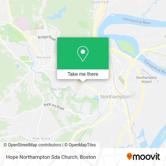
See Hope Northampton Sda Church, Boston, on the map
Public Transit to Hope Northampton Sda Church in Boston
Wondering how to get to Hope Northampton Sda Church in Boston? Moovit helps you find the best way to get to Hope Northampton Sda Church with step-by-step directions from the nearest public transit station.
Moovit provides free maps and live directions to help you navigate through your city. View schedules, routes, timetables, and find out how long does it take to get to Hope Northampton Sda Church in real time.
Looking for the nearest stop or station to Hope Northampton Sda Church? Check out this list of stops closest to your destination: Locust / Prospect (1); Elm / Franklin; Northampton.
Bus: 31, B48, G73E, R42, R44.Train: VERMONTER, VALLEY FLYER.
Want to see if there’s another route that gets you there at an earlier time? Moovit helps you find alternative routes or times. Get directions from and directions to Hope Northampton Sda Church easily from the Moovit App or Website.
We make riding to Hope Northampton Sda Church easy, which is why over 1.7 million users, including users in Boston, trust Moovit as the best app for public transit. You don’t need to download an individual bus app or train app, Moovit is your all-in-one transit app that helps you find the best bus time or train time available.
For information on prices of bus and train, costs and ride fares to Hope Northampton Sda Church, please check the Moovit app.
Use the app to navigate to popular places including to the airport, hospital, stadium, grocery store, mall, coffee shop, school, college, and university.
Hope Northampton Sda Church Address: 354 Elm St street in Boston
- Collaborative for Educational Services,
- Northampton High,
- Gallery of Readers Press,
- Columbia Chiropractic,
- Marten Cornelissen Violinmaker,
- Harrison, Mina M,
- Iliza Shlesinger,
- DHHS Indian Health Service,
- Jeffo Piano,
- Community Action,
- Head Start,
- Stephanie T Osiecki,
- Ellery Hotel,
- Made by Me Music,
- All Star Siding Roofing & Installations Co.,
- Smith School,
- Nettler Lydia,
- Maxwell David Photography,
- Bollywood Shows USA,
- Medicare Insurance Advisors Northampton
Places Near Hope Northampton Sda Church (Boston)
- House Of Blues, Boston,
- Wilbur Theatre, Boston,
- Cheers, Boston,
- Boston Common, Boston,
- North End, Boston,
- Museum Of Science, Boston,
- Leader Bank Pavilion (Leader Bank Pavillion), Boston,
- Boston Children's Hospital, Boston,
- Wang Theater, Boston,
- Seaport District, Boston,
- Mgm Music Hall, Boston,
- Faneuil Hall, Boston,
- Massachusetts General Hospital, Boston,
- Quincy Market, Boston,
- Prudential Center, Boston,
- Boston Medical Center, Boston,
- Boston Convention & Exhibition Center, Boston,
- Castle Island, Boston,
- Isabella Stewart Gardner Museum, Boston,
- Td Garden, Boston
How to get to popular places in Boston with public transit
Get around Boston by public transit!
Traveling around Boston has never been so easy. See step by step directions as you travel to any attraction, street or major public transit station. View bus and train schedules, arrival times, service alerts and detailed routes on a map, so you know exactly how to get to anywhere in Boston.
When traveling to any destination around Boston use Moovit's Live Directions with Get Off Notifications to know exactly where and how far to walk, how long to wait for your line, and how many stops are left. Moovit will alert you when it's time to get off — no need to constantly re-check whether yours is the next stop.
Wondering how to use public transit in Boston or how to pay for public transit in Boston? Moovit public transit app can help you navigate your way with public transit easily, and at minimum cost. It includes public transit fees, ticket prices, and costs. Looking for a map of Boston public transit lines? Moovit public transit app shows all public transit maps in Boston with all Bus, Train, Subway and Ferry routes and stops on an interactive map.
Boston has 4 transit type(s), including: Bus, Train, Subway and Ferry, operated by several transit agencies, including MBTA, Southeastern Regional Transit Authority, MetroWest Regional Transit Authority, Rhode Island Public Transit Authority, WRTA, Lowell Regional Transit Authority, Merrimack Valley Transit, Montachusett Regional Transit Authority, Cape Cod Regional Transit Authority, Brockton Area Transit Authority, Martha's Vineyard Transit Authority, the WAVE - Nantucket Regional Transit Authority, GATRA, Cape Ann Transportation Authority and Massport