Directions to HospiNet (Centro) with public transportation
The following transit lines have routes that pass near HospiNet
How to get to HospiNet by bus?
Click on the bus route to see step by step directions with maps, line arrival times and updated time schedules.
From Expotrade, Pinhais
48 minFrom Rua Doutor Bley Zornig, Boqueirão
36 minFrom Rua Professora Maria De Assumpção, Boqueirão
37 minFrom Rua Desembargador Cid Campêlo, Cic
59 minFrom terminal do hauer, Boqueirão
51 minFrom Rua João Reffo, Santa Felicidade
52 minFrom Pequeno Cotolengo, Campo Comprido
44 minFrom Expotrade Convention Center, Pinhais
48 minFrom Detran/Pr - Unidade Tarumã, Capão Da Imbúia
28 minFrom UPA Cidade Industrial, Cic
61 min
Bus stops near HospiNet in Centro
- Av. Visconde de Guarapuava, 2646 (Instituto de Criminalística), 3 min walk,VIEW
- R. André de Barros, 360, 3 min walk,VIEW
- Carlos Gomes, 4 min walk,VIEW
- R. Lourenço Pinto, 10 (Praça Carlos Gomes), 5 min walk,VIEW
- R. José Loureiro, 476, 5 min walk,VIEW
- Guadalupe (sentido Boqueirão), 6 min walk,VIEW
- Terminal Metropolitano Guadalupe, 6 min walk,VIEW
- Terminal Guadalupe (C03), 6 min walk,VIEW
- Guadalupe (sentido São José), 6 min walk,VIEW
- Guadalupe (sentido Caiuá), 7 min walk,VIEW
- Guadalupe (sentido Pinheirinho), 7 min walk,VIEW
Bus lines to HospiNet in Centro
- H01 ARAUCÁRIA / GUADALUPE, Terminal Araucária → Terminal Guadalupe,VIEW
- G72 AREIA BRANCA / GUADALUPE, Terminal Guadalupe → Areia Branca (via Queimados),VIEW
- G72 QUITANDINHA / GUADALUPE, Quitandinha → Terminal Guadalupe,VIEW
- H97 ANGÉLICA / GUADALUPE, Terminal Guadalupe → Terminal Angélica,VIEW
- 387 PALOTINOS, Praça Rui Barbosa → Terminal Centenário,VIEW
- 461 SANTA BÁRBARA, Praça Rui Barbosa → Santa Bárbara,VIEW
- 462 PETRÓPOLIS, Praça Rui Barbosa → Ouro Verde,VIEW
- 463 SOLITUDE / PLANTA EVARISTO, Praça Carlos Gomes → Planta Evaristo / Solitude,VIEW
- 465 ERASTO GAERTNER, Hospital Erasto Gaertner → Praça Rui Barbosa,VIEW
- 468 JARDIM CENTAURO, Jardim Centauro → Praça Rui Barbosa,VIEW
- 471 VILA SÃO PAULO, Vila São Paulo → Praça Rui Barbosa,VIEW
- 472 UBERABA, Uberaba → Praça Rui Barbosa,VIEW
- 474 JARDIM ITIBERÊ, Jardim Itiberê → Praça Rui Barbosa,VIEW
- 475 CANAL BELÉM, Canal Belém → Praça Rui Barbosa,VIEW
- 477 VILA MACEDO (VIA GUABIROTUBA), Vila Macedo → Praça Rui Barbosa,VIEW
- 489 MAD. PETRÓPOLIS / SOLITUDE, Praça Rui Barbosa ↺ Petrópolis / Solitude (Circular),VIEW
- B06 GUARAITUBA / RUI BARBOSA (VIA MARACANÃ / SEMIDIRETO), Marechal Dedoro / Rui Barbosa → Terminal Guaraituba ,VIEW
- J62 CAMPO LARGO / GUADALUPE, Terminal Guadalupe → Terminal Campo Largo,VIEW
- G71 MANDIRITUBA / GUADALUPE, Terminal Rodoviário Mandirituba → Terminal Guadalupe,VIEW
- B89 GUARAITUBA / RUI BARBOSA (VIA MARACANÃ / CABRAL), Praça Rui Barbosa → Terminal Guaraituba,VIEW
What are the closest stations to HospiNet?
The closest stations to HospiNet are:
- Av. Visconde de Guarapuava, 2646 (Instituto de Criminalística) is 217 meters away, 3 min walk.
- R. André de Barros, 360 is 224 meters away, 3 min walk.
- Carlos Gomes is 230 meters away, 4 min walk.
- R. Lourenço Pinto, 10 (Praça Carlos Gomes) is 340 meters away, 5 min walk.
- R. José Loureiro, 476 is 348 meters away, 5 min walk.
- Guadalupe (sentido Boqueirão) is 387 meters away, 6 min walk.
- Terminal Metropolitano Guadalupe is 397 meters away, 6 min walk.
- Terminal Guadalupe (C03) is 427 meters away, 6 min walk.
- Guadalupe (sentido São José) is 458 meters away, 6 min walk.
- Guadalupe (sentido Caiuá) is 494 meters away, 7 min walk.
- Guadalupe (sentido Pinheirinho) is 507 meters away, 7 min walk.
Which bus lines stop near HospiNet?
These bus lines stop near HospiNet: 307 BAIRRO ALTO / SANTA FELICIDADE, 503 BOQUEIRÃO, 505 BOQUEIRÃO / CENTRO CÍVICO, 508 SÍTIO CERCADO (ANTI-HORÁRIO), C03 PINHAIS / GUADALUPE, D02 T. SÃO ROQUE / SANTOS ANDRADE, G72 AREIA BRANCA / GUADALUPE, H01 ARAUCÁRIA / GUADALUPE.
What’s the nearest bus station to HospiNet in Centro?
The nearest bus stations to HospiNet in Centro are Av. Visconde de Guarapuava, 2646 (Instituto de Criminalística) and R. André de Barros, 360. The closest one is a 3 min walk away.
What time is the first bus to HospiNet in Centro?
The 389 MAD. TARUMÃ / AUGUSTA is the first bus that goes to HospiNet in Centro. It stops nearby at 3:00 AM.
What time is the last bus to HospiNet in Centro?
The 489 MAD. PETRÓPOLIS / SOLITUDE is the last bus that goes to HospiNet in Centro. It stops nearby at 2:48 AM.
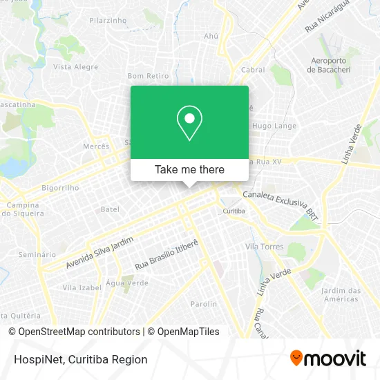
See HospiNet, Centro, on the map
Public Transit to HospiNet in Centro
Wondering how to get to HospiNet in Centro? Moovit helps you find the best way to get to HospiNet with step-by-step directions from the nearest public transit station.
Moovit provides free maps and live directions to help you navigate through your city. View schedules, routes, timetables, and find out how long does it take to get to HospiNet in real time.
Looking for the nearest stop or station to HospiNet? Check out this list of stops closest to your destination: Av. Visconde de Guarapuava; R. André de Barros; Carlos Gomes; R. Lourenço Pinto; R. José Loureiro; Guadalupe (sentido Boqueirão); Terminal Metropolitano Guadalupe; Terminal Guadalupe (C03); Guadalupe (sentido São José); Guadalupe (sentido Caiuá); Guadalupe (sentido Pinheirinho).
Bus: 307 BAIRRO ALTO / SANTA FELICIDADE, 503 BOQUEIRÃO, 505 BOQUEIRÃO / CENTRO CÍVICO, 508 SÍTIO CERCADO (ANTI-HORÁRIO), C03 PINHAIS / GUADALUPE, D02 T. SÃO ROQUE / SANTOS ANDRADE, G72 AREIA BRANCA / GUADALUPE, H01 ARAUCÁRIA / GUADALUPE, G72 QUITANDINHA / GUADALUPE, H97 ANGÉLICA / GUADALUPE, 387 PALOTINOS, B06 GUARAITUBA / RUI BARBOSA (VIA MARACANÃ / SEMIDIRETO), J62 CAMPO LARGO / GUADALUPE, G71 MANDIRITUBA / GUADALUPE, B89 GUARAITUBA / RUI BARBOSA (VIA MARACANÃ / CABRAL), 385 CRISTO REI, F02 FAZENDA RIO GRANDE / CURITIBA, 550 LIGEIRÃO PINHEIRINHO / CARLOS GOMES, X48 ESPECIAL EUFRÁSIO CORREIA / RUI BARBOSA, 365 JARDIM SOCIAL / BATEL, 372 TARUMÃ, 373 ALTO TARUMÃ, 386 CAJURU, 389 MAD. TARUMÃ / AUGUSTA.
Want to see if there’s another route that gets you there at an earlier time? Moovit helps you find alternative routes or times. Get directions from and directions to HospiNet easily from the Moovit App or Website.
We make riding to HospiNet easy, which is why over 1.5 million users, including users in Centro, trust Moovit as the best app for public transit. You don’t need to download an individual bus app or train app, Moovit is your all-in-one transit app that helps you find the best bus time or train time available.
For information on prices of bus, costs and ride fares to HospiNet, please check the Moovit app.
Use the app to navigate to popular places including to the airport, hospital, stadium, grocery store, mall, coffee shop, school, college, and university.
HospiNet Address: R. Barão do Rio Branco, 518 - Centro, Curitiba - PR, 80010-180 street in Centro
- CRE Metropolitano,
- Hotel Nikko,
- Mom,
- Poli Sani Produtos Hospitalares,
- Centro de Referência para Imunobiológicos Especiais (CRIE),
- Javanesa Tecidos,
- Secretaria Da Saúde - 2ª Regional,
- Fin SENAC PR,
- SOBS Academia de Krav Maga,
- Centro De Pesquisa E Atendimento A Travestis E Transexuais (Cpatt),
- Jardim Botânico de Curitiba PR,
- Drop Dead Skate Park,
- Pc Carlos Gomes 211,
- Curitiba Palace Hotel Slim,
- Centro de triagem I, rua Barão do rio branco, 401,
- Rua Barão do Rio Branco 370,
- Campo Base - Ginásio de Escalada,
- Medcurso,
- Acupuntura Dr. Ademir,
- Instituto De Criminalística
Places Near HospiNet (Centro)
- Hospital de Clínicas (HC - UFPR), Centro,
- Hospital Nossa Senhora Das Graças, Mercês,
- Campo Largo, Campo,
- Rua Martim Afonso 558, Mercês,
- Shopping Palladium, Portão,
- Parque Barigui, Mercês,
- Hospital Erasto Gaertner, Jardim Das Américas,
- Hospital Madalena Sofia, Bairro Alto,
- Hospital Angelina Caron, Campina Grande Do Sul,
- Hospital Universitário Evangélico de Curitiba, Bigorrilho,
- Hhhhh, Fazendinha,
- Arena Da Baixada - Curitiba,
- Hospital Da Cruz Vermelha, Batel,
- Shopping Estação, Rebouças,
- Pontifícia Universidade Católica do Paraná (PUCPR), Prado Velho,
- Jockey Plaza Shopping Center, Tarumã,
- Park Shopping Barigüi, Mossunguê,
- Rua General Mário Tourinho, Campina Do Siqueira,
- Hospital do Rocio, Campo,
- Jardim Botânico de Curitiba PR, Centro
How to get to popular places in Curitiba Region with public transit
Get around Centro by public transit!
Traveling around Centro has never been so easy. See step by step directions as you travel to any attraction, street or major public transit station. View bus and train schedules, arrival times, service alerts and detailed routes on a map, so you know exactly how to get to anywhere in Centro.
When traveling to any destination around Centro use Moovit's Live Directions with Get Off Notifications to know exactly where and how far to walk, how long to wait for your line, and how many stops are left. Moovit will alert you when it's time to get off — no need to constantly re-check whether yours is the next stop.
Wondering how to use public transit in Centro or how to pay for public transit in Centro? Moovit public transit app can help you navigate your way with public transit easily, and at minimum cost. It includes public transit fees, ticket prices, and costs. Looking for a map of Centro public transit lines? Moovit public transit app shows all public transit maps in Centro with all Bus and Cable Car routes and stops on an interactive map.
Curitiba Region has 2 transit type(s), including: Bus and Cable Car, operated by several transit agencies, including Sistema Integrado de Mobilidade (URBS), Sistema Integrado de Mobilidade (AMEP), URBS (Cartões bancários e Dinheiro), URBS (Cartões bancários / Cartão URBS), AMEP (Cartões bancários / Cartão MetroCard), AMEP (Cartões bancários / Cartão MetroCard / Dinheiro), Viação Colombo (Dinheiro), TRIAR (Cartão TRIAR / Dinheiro), Empresa Curitiba Cerro Azul (Dinheiro), Expresso Nossa Senhora da Penha (Dinheiro), Empresa Campo Alto Tijucas (Dinheiro), Auto Viação São José (Cartão VEM / Dinheiro), BRT S/A (Cartão VEM / Dinheiro), TransPiedade (Cartão Cidadão / Dinheiro) and Oceânica Sul (Cartão Transporte / Dinheiro)
Public transit lines with stations closest to HospiNet in Centro
Bus lines with stations closest to HospiNet in Centro
R. André de Barros, 360
 B06 GUARAITUBA / RUI BARBOSA (VIA MARACANÃ / SEMIDIRETO)GUARAITUBA / RUI BARBOSA (via MARACANÃ / SEMIDIRETO)
- J62 CAMPO LARGO / GUADALUPECAMPO LARGO / GUADALUPE
- G71 MANDIRITUBA / GUADALUPEMANDIRITUBA / GUADALUPE
- B89 GUARAITUBA / RUI BARBOSA (VIA MARACANÃ / CABRAL)GUARAITUBA / RUI BARBOSA (via MARACANÃ / CABRAL)
- 385 CRISTO REICRISTO REI