See Hospital Sírio-Libanês, Bela Vista, on the map
Directions to Hospital Sírio-Libanês (Bela Vista) with public transportation
The following transit lines have routes that pass near Hospital Sírio-Libanês
Bus:
Metro:
Train:
How to get to Hospital Sírio-Libanês by bus?
Click on the bus route to see step by step directions with maps, line arrival times and updated time schedules.
How to get to Hospital Sírio-Libanês by train?
Click on the train route to see step by step directions with maps, line arrival times and updated time schedules.
How to get to Hospital Sírio-Libanês by metro?
Click on the metro route to see step by step directions with maps, line arrival times and updated time schedules.
Metro stations near Hospital Sírio-Libanês in Bela Vista
- Trianon-Masp,3 min walk,
- Paulista - Pernambucanas,8 min walk,
Bus stations near Hospital Sírio-Libanês in Bela Vista
- Rua Frei Caneca, 995 - San Gabriel - Consolação, São Paulo,5 min walk,
- Viaduto Professor Bernardino Tranchesi,5 min walk,
- Getúlio Vargas C/B 2,6 min walk,
- R. S. Carlos do Pinhal, 1306,6 min walk,
- Ponto Provisório,6 min walk,
- R. Antônio Carlos, 196 - Baixo Augusta, São Paulo,6 min walk,
- R. Augusta, 1300,8 min walk,
Bus lines to Hospital Sírio-Libanês in Bela Vista
- 316,Guarulhos (Aeroporto Internacional de Sao Paulo),
- 177H-21,Metrô Santana,
- 106A-10,Metrô Santana - Itaim Bibi,
- 6250-10,Jardim Jaqueline - Terminal Bandeira,
- 6262-10,Ceasa - Terminal Bandeira,
- 6358-10,Jardim Luso - Terminal Bandeira,
- 6414-10,Socorro - Terminal Bandeira,
- 6422-10,Vila Cruzeiro - Terminal Bandeira,
- 6475-10,Jardim Vaz de Lima - Terminal Bandeira,
- 8610-10,Jardim Paulo VI - Terminal Bandeira,
- N841-11,Sta. Cecília,
- 609F-10,Chácara Santana - Terminal Princesa Isabel,
- 609F-21,Chácara Santana - Anhangabaú,
- N701-11,Terminal Santo Amaro - Terminal Parque Dom Pedro II,
- 6200-10,Terminal Santo Amaro - Terminal Bandeira,
- 6291-10,Inocoop Campo Limpo - Terminal Bandeira,
- 6400-10,Terminal João Dias - Terminal Bandeira,
- 6403-10,Terminal João Domas - Terminal Parque Dom Pedro II,
- 6450-10,Terminal Capelinha - Terminal Bandeira,
- 6451-10,Terminal Capelinha - Terminal Bandeira,
What are the closest stations to Hospital Sírio-Libanês?
The closest stations to Hospital Sírio-Libanês are:
- Trianon-Masp is 139 meters away, 3 min walk.
- Rua Frei Caneca, 995 - San Gabriel - Consolação, São Paulo is 319 meters away, 5 min walk.
- Viaduto Professor Bernardino Tranchesi is 341 meters away, 5 min walk.
- Getúlio Vargas C/B 2 is 374 meters away, 6 min walk.
- R. S. Carlos do Pinhal, 1306 is 387 meters away, 6 min walk.
- Ponto Provisório is 392 meters away, 6 min walk.
- R. Antônio Carlos, 196 - Baixo Augusta, São Paulo is 411 meters away, 6 min walk.
- R. Augusta, 1300 is 528 meters away, 8 min walk.
- Paulista - Pernambucanas is 556 meters away, 8 min walk.
Which bus lines stop near Hospital Sírio-Libanês?
These bus lines stop near Hospital Sírio-Libanês: 106A-10, 609F-10, 6250-10, 6403-10, 6422-10, 8610-10, 875A-10, 917H-10.
Which metro lines stop near Hospital Sírio-Libanês?
These metro lines stop near Hospital Sírio-Libanês: LINHA 2, LINHA 4.
Which train lines stop near Hospital Sírio-Libanês?
These train lines stop near Hospital Sírio-Libanês: LINHA 11, SERVIÇO 710.
What’s the nearest metro station to Hospital Sírio-Libanês in Bela Vista?
The nearest metro station to Hospital Sírio-Libanês in Bela Vista is Trianon-Masp. It’s a 3 min walk away.
What’s the nearest bus stop to Hospital Sírio-Libanês in Bela Vista?
The nearest bus stops to Hospital Sírio-Libanês in Bela Vista are Rua Frei Caneca, 995 - San Gabriel - Consolação, São Paulo and Viaduto Professor Bernardino Tranchesi. The closest one is a 5 min walk away.
What time is the first metro to Hospital Sírio-Libanês in Bela Vista?
The LINHA 4 is the first metro that goes to Hospital Sírio-Libanês in Bela Vista. It stops nearby at 4:43 AM.
What time is the last metro to Hospital Sírio-Libanês in Bela Vista?
The LINHA 2 is the last metro that goes to Hospital Sírio-Libanês in Bela Vista. It stops nearby at 12:19 AM.
What time is the first bus to Hospital Sírio-Libanês in Bela Vista?
The N307-11 is the first bus that goes to Hospital Sírio-Libanês in Bela Vista. It stops nearby at 3:09 AM.
What time is the last bus to Hospital Sírio-Libanês in Bela Vista?
The N701-11 is the last bus that goes to Hospital Sírio-Libanês in Bela Vista. It stops nearby at 3:25 AM.
See Hospital Sírio-Libanês, Bela Vista, on the map
Public Transit to Hospital Sírio-Libanês in Bela Vista
Wondering how to get to Hospital Sírio-Libanês in Bela Vista, Brazil? Moovit helps you find the best way to get to Hospital Sírio-Libanês with step-by-step directions from the nearest public transit station.
Moovit provides free maps and live directions to help you navigate through your city. View schedules, routes, timetables, and find out how long does it take to get to Hospital Sírio-Libanês in real time.
Looking for the nearest stop or station to Hospital Sírio-Libanês? Check out this list of stops closest to your destination: Trianon-Masp; Rua Frei Caneca; Viaduto Professor Bernardino Tranchesi; Getúlio Vargas C/B 2; R. S. Carlos do Pinhal; Ponto Provisório; R. Antônio Carlos; R. Augusta; Paulista - Pernambucanas.
Bus:Metro:Train:
Want to see if there’s another route that gets you there at an earlier time? Moovit helps you find alternative routes or times. Get directions from and directions to Hospital Sírio-Libanês easily from the Moovit App or Website.
We make riding to Hospital Sírio-Libanês easy, which is why over 1.5 million users, including users in Bela Vista, trust Moovit as the best app for public transit. You don’t need to download an individual bus app or train app, Moovit is your all-in-one transit app that helps you find the best bus time or train time available.
For information on prices of bus, metro and train, costs and ride fares to Hospital Sírio-Libanês, please check the Moovit app.
Use the app to navigate to popular places including to the airport, hospital, stadium, grocery store, mall, coffee shop, school, college, and university.
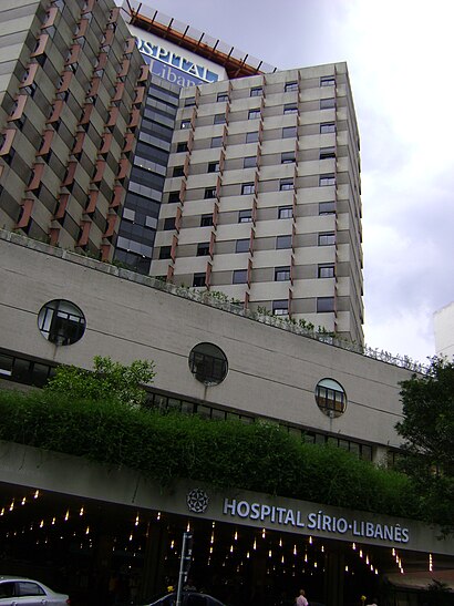
Hospital Sírio-Libanês Address: R. Da. Adma Jafet, 91 street in Bela Vista
![How to get to Hospital Sírio-Libanês with public transit - About the place](https://upload.wikimedia.org/wikipedia/commons/thumb/8/8f/Hosp_sirio_lib2.jpg/410px-Hosp_sirio_lib2.jpg)
Attractions near Hospital Sírio-Libanês
- Centro de Reabilitação - Hospital Sírio Libanês
- PAB - Bradesco - Hosp. Sírio Libanês
- Capela Hospital Sírio-Libanês
- Clinica Dr. Guilherme de Almeida
- Dra Valéria Carvalho - Cardiologista
- Rua Dona Adma Jafet / Rua Barata Ribeiro
- Centro de Medicina Nuclear Do Hospital Sírio Libanês
- Ipoc
- Clinica Saad
- Clínica de Otorrinolaringologia Dr. Andre Bordasch
- CLINICA VISAO - CENTRO ESPECIALIZADO DE OFTALMOLOGIA
- Neurologia E Neurofisiologia - Clinica Dra. Eliana Garzon
- Clinica Dr Oswaldo Laercio Cruz .
- Consultorio Dra Gilda Porta
- RUA BARATA RIBEIRO
- Dr. Tulio Diniz Fernandes Ortopedia
- Rua Dona Adma Jafet 91
- Bela Vista
- Edifício Medical Center
- Rua Barata Ribeiro 448
How to get to popular attractions in Bela Vista with public transit
- General Motors Mercosul, São Caetano Do Sul
- Shopping Center Norte, Vila Guilherme
- Shopping Taboão, Taboão Da Serra
- Metrô Vila Madalena, Pinheiros
- Ibirapuera, Moema
- Armênia, Bom Retiro
- Diadema, Diadema
- Terminal de Ônibus Santana, Santana
- Terminal Capelinha, Capão Redondo
- Ana Rosa - Linha 1 Azul e 2 Verde - Acesso À Rua Vergueiro, Lado Ímpar, Vila Mariana
- Centro Esportivo, Recreativo e Educativo do Trabalhador (CERET), Vila Formosa
- Praça Doutor João Mendes, Sé
- Terminal Metropolitano Piraporinha, Diadema
- Shopping SP Market, Campo Grande
- Shopping Tamboré, Barueri
- Universidade Paulista Chácara Santo Antônio Campus III, Santo Amaro
- Shopping Morumbi, Santo Amaro
- Praça Benedito Calixto, Jardim Paulista
- Parque Ibirapuera, Moema
- Arujá, Arujá
Get around Bela Vista by public transit!
Traveling around Bela Vista has never been so easy. See step by step directions as you travel to any attraction, street or major public transit station. View bus and train schedules, arrival times, service alerts and detailed routes on a map, so you know exactly how to get to anywhere in Bela Vista.
When traveling to any destination around Bela Vista use Moovit's Live Directions with Get Off Notifications to know exactly where and how far to walk, how long to wait for your line, and how many stops are left. Moovit will alert you when it's time to get off — no need to constantly re-check whether yours is the next stop.
Wondering how to use public transit in Bela Vista or how to pay for public transit in Bela Vista? Moovit public transit app can help you navigate your way with public transit easily, and at minimum cost. It includes public transit fees, ticket prices, and costs. Looking for a map of Bela Vista public transit lines? Moovit public transit app shows all public transit maps in Bela Vista with all bus, metro or train routes and stops on an interactive map.
Bela Vista has 3 transit type(s), including: bus, metro or train, operated by several transit agencies, including Metrô de São Paulo, ViaQuatro, ViaMobilidade, CPTM, ViaMobilidade, Aquático SP, SPTrans, EMTU, STT - Secretaria de Transportes e Trânsito de Guarulhos, Auto Ônibus Moratense, GRU Airport (Aeroporto de Guarulhos), Auto Viação Urubupungá (Cajamar), Viação Cometa, Auto Viação Urubupungá (Osasco) and Viação Ultra / Rápido Brasil