Directions to Hot 96.9 Boston (Waltham) with public transportation
The following transit lines have routes that pass near Hot 96.9 Boston
 Bus: 70, 553.
- Train: FITCHBURG, FRAMINGHAM/WORCESTER.
How to get to Hot 96.9 Boston by bus?
Click on the bus route to see step by step directions with maps, line arrival times and updated time schedules.
From McLean Hospital, Belmont
68 minFrom Mount Ida College, Newton
73 minFrom Regina Pizzeria, Boston
61 minFrom Newton-Wellesley Hospital, Newton
67 minFrom Ac Hotel Cambridge, Cambridge
89 minFrom AC Hotel Boston Cambridge, Cambridge
114 minFrom Brighton Music Hall, Boston
66 minFrom Allston, Boston
64 minFrom AC Hotel by Marriott Boston Cleveland Circle, Boston
57 minFrom Citizens Bank Opera House, Boston
66 min
How to get to Hot 96.9 Boston by train?
Click on the train route to see step by step directions with maps, line arrival times and updated time schedules.
Bus stop near Hot 96.9 Boston in Waltham
- Main St @ Prospect St, 2 min walk,VIEW
Train stations near Hot 96.9 Boston in Waltham
What are the closest stations to Hot 96.9 Boston?
The closest stations to Hot 96.9 Boston are:
- Main St @ Prospect St is 141 yards away, 2 min walk.
- Auburndale is 3327 yards away, 39 min walk.
- Kendal Green is 3397 yards away, 41 min walk.
Which bus line stops near Hot 96.9 Boston?
70 (Market Place Dr)
Which train line stops near Hot 96.9 Boston?
FITCHBURG (#409 | Wachusett)
What’s the nearest bus station to Hot 96.9 Boston in Waltham?
The nearest bus station to Hot 96.9 Boston in Waltham is Main St @ Prospect St. It’s a 2 min walk away.
What time is the first train to Hot 96.9 Boston in Waltham?
The FRAMINGHAM/WORCESTER is the first train that goes to Hot 96.9 Boston in Waltham. It stops nearby at 5:19 AM.
What time is the last train to Hot 96.9 Boston in Waltham?
The FRAMINGHAM/WORCESTER is the last train that goes to Hot 96.9 Boston in Waltham. It stops nearby at 12:22 AM.
What time is the first bus to Hot 96.9 Boston in Waltham?
The 70 is the first bus that goes to Hot 96.9 Boston in Waltham. It stops nearby at 4:55 AM.
What time is the last bus to Hot 96.9 Boston in Waltham?
The 70 is the last bus that goes to Hot 96.9 Boston in Waltham. It stops nearby at 12:24 AM.
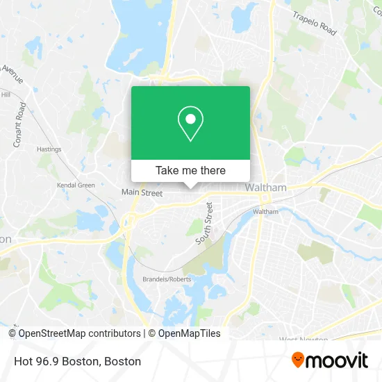
See Hot 96.9 Boston, Waltham, on the map
Public Transit to Hot 96.9 Boston in Waltham
Wondering how to get to Hot 96.9 Boston in Waltham? Moovit helps you find the best way to get to Hot 96.9 Boston with step-by-step directions from the nearest public transit station.
Moovit provides free maps and live directions to help you navigate through your city. View schedules, routes, timetables, and find out how long does it take to get to Hot 96.9 Boston in real time.
Looking for the nearest stop or station to Hot 96.9 Boston? Check out this list of stops closest to your destination: Main St @ Prospect St; Auburndale; Kendal Green.
Bus: 70, 553.Train: FITCHBURG, FRAMINGHAM/WORCESTER.
Want to see if there’s another route that gets you there at an earlier time? Moovit helps you find alternative routes or times. Get directions from and directions to Hot 96.9 Boston easily from the Moovit App or Website.
We make riding to Hot 96.9 Boston easy, which is why over 1.7 million users, including users in Waltham, trust Moovit as the best app for public transit. You don’t need to download an individual bus app or train app, Moovit is your all-in-one transit app that helps you find the best bus time or train time available.
For information on prices of bus, train and subway, costs and ride fares to Hot 96.9 Boston, please check the Moovit app.
Use the app to navigate to popular places including to the airport, hospital, stadium, grocery store, mall, coffee shop, school, college, and university.
Hot 96.9 Boston Address: 1075 Main St street in Waltham
- Senior Whole Health of Massachusetts,
- Sunny & Fine's Breakfast Burritos,
- 1075 Burgers,
- Cricket Cafe & Catering (Cloud9 Cafe Walth),
- Veronica Mini Mart,
- Div Waltham Main Street,
- Chase,
- Mattress Firm,
- Smiley Dental,
- Waltham & Greater Boston,
- Korean Hope Church in Boston,
- Highland Oral Surgery & Implant Center,
- JMC Driving School,
- Mixed Media Entertainment Co.,
- E.M. Snow, Inc,
- Deleo Joseph,
- A 24 Hour Emergency Locksmith,
- JDL Remodeling,
- Us Best Garage Door Repair Waltham,
- Rieger Tennis Courts
Places Near Hot 96.9 Boston (Waltham)
- Prudential Center, Boston,
- Castle Island, Boston,
- North End, Boston,
- Seaport District, Boston,
- House Of Blues, Boston,
- Boston Convention & Exhibition Center, Boston,
- Quincy Market, Boston,
- Td Garden, Boston,
- Faneuil Hall, Boston,
- Boston Medical Center, Boston,
- Mgm Music Hall, Boston,
- Museum Of Science, Boston,
- Cheers, Boston,
- Leader Bank Pavilion (Leader Bank Pavillion), Boston,
- Wang Theater, Boston,
- Massachusetts General Hospital, Boston,
- Wilbur Theatre, Boston,
- Boston Children's Hospital, Boston,
- Boston Common, Boston,
- Isabella Stewart Gardner Museum, Boston
How to get to popular places in Boston with public transit
Get around Waltham by public transit!
Traveling around Waltham has never been so easy. See step by step directions as you travel to any attraction, street or major public transit station. View bus and train schedules, arrival times, service alerts and detailed routes on a map, so you know exactly how to get to anywhere in Waltham.
When traveling to any destination around Waltham use Moovit's Live Directions with Get Off Notifications to know exactly where and how far to walk, how long to wait for your line, and how many stops are left. Moovit will alert you when it's time to get off — no need to constantly re-check whether yours is the next stop.
Wondering how to use public transit in Waltham or how to pay for public transit in Waltham? Moovit public transit app can help you navigate your way with public transit easily, and at minimum cost. It includes public transit fees, ticket prices, and costs. Looking for a map of Waltham public transit lines? Moovit public transit app shows all public transit maps in Waltham with all Bus, Train, Subway and Ferry routes and stops on an interactive map.
Boston has 4 transit type(s), including: Bus, Train, Subway and Ferry, operated by several transit agencies, including MBTA, Southeastern Regional Transit Authority, MetroWest Regional Transit Authority, Rhode Island Public Transit Authority, WRTA, Lowell Regional Transit Authority, Merrimack Valley Transit, Montachusett Regional Transit Authority, Cape Cod Regional Transit Authority, Brockton Area Transit Authority, Martha's Vineyard Transit Authority, the WAVE - Nantucket Regional Transit Authority, GATRA, Cape Ann Transportation Authority and Massport