Directions to Hotel Kempsford (Brookline) with public transportation
The following transit lines have routes that pass near Hotel Kempsford
 Bus: 39, 66, 60, 65, GREEN LINE D SHUTTLE.
- Train: PROVIDENCE/STOUGHTON.
- Subway: GREEN LINE D, GREEN LINE E.
How to get to Hotel Kempsford by bus?
Click on the bus route to see step by step directions with maps, line arrival times and updated time schedules.
From Dedham District Court, Dedham
54 minFrom Apple Cinemas, Cambridge
67 minFrom Wellington Station, Medford
89 minFrom Chelsea, MA, Chelsea
80 minFrom Massachusetts Water Resource Authority (MWRA), Chelsea
76 minFrom Arlington, MA, Arlington
83 minFrom Everett, MA, Everett
84 minFrom The Westin Boston Seaport District, Boston
52 minFrom Aloft-Boston Seaport Dist, Boston
62 minFrom Silver Line Stop Terminal B, Boston
38 min
How to get to Hotel Kempsford by train?
Click on the train route to see step by step directions with maps, line arrival times and updated time schedules.
How to get to Hotel Kempsford by subway?
Click on the subway route to see step by step directions with maps, line arrival times and updated time schedules.
Bus stops near Hotel Kempsford in Brookline
Subway stations near Hotel Kempsford in Brookline
Bus lines to Hotel Kempsford in Brookline
- 60, Brookline Village,VIEW
- 66, Nubian Via Allston,VIEW
- 65, Kenmore,VIEW
- GREEN LINE D SHUTTLE, Reservoir - Fenway,VIEW
- GREEN LINE D SHUTTLE, Newton Highlands - Fenway,VIEW
- GREEN LINE D SHUTTLE, Reservoir - Kenmore,VIEW
- GREEN LINE D SHUTTLE, Brookline Hills - Kenmore,VIEW
- GREEN LINE D SHUTTLE, Newton Highlands - Kenmore via Saint Mary's Street,VIEW
- GREEN LINE D SHUTTLE, Riverside - Fenway,VIEW
- GREEN LINE D SHUTTLE, Riverside - Kenmore via Saint Mary's Street,VIEW
- GREEN LINE D SHUTTLE, Brookline Hills - Back Bay (Shuttle),VIEW
- GREEN LINE D SHUTTLE, Newton Highlands (Shuttle),VIEW
- GREEN LINE D SHUTTLE, Riverside (Shuttle),VIEW
- GREEN LINE D SHUTTLE, Brookline Village (Shuttle),VIEW
- GREEN LINE D SHUTTLE, Kenmore (Shuttle),VIEW
What are the closest stations to Hotel Kempsford?
The closest stations to Hotel Kempsford are:
- High St @ Cumberland Ave is 302 yards away, 4 min walk.
- Huntington Ave @ Riverway is 323 yards away, 4 min walk.
- Washington St @ Pearl St is 337 yards away, 5 min walk.
- Heath Street is 377 yards away, 5 min walk.
- Brookline Hills is 445 yards away, 6 min walk.
- Brookline Ave Opp Pearl St is 585 yards away, 7 min walk.
- Pearl St @ Brookline Village is 670 yards away, 9 min walk.
Which bus lines stop near Hotel Kempsford?
These bus lines stop near Hotel Kempsford: 39, 66.
Which train line stops near Hotel Kempsford?
PROVIDENCE/STOUGHTON (#825 | Providence)
Which subway line stops near Hotel Kempsford?
GREEN LINE D (Riverside)
What’s the nearest subway station to Hotel Kempsford in Brookline?
The nearest subway station to Hotel Kempsford in Brookline is Heath Street. It’s a 5 min walk away.
What’s the nearest bus station to Hotel Kempsford in Brookline?
The nearest bus stations to Hotel Kempsford in Brookline are High St @ Cumberland Ave and Huntington Ave @ Riverway. The closest one is a 4 min walk away.
What time is the first subway to Hotel Kempsford in Brookline?
The GREEN LINE D is the first subway that goes to Hotel Kempsford in Brookline. It stops nearby at 4:51 AM.
What time is the last subway to Hotel Kempsford in Brookline?
The GREEN LINE D is the last subway that goes to Hotel Kempsford in Brookline. It stops nearby at 2:26 AM.
What time is the first bus to Hotel Kempsford in Brookline?
The 60 is the first bus that goes to Hotel Kempsford in Brookline. It stops nearby at 4:55 AM.
What time is the last bus to Hotel Kempsford in Brookline?
The 66 is the last bus that goes to Hotel Kempsford in Brookline. It stops nearby at 2:21 AM.
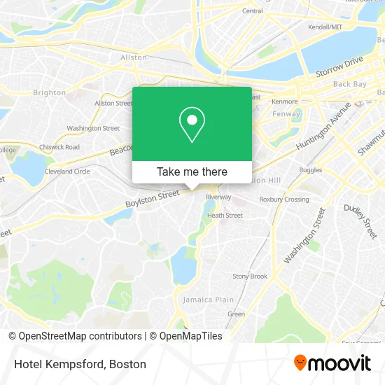
See Hotel Kempsford, Brookline, on the map
Public Transit to Hotel Kempsford in Brookline
Wondering how to get to Hotel Kempsford in Brookline? Moovit helps you find the best way to get to Hotel Kempsford with step-by-step directions from the nearest public transit station.
Moovit provides free maps and live directions to help you navigate through your city. View schedules, routes, timetables, and find out how long does it take to get to Hotel Kempsford in real time.
Looking for the nearest stop or station to Hotel Kempsford? Check out this list of stops closest to your destination: High St @ Cumberland Ave; Huntington Ave @ Riverway; Washington St @ Pearl St; Heath Street; Brookline Hills; Brookline Ave Opp Pearl St; Pearl St @ Brookline Village.
Bus: 39, 66, 60, 65, GREEN LINE D SHUTTLE, GREEN LINE D SHUTTLE, GREEN LINE D SHUTTLE, GREEN LINE D SHUTTLE, GREEN LINE D SHUTTLE.Train: PROVIDENCE/STOUGHTON.Subway: GREEN LINE D, GREEN LINE E.
Want to see if there’s another route that gets you there at an earlier time? Moovit helps you find alternative routes or times. Get directions from and directions to Hotel Kempsford easily from the Moovit App or Website.
We make riding to Hotel Kempsford easy, which is why over 1.7 million users, including users in Brookline, trust Moovit as the best app for public transit. You don’t need to download an individual bus app or train app, Moovit is your all-in-one transit app that helps you find the best bus time or train time available.
For information on prices of bus, subway and train, costs and ride fares to Hotel Kempsford, please check the Moovit app.
Use the app to navigate to popular places including to the airport, hospital, stadium, grocery store, mall, coffee shop, school, college, and university.
Hotel Kempsford Address: 72 Walnut St street in Brookline
- NETA,
- Neta Brookline,
- US Post Office,
- Northend Pomodoro of Boston,
- Boston Business Consulting,
- Homewood Suites by Hilton Boston Brookline-Longwood Medical,
- MBTA Brookline Village Station,
- Garrison House,
- Liberty Tax Service,
- Old Lincoln School,
- Kent & Webster-Parking Lot 6,
- Jacqueline Stephen,
- Automotive Near You,
- Monalisa Touch Boston (Calming Touch of Infant Massage),
- Boston Center for Facial Rejuvenation,
- Warhammer,
- 1 Brookline Place,
- Beth Israel Deaconess Medical Center,
- Brookline Place Pediodontics,
- Manderlay Bar
Places Near Hotel Kempsford (Brookline)
- Boston Convention & Exhibition Center, Boston,
- Mgm Music Hall, Boston,
- Quincy Market, Boston,
- North End, Boston,
- Boston Children's Hospital, Boston,
- Leader Bank Pavilion (Leader Bank Pavillion), Boston,
- Wang Theater, Boston,
- Seaport District, Boston,
- Prudential Center, Boston,
- House Of Blues, Boston,
- Cheers, Boston,
- Isabella Stewart Gardner Museum, Boston,
- Massachusetts General Hospital, Boston,
- Wilbur Theatre, Boston,
- Boston Common, Boston,
- Castle Island, Boston,
- Faneuil Hall, Boston,
- Td Garden, Boston,
- Museum Of Science, Boston,
- Boston Medical Center, Boston
How to get to popular places in Boston with public transit
Get around Brookline by public transit!
Traveling around Brookline has never been so easy. See step by step directions as you travel to any attraction, street or major public transit station. View bus and train schedules, arrival times, service alerts and detailed routes on a map, so you know exactly how to get to anywhere in Brookline.
When traveling to any destination around Brookline use Moovit's Live Directions with Get Off Notifications to know exactly where and how far to walk, how long to wait for your line, and how many stops are left. Moovit will alert you when it's time to get off — no need to constantly re-check whether yours is the next stop.
Wondering how to use public transit in Brookline or how to pay for public transit in Brookline? Moovit public transit app can help you navigate your way with public transit easily, and at minimum cost. It includes public transit fees, ticket prices, and costs. Looking for a map of Brookline public transit lines? Moovit public transit app shows all public transit maps in Brookline with all Bus, Train, Subway and Ferry routes and stops on an interactive map.
Boston has 4 transit type(s), including: Bus, Train, Subway and Ferry, operated by several transit agencies, including MBTA, Southeastern Regional Transit Authority, MetroWest Regional Transit Authority, Rhode Island Public Transit Authority, WRTA, Lowell Regional Transit Authority, Merrimack Valley Transit, Montachusett Regional Transit Authority, Cape Cod Regional Transit Authority, Brockton Area Transit Authority, Martha's Vineyard Transit Authority, the WAVE - Nantucket Regional Transit Authority, GATRA, Cape Ann Transportation Authority and Massport