How to get to Hotelera Muso by bus?
Click on the bus route to see step by step directions with maps, line arrival times and updated time schedules.
From Cancha Tenis Techada, Los Ángeles
27 minFrom Parque del Recuerdo Santa Maria de Los Angeles, Los Ángeles
25 minFrom Edificio Corporativo Cmpc, Los Ángeles
41 minFrom Granja Osiris, Los Ángeles
35 minFrom Plaza San Marcos, Los Ángeles
35 minFrom Maderas Rarinco, Los Ángeles
28 minFrom Greenvic Planta Callaqui, Los Ángeles
39 minFrom Molino Biobio S.A., Los Ángeles
33 min
Bus stops near Hotelera Muso in Los Ángeles
Bus lines to Hotelera Muso in Los Ángeles
- 1-I, Baquedano,VIEW
- C20-I, Villa Grecia,VIEW
- C8-R, Villa Plazas De Sta María,VIEW
- C11-R, Villa Ciudades De Chile,VIEW
- C12-R, Poblacion 2 De Septiembre,VIEW
- C24-R, Villa Colocolo,VIEW
- C29-R, Villa Colo Colo,VIEW
- C20V-I, Villa Grecia,VIEW
- C20V2-I, El Avellano,VIEW
- C8V-R, Villa Plazas De Sta María,VIEW
- C29V-R, Villa Colo Colo,VIEW
- C8V3-R, Villa Plaza Sta María,VIEW
- C11V2-R, Villa Colo Colo,VIEW
- 1V-I, Lynch,VIEW
- 6-I, Villa Génesis - Socavio,VIEW
- 10-I, Laguna del Laja - Villa Sur,VIEW
- 2-R, Av. Las Industrias - Pailluhue,VIEW
- 7-R, Villa Lomas de Sta María - Villa Sur,VIEW
- 8-R, Villa Lomas de Sta María - Socavio,VIEW
- C19-I, Las Trancas - Av. Oriente,VIEW
What are the closest stations to Hotelera Muso?
The closest stations to Hotelera Muso are:
- Valdivia / Colo Colo is 83 meters away, 2 min walk.
- Ricardo Vicuna / Manuel Rodriguez is 211 meters away, 3 min walk.
- Mendoza / Rengo is 304 meters away, 4 min walk.
- Almagro / Caupolican is 400 meters away, 6 min walk.
- Ricardo Vicuna / San Martin is 441 meters away, 6 min walk.
- Ricardo Vicuna / Colon is 497 meters away, 7 min walk.
Which bus lines stop near Hotelera Muso?
These bus lines stop near Hotelera Muso: 2-R, 2V-R, 7-I.
What’s the nearest bus station to Hotelera Muso in Los Ángeles?
The nearest bus station to Hotelera Muso in Los Ángeles is Valdivia / Colo Colo. It’s a 2 min walk away.
What time is the first bus to Hotelera Muso in Los Ángeles?
The 1-R is the first bus that goes to Hotelera Muso in Los Ángeles. It stops nearby at 7:24 AM.
What time is the last bus to Hotelera Muso in Los Ángeles?
The 4-I is the last bus that goes to Hotelera Muso in Los Ángeles. It stops nearby at 8:39 PM.
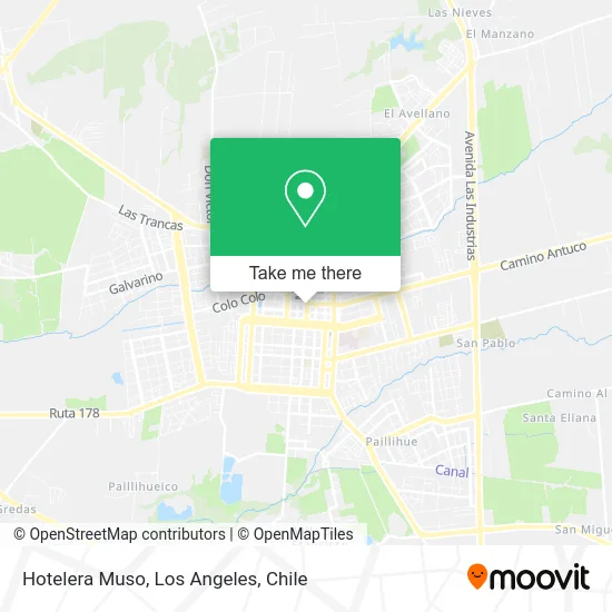
See Hotelera Muso, Los Ángeles, on the map
Public Transit to Hotelera Muso in Los Ángeles
Wondering how to get to Hotelera Muso in Los Ángeles? Moovit helps you find the best way to get to Hotelera Muso with step-by-step directions from the nearest public transit station.
Moovit provides free maps and live directions to help you navigate through your city. View schedules, routes, timetables, and find out how long does it take to get to Hotelera Muso in real time.
Looking for the nearest stop or station to Hotelera Muso? Check out this list of stops closest to your destination: Valdivia / Colo Colo; Ricardo Vicuna / Manuel Rodriguez; Mendoza / Rengo; Almagro / Caupolican; Ricardo Vicuna / San Martin; Ricardo Vicuna / Colon.
Bus: 2-R, 2V-R, 7-I, 1-I, C20-I, C8-R, C11-R, C12-R, 6-I, 10-I, 7-R, 8-R, C8-I, C11-I, C12-I, C24-I, C29-I, 4-R, 5-R, 10-R, C15-I, C25-I, 4-I, 5-I, C7-I, C9-I, C10-I, 1-R.
Want to see if there’s another route that gets you there at an earlier time? Moovit helps you find alternative routes or times. Get directions from and directions to Hotelera Muso easily from the Moovit App or Website.
We make riding to Hotelera Muso easy, which is why over 1.5 million users, including users in Los Ángeles, trust Moovit as the best app for public transit. You don’t need to download an individual bus app or train app, Moovit is your all-in-one transit app that helps you find the best bus time or train time available.
For information on prices of bus, costs and ride fares to Hotelera Muso, please check the Moovit app.
Use the app to navigate to popular places including to the airport, hospital, stadium, grocery store, mall, coffee shop, school, college, and university.
Hotelera Muso Address: Calle Valdivia, 4440000 Los Ángeles, Bíobío street in Los Ángeles
- Parroquia San Miguel,
- Edificio Plaza Fundación,
- Dentista-Wilton Briones Mejías,
- Dentist-Ceident,
- Soc Agricola Santa Camila Ltda,
- Artequín,
- Primer Juzgado De Policia Local,
- Plaza de Armas,
- Santa María,
- Outlet Los Angeles,
- Lautaro 624,
- Dirección General de Aguas,
- Liga contra La Epilepsia Los Angeles,
- SII - Servicio De Impuestos Internos Los Angeles,
- Inspección Provincial del Trabajo del Bío Bío,
- Registro Civil,
- Los Ángeles Chile,
- Mall Muebles Los Ángeles,
- Laboratorio Clínico Central,
- Mueblerias-Sociedad Comercial Oyarzun Limitada
Places Near Hotelera Muso (Los Ángeles)
- Jardines de Rucalhue, Los Ángeles,
- Parque Lauquen Pje 7 Oriente Los Angeles Chile, Los Ángeles,
- Villa España, Los Ángeles,
- Antuco, Los Ángeles,
- 2° Juzgado de Policia Local, Los Angeles., Los Ángeles,
- Villa Parque Lauquen, Los Ángeles,
- Villa Jardines De La Republica (Av. Gabriela Mistral), Los Ángeles,
- Terminal Rural Vega Techada, Los Ángeles,
- Villa Las Tranqueras, Los Ángeles,
- Los Ángeles Chile, Los Ángeles,
- Villa Parque Historiadores, Los Ángeles,
- Villa los Alcaldes, Los Ángeles,
- Terminal Rodoviario Sta. María de Los Ángeles, Los Ángeles,
- Cruce Los Ángeles - Santa Bárbara / Ralco, Los Ángeles,
- Villa Mininco, Los Ángeles,
- Ruta Q-61-R (Los Ángeles - Santa Bárbara / Ralco), Los Ángeles,
- camino cerro colorado, Los Ángeles,
- Avenida Las industrias - Los Ángeles, Los Ángeles,
- Villa Lomas De Santa María, Los Ángeles,
- Clínica Los Andes, Los Ángeles
How to get to popular places in Los Angeles, Chile with public transit
Get around Los Ángeles by public transit!
Traveling around Los Ángeles has never been so easy. See step by step directions as you travel to any attraction, street or major public transit station. View bus and train schedules, arrival times, service alerts and detailed routes on a map, so you know exactly how to get to anywhere in Los Ángeles.
When traveling to any destination around Los Ángeles use Moovit's Live Directions with Get Off Notifications to know exactly where and how far to walk, how long to wait for your line, and how many stops are left. Moovit will alert you when it's time to get off — no need to constantly re-check whether yours is the next stop.
Wondering how to use public transit in Los Ángeles or how to pay for public transit in Los Ángeles? Moovit public transit app can help you navigate your way with public transit easily, and at minimum cost. It includes public transit fees, ticket prices, and costs. Looking for a map of Los Ángeles public transit lines? Moovit public transit app shows all public transit maps in Los Ángeles with all bus routes and stops on an interactive map.
Los Angeles, Chile has 1 transit type(s), including: bus, operated by several transit agencies, including Paillihue, Chiprodal Bolson, Iansa Avellano, Orompello Montecea, Transportes de pasajeros S.A., El esfuerzo, Paillihue Bolson, Ciudades de Chile, Las Americas, Linea Azul, Paillihue Avellano, Expreso Araucano, Sotracoli, San Sebastian and Duqueco