How to get to Howe And Co. Cpas by bus?
Click on the bus route to see step by step directions with maps, line arrival times and updated time schedules.
Bus stops near Howe And Co. Cpas in Kansas City
Light Rail stations near Howe And Co. Cpas in Kansas City
- Library (9th & Main St), 4 min walk,VIEW
Bus lines to Howe And Co. Cpas in Kansas City
- 201, 201 - North Oak / To 27th And Main,VIEW
- 238, 238 - Eastvillage,VIEW
- 9, 9th Street/Truman & Ewing,VIEW
- 11, 11-Northeast-Westside/To Mcc,VIEW
- 12, 12 - 12th Street/31st & Van Brunt,VIEW
- 18, 18 - Indiana/Kc Zoo,VIEW
- 23, 23 - 23rd Street / To Park Tower,VIEW
- 24, 24 - Independenceto Independence,VIEW
- 210, 210-Front Street / To Downtown,VIEW
- 229, 229-Boardwalk / To Kci Airport,VIEW
- 85, 85 - Paseo/To 3rd And Grand,VIEW
- 550, 550 - Lee's Summit/ To Lee's Summit,VIEW
- PMAX, Prospect Max / To 75th And Prospect,VIEW
- TMAX, Troost Max/To 75th St,VIEW
- 101, 101-State Ave / To Village West,VIEW
- 404, Metcalf Walmart,VIEW
- 520, Pennsylvania/12th,VIEW
What are the closest stations to Howe And Co. Cpas?
The closest stations to Howe And Co. Cpas are:
- On 12th at Mcgee Eastbound is 194 yards away, 3 min walk.
- On 12th Between Grand And Mcgee Eastbound is 209 yards away, 3 min walk.
- On Grand at 11th Northbound is 235 yards away, 3 min walk.
- On 11th at Grand Westbound Nearside is 265 yards away, 4 min walk.
- Library (9th & Main St) is 296 yards away, 4 min walk.
Which bus lines stop near Howe And Co. Cpas?
These bus lines stop near Howe And Co. Cpas: 11, 18, PMAX, TMAX.
Which light rail line stops near Howe And Co. Cpas?
STCR (Riverfront)
What’s the nearest light rail station to Howe And Co. Cpas in Kansas City?
The nearest light rail station to Howe And Co. Cpas in Kansas City is Library (9th & Main St). It’s a 4 min walk away.
What’s the nearest bus station to Howe And Co. Cpas in Kansas City?
The nearest bus stations to Howe And Co. Cpas in Kansas City are On 12th at Mcgee Eastbound, On 12th Between Grand And Mcgee Eastbound and On Grand at 11th Northbound. The closest one is a 3 min walk away.
What time is the first light rail to Howe And Co. Cpas in Kansas City?
The STCR is the first light rail that goes to Howe And Co. Cpas in Kansas City. It stops nearby at 5:21 AM.
What time is the last light rail to Howe And Co. Cpas in Kansas City?
The STCR is the last light rail that goes to Howe And Co. Cpas in Kansas City. It stops nearby at 12:15 AM.
What time is the first bus to Howe And Co. Cpas in Kansas City?
The 201 is the first bus that goes to Howe And Co. Cpas in Kansas City. It stops nearby at 4:33 AM.
What time is the last bus to Howe And Co. Cpas in Kansas City?
The 12 is the last bus that goes to Howe And Co. Cpas in Kansas City. It stops nearby at 2:03 AM.
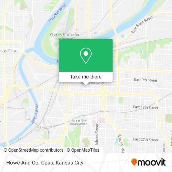
See Howe And Co. Cpas, Kansas City, on the map
Public Transit to Howe And Co. Cpas in Kansas City
Wondering how to get to Howe And Co. Cpas in Kansas City? Moovit helps you find the best way to get to Howe And Co. Cpas with step-by-step directions from the nearest public transit station.
Moovit provides free maps and live directions to help you navigate through your city. View schedules, routes, timetables, and find out how long does it take to get to Howe And Co. Cpas in real time.
Looking for the nearest stop or station to Howe And Co. Cpas? Check out this list of stops closest to your destination: On 12th at Mcgee Eastbound; On 12th Between Grand And Mcgee Eastbound; On Grand at 11th Northbound; On 11th at Grand Westbound Nearside; Library (9th & Main St).
Bus: 11, 18, PMAX, TMAX, 201, 238, 9, 12, 23, 85, 550, 101, 404, 520.Light Rail: STCR.
Want to see if there’s another route that gets you there at an earlier time? Moovit helps you find alternative routes or times. Get directions from and directions to Howe And Co. Cpas easily from the Moovit App or Website.
We make riding to Howe And Co. Cpas easy, which is why over 1.5 million users, including users in Kansas City, trust Moovit as the best app for public transit. You don’t need to download an individual bus app or train app, Moovit is your all-in-one transit app that helps you find the best bus time or train time available.
For information on prices of bus and light rail, costs and ride fares to Howe And Co. Cpas, please check the Moovit app.
Use the app to navigate to popular places including to the airport, hospital, stadium, grocery store, mall, coffee shop, school, college, and university.
Howe And Co. Cpas Address: 1201 Walnut St street in Kansas City
- Power & Light,
- Howl USA (Howl at the Moon),
- Arvest Bank Theatre at the Midland,
- Homegrown - Power & Light,
- Kansas City Power & Light District,
- Lightwell,
- Bartle Hall,
- H&R Block Parking Garage,
- Sprint Center,
- Downtown Kansas City,
- Downtown Kansas City,
- Muehlebach Hotel,
- Hotel Phillips Kansas City Curio Collection By Hilton,
- Curio Collection by Hilton-Phillips Kansas City Curio Collection by Hilton,
- Unbound Collection by Hyatt-Kansas City,
- T-Mobile Center,
- Parking-11th and Oak Garage,
- Hilton President Kansas City,
- The Nelson-Atkins Museum of Art,
- Jackson County Courthouse Division 26
Places Near Howe And Co. Cpas (Kansas City)
- The Glory Hole,
- Amazon Fulfilment Center-MKC6, Kansas City,
- Legends Outlets Kansas City, Kansas City,
- St. Luke's Hospital - Medical Plaza I,
- Truman Medical Center,
- Worlds of Fun,
- Ku Medical Center, Kansas City,
- T-Mobile Center,
- Liberty, MO, Liberty,
- Grandview, MO, Grandview,
- Walmart Supercenter,
- Kauffman Stadium,
- Kansas City International Airport (MCI) (Kansas City International Airport),
- Kansas City Zoo,
- GEHA Field at Arrowhead Stadium,
- Arrowhead Stadium,
- Country Club Plaza,
- Harrah's Casino, North Kansas City,
- Stans Glory Hole,
- Walmart, Kansas City
How to get to popular places in Kansas City with public transit
Get around Kansas City by public transit!
Traveling around Kansas City has never been so easy. See step by step directions as you travel to any attraction, street or major public transit station. View bus and train schedules, arrival times, service alerts and detailed routes on a map, so you know exactly how to get to anywhere in Kansas City.
When traveling to any destination around Kansas City use Moovit's Live Directions with Get Off Notifications to know exactly where and how far to walk, how long to wait for your line, and how many stops are left. Moovit will alert you when it's time to get off — no need to constantly re-check whether yours is the next stop.
Wondering how to use public transit in Kansas City or how to pay for public transit in Kansas City? Moovit public transit app can help you navigate your way with public transit easily, and at minimum cost. It includes public transit fees, ticket prices, and costs. Looking for a map of Kansas City public transit lines? Moovit public transit app shows all public transit maps in Kansas City with all Bus, Train and Light Rail routes and stops on an interactive map.
Kansas City has 3 transit type(s), including: Bus, Train and Light Rail, operated by several transit agencies, including Kansas City Area Transportation Authority, Lawrence Transit, Topeka Metro, RideKC Johnson County, Amtrak, Greyhound-us and FlixBus-us