See Hugh Lane Gallery, Dublin, on the map
Directions to Hugh Lane Gallery (Dublin) with public transportation
The following transit lines have routes that pass near Hugh Lane Gallery
 Bus:
Bus: - Train:
How to get to Hugh Lane Gallery by bus?
Click on the bus route to see step by step directions with maps, line arrival times and updated time schedules.
How to get to Hugh Lane Gallery by train?
Click on the train route to see step by step directions with maps, line arrival times and updated time schedules.
Bus stations near Hugh Lane Gallery in Dublin
- Gate Theatre,2 min walk,
Bus lines to Hugh Lane Gallery in Dublin
- 1,Shaw Street,
- 9,Limekiln Avenue,
- 38,Burlington Road,
- 38A,Parnell Sq,
- 38B,O'Connell Street,
- 38D,Burlington Road,
- 44,O'Connell Street,
- 46A,Dun Laoghaire,
- 120,Ballsbridge,
- 122,Parnell Square,
- 140,O'Connell St,
- 155,Bray,
What are the closest stations to Hugh Lane Gallery?
The closest stations to Hugh Lane Gallery are:
- Gate Theatre is 144 meters away, 2 min walk.
Which bus lines stop near Hugh Lane Gallery?
These bus lines stop near Hugh Lane Gallery: 16, 40, 44.
Which train line stops near Hugh Lane Gallery?
MAYNOOTH SERVICE
What’s the nearest bus stop to Hugh Lane Gallery in Dublin?
The nearest bus stop to Hugh Lane Gallery in Dublin is Gate Theatre. It’s a 2 min walk away.
See Hugh Lane Gallery, Dublin, on the map
Public Transit to Hugh Lane Gallery in Dublin
Wondering how to get to Hugh Lane Gallery in Dublin, Ireland? Moovit helps you find the best way to get to Hugh Lane Gallery with step-by-step directions from the nearest public transit station.
Moovit provides free maps and live directions to help you navigate through your city. View schedules, routes, timetables, and find out how long does it take to get to Hugh Lane Gallery in real time.
Looking for the nearest stop or station to Hugh Lane Gallery? Check out this list of stops closest to your destination: Gate Theatre.
Bus:Train:
Want to see if there’s another route that gets you there at an earlier time? Moovit helps you find alternative routes or times. Get directions from and directions to Hugh Lane Gallery easily from the Moovit App or Website.
We make riding to Hugh Lane Gallery easy, which is why over 1.5 million users, including users in Dublin, trust Moovit as the best app for public transit. You don’t need to download an individual bus app or train app, Moovit is your all-in-one transit app that helps you find the best bus time or train time available.
For information on prices of bus and train, costs and ride fares to Hugh Lane Gallery, please check the Moovit app.
Use the app to navigate to popular places including to the airport, hospital, stadium, grocery store, mall, coffee shop, school, college, and university.
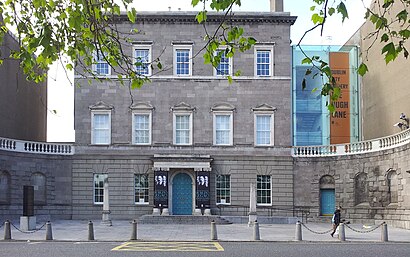
Hugh Lane Gallery Address: Charlemont House street in Dublin
Attractions near Hugh Lane Gallery
Dubray Books,Hugh Lane Municipal Gallery of Modern Art,Charelmont House,Suzanne Walking In Leather Skirt,Dublin City Gallery The Hugh Lane,John McGinley Bus Stop,Parnell Square,St. Patricks Day Parade,itsa .. Hugh Lane,Chapter One,Apartment 23,Garden Of Remembrance,Frederick Lane Apartments,The Children Of Lir,Dublin Writers Museum,Bus 16/a,Deaf Hear.Ie,Abbey Church,Parnell Square North,Hatch & SonsHow to get to popular attractions in Dublin with public transit
Stillorgan Luas, Dundrum,Swords / Sord Cholmcille, Swords Village,Swan Leisure Centre, Dublin,DCU Sports Complex, Dublin,National Botanic Gardens, Dublin,Ikea, Dubber,Rds Main Arena, Dublin,Carrigaline, Carrigaline,Sheraton Athlone Hotel, Athlone,Howth, Howth,Griffith College Dublin, Dublin,Navan / an Uaimh, Navan,Dundrum Shopping Centre, Dundrum,Kildare Village, Kildare,Royal Canal Park, Dublin,Dublin Airport (DUB), Airport,Dundalk Clarke Railway Station, Dundalk,Citywest Business Campus, Tallaght,Intel, Leixlip,Spire Of Dublin, DublinGet around Dublin by public transit!
Traveling around Dublin has never been so easy. See step by step directions as you travel to any attraction, street or major public transit station. View bus and train schedules, arrival times, service alerts and detailed routes on a map, so you know exactly how to get to anywhere in Dublin.
When traveling to any destination around Dublin use Moovit's Live Directions with Get Off Notifications to know exactly where and how far to walk, how long to wait for your line, and how many stops are left. Moovit will alert you when it's time to get off — no need to constantly re-check whether yours is the next stop.
Wondering how to use public transit in Dublin or how to pay for public transit in Dublin? Moovit public transit app can help you navigate your way with public transit easily, and at minimum cost. It includes public transit fees, ticket prices, and costs. Looking for a map of Dublin public transit lines? Moovit public transit app shows all public transit maps in Dublin with all bus or train routes and stops on an interactive map.
Dublin has 2 transit type(s), including: bus or train, operated by several transit agencies, including Luas, Bus Átha Cliath – Dublin Bus, Bus Éireann, Go-Ahead Ireland, Nitelink, Dublin Bus, Citylink, Kenneally's Bus Service, Aircoach, TFI Local Link Mayo, Irish Rail, Express Bus, JJ/Bernard Kavanagh, Dublin Coach, Kearns Transport and Matthews Coach Hire