Directions to Humayun Morshed (Medford) with public transportation
The following transit lines have routes that pass near Humayun Morshed
 Bus: 134, 354, 95, 96, 94.
- Train: LOWELL.
- Subway: GREEN LINE E, GREEN LINE B, GREEN LINE C, RED LINE.
How to get to Humayun Morshed by bus?
Click on the bus route to see step by step directions with maps, line arrival times and updated time schedules.
From Boston University Goldman School of Dental Medicine, Boston
50 minFrom Guitar Center, Boston
62 minFrom Hampton Inn & Suites Boston Crosstown Ctr, Boston
66 minFrom Boston University Henry M. Goldman School of Dental Medicine, Boston
66 minFrom 200 Trade Center, Woburn
35 minFrom Abe & Louie's, Boston
51 minFrom Museum Of Fine Arts MBTA Station, Boston
78 minFrom Hampton Inn Boston, Boston
66 minFrom Astrazeneca Hope Lodge, Boston
77 minFrom Residence Inn by Marriott Boston Back Bay/Fenway, Boston
61 min
How to get to Humayun Morshed by subway?
Click on the subway route to see step by step directions with maps, line arrival times and updated time schedules.
From Boston University Goldman School of Dental Medicine, Boston
78 minFrom Guitar Center, Boston
72 minFrom Hampton Inn & Suites Boston Crosstown Ctr, Boston
78 minFrom Boston University Henry M. Goldman School of Dental Medicine, Boston
75 minFrom Abe & Louie's, Boston
62 minFrom Museum Of Fine Arts MBTA Station, Boston
67 minFrom Hampton Inn Boston, Boston
78 minFrom Astrazeneca Hope Lodge, Boston
79 minFrom Residence Inn by Marriott Boston Back Bay/Fenway, Boston
72 min
Bus stops near Humayun Morshed in Medford
Subway stations near Humayun Morshed in Medford
Train station near Humayun Morshed in Medford
- West Medford, 26 min walk,VIEW
Bus lines to Humayun Morshed in Medford
What are the closest stations to Humayun Morshed?
The closest stations to Humayun Morshed are:
- High St @ Powder House Rd is 256 yards away, 3 min walk.
- City Hall Mall @ Salem St - Medford City Hall is 344 yards away, 5 min walk.
- Main St @ Emerson St is 387 yards away, 5 min walk.
- Medford/Tufts Station is 451 yards away, 6 min walk.
- Davis Sq. is 1191 yards away, 15 min walk.
- West Medford is 2139 yards away, 26 min walk.
Which bus lines stop near Humayun Morshed?
These bus lines stop near Humayun Morshed: 134, 354, 95, 96.
Which subway line stops near Humayun Morshed?
GREEN LINE E (Lechmere)
What’s the nearest subway station to Humayun Morshed in Medford?
The nearest subway station to Humayun Morshed in Medford is Medford/Tufts Station. It’s a 6 min walk away.
What’s the nearest train station to Humayun Morshed in Medford?
The nearest train station to Humayun Morshed in Medford is West Medford. It’s a 26 min walk away.
What’s the nearest bus station to Humayun Morshed in Medford?
The nearest bus station to Humayun Morshed in Medford is High St @ Powder House Rd. It’s a 3 min walk away.
What time is the first subway to Humayun Morshed in Medford?
The GREEN LINE E is the first subway that goes to Humayun Morshed in Medford. It stops nearby at 4:53 AM.
What time is the last subway to Humayun Morshed in Medford?
The GREEN LINE E is the last subway that goes to Humayun Morshed in Medford. It stops nearby at 2:41 AM.
What time is the first train to Humayun Morshed in Medford?
The LOWELL is the first train that goes to Humayun Morshed in Medford. It stops nearby at 5:31 AM.
What time is the last train to Humayun Morshed in Medford?
The LOWELL is the last train that goes to Humayun Morshed in Medford. It stops nearby at 12:20 AM.
What time is the first bus to Humayun Morshed in Medford?
The 95 is the first bus that goes to Humayun Morshed in Medford. It stops nearby at 4:52 AM.
What time is the last bus to Humayun Morshed in Medford?
The 96 is the last bus that goes to Humayun Morshed in Medford. It stops nearby at 1:35 AM.
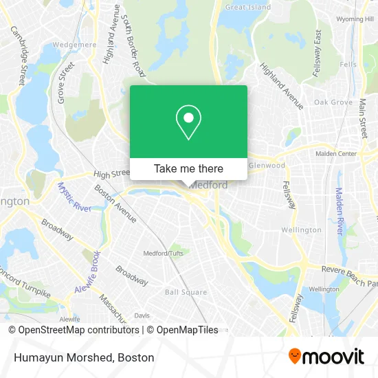
See Humayun Morshed, Medford, on the map
Public Transit to Humayun Morshed in Medford
Wondering how to get to Humayun Morshed in Medford? Moovit helps you find the best way to get to Humayun Morshed with step-by-step directions from the nearest public transit station.
Moovit provides free maps and live directions to help you navigate through your city. View schedules, routes, timetables, and find out how long does it take to get to Humayun Morshed in real time.
Looking for the nearest stop or station to Humayun Morshed? Check out this list of stops closest to your destination: High St @ Powder House Rd; City Hall Mall @ Salem St - Medford City Hall; Main St @ Emerson St; Medford/Tufts Station; Davis Sq.; West Medford.
Bus: 134, 354, 95, 96, 94, 101.Train: LOWELL.Subway: GREEN LINE E, GREEN LINE B, GREEN LINE C, RED LINE.
Want to see if there’s another route that gets you there at an earlier time? Moovit helps you find alternative routes or times. Get directions from and directions to Humayun Morshed easily from the Moovit App or Website.
We make riding to Humayun Morshed easy, which is why over 1.7 million users, including users in Medford, trust Moovit as the best app for public transit. You don’t need to download an individual bus app or train app, Moovit is your all-in-one transit app that helps you find the best bus time or train time available.
For information on prices of bus and subway, costs and ride fares to Humayun Morshed, please check the Moovit app.
Use the app to navigate to popular places including to the airport, hospital, stadium, grocery store, mall, coffee shop, school, college, and university.
Humayun Morshed Address: 43 High Street street in Medford
- Easyacct Pros,
- Taibah Fashion,
- Isaac Hall House,
- Shred Nations,
- Navy Federal Credit Union,
- Citizens Bank & Trust,
- Vault,
- Medford MA Locksmith Store,
- Ovvo Optics,
- Niji Ya Japanese Restaurant,
- McCourt Construction Company,
- Ronal Realty,
- The Law Office of Rafaela Garreta P Serranoa,
- Laurie A Coleman,
- David Ladner Realty Group,
- Cheap Locksmith,
- Homes with Alexa,
- Ak Financial Administration Inc,
- Fox Forge Capitol,
- Efficiency Forward
Places Near Humayun Morshed (Medford)
- Leader Bank Pavilion (Leader Bank Pavillion), Boston,
- Td Garden, Boston,
- Boston Medical Center, Boston,
- Boston Convention & Exhibition Center, Boston,
- Seaport District, Boston,
- North End, Boston,
- Boston Common, Boston,
- Cheers, Boston,
- Boston Children's Hospital, Boston,
- Museum Of Science, Boston,
- Quincy Market, Boston,
- Isabella Stewart Gardner Museum, Boston,
- Mgm Music Hall, Boston,
- House Of Blues, Boston,
- Prudential Center, Boston,
- Wilbur Theatre, Boston,
- Massachusetts General Hospital, Boston,
- Castle Island, Boston,
- Wang Theater, Boston,
- Faneuil Hall, Boston
How to get to popular places in Boston with public transit
Get around Medford by public transit!
Traveling around Medford has never been so easy. See step by step directions as you travel to any attraction, street or major public transit station. View bus and train schedules, arrival times, service alerts and detailed routes on a map, so you know exactly how to get to anywhere in Medford.
When traveling to any destination around Medford use Moovit's Live Directions with Get Off Notifications to know exactly where and how far to walk, how long to wait for your line, and how many stops are left. Moovit will alert you when it's time to get off — no need to constantly re-check whether yours is the next stop.
Wondering how to use public transit in Medford or how to pay for public transit in Medford? Moovit public transit app can help you navigate your way with public transit easily, and at minimum cost. It includes public transit fees, ticket prices, and costs. Looking for a map of Medford public transit lines? Moovit public transit app shows all public transit maps in Medford with all Bus, Train, Subway and Ferry routes and stops on an interactive map.
Boston has 4 transit type(s), including: Bus, Train, Subway and Ferry, operated by several transit agencies, including MBTA, Southeastern Regional Transit Authority, MetroWest Regional Transit Authority, Rhode Island Public Transit Authority, WRTA, Lowell Regional Transit Authority, Merrimack Valley Transit, Montachusett Regional Transit Authority, Cape Cod Regional Transit Authority, Brockton Area Transit Authority, Martha's Vineyard Transit Authority, the WAVE - Nantucket Regional Transit Authority, GATRA, Cape Ann Transportation Authority and Massport