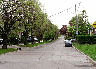
See Humewood - Cedarvale, Toronto, on the map
Directions to Humewood - Cedarvale (Toronto) with public transportation
The following transit lines have routes that pass near Humewood - Cedarvale
 Bus:
Bus: - Subway:
- Streetcar:
How to get to Humewood - Cedarvale by bus?
Click on the bus route to see step by step directions with maps, line arrival times and updated time schedules.
How to get to Humewood - Cedarvale by subway?
Click on the subway route to see step by step directions with maps, line arrival times and updated time schedules.
Bus stations near Humewood - Cedarvale in Toronto
- Vaughan Rd At Arlington Ave,1 min walk,
Bus lines to Humewood - Cedarvale in Toronto
- 90C,Vaughan Rd at Oakwood Ave East Side,
What are the closest stations to Humewood - Cedarvale?
The closest stations to Humewood - Cedarvale are:
- Vaughan Rd At Arlington Ave is 64 meters away, 1 min walk.
Which bus lines stop near Humewood - Cedarvale?
These bus lines stop near Humewood - Cedarvale: 161, 32, 63, 90.
Which subway line stops near Humewood - Cedarvale?
1
Which Streetcar line stops near Humewood - Cedarvale?
512
What’s the nearest bus stop to Humewood - Cedarvale in Toronto?
The nearest bus stop to Humewood - Cedarvale in Toronto is Vaughan Rd At Arlington Ave. It’s a 1 min walk away.
See Humewood - Cedarvale, Toronto, on the map
Public Transit to Humewood - Cedarvale in Toronto
Wondering how to get to Humewood - Cedarvale in Toronto, Canada? Moovit helps you find the best way to get to Humewood - Cedarvale with step-by-step directions from the nearest public transit station.
Moovit provides free maps and live directions to help you navigate through your city. View schedules, routes, timetables, and find out how long does it take to get to Humewood - Cedarvale in real time.
Looking for the nearest stop or station to Humewood - Cedarvale? Check out this list of stops closest to your destination: Vaughan Rd At Arlington Ave.
Bus:Subway:Streetcar:
Want to see if there’s another route that gets you there at an earlier time? Moovit helps you find alternative routes or times. Get directions from and directions to Humewood - Cedarvale easily from the Moovit App or Website.
We make riding to Humewood - Cedarvale easy, which is why over 1.5 million users, including users in Toronto, trust Moovit as the best app for public transit. You don’t need to download an individual bus app or train app, Moovit is your all-in-one transit app that helps you find the best bus time or train time available.
For information on prices of bus, subway and Streetcar, costs and ride fares to Humewood - Cedarvale, please check the Moovit app.
Use the app to navigate to popular places including to the airport, hospital, stadium, grocery store, mall, coffee shop, school, college, and university.
Location: Toronto
Attractions near Humewood - Cedarvale
Sudsy Sue's Coin Laundry,Italy At Home,Extreme Laundry,Fair Mart,Italy At Home,Vaughan Convenience,Hogtown Mascots,425 Vaughan Road,Three Brothers Supermarket,Alberto hair,Three Brothers,Alberto Hair Design,Provincial Butchers Machinery,Marathon Cleaners,Communication Matters,Vaughan Home Hardware,Vaughan Rd at Arlington Ave East Side,First Hungarian Presbyterian Church,Hungarian Chuch,Travel KioskHow to get to popular attractions in Toronto with public transit
Canada's Wonderland, Vaughan,Oshawa, Ontario, Oshawa,Jack Astor's Bar & Grill, Toronto,Trinity Common Bus Terminal, Brampton,McMaster University, Hamilton,Erin Mills Town Centre, Mississauga,Destiny 緣續園, Richmond Hill,Mcmaster University, Hamilton,RioCan Georgian Mall, Barrie,TTC #511 Bathurst Streetcar, Toronto,Vaughan Mills, Vaughan,The Rivoli, Toronto,Toronto Zoo, Toronto,GoodLife Fitness Centres, Toronto,Charles Street Transit Terminal, Kitchener,Insomnia Restaurant and Lounge, Toronto,City of Welland, Welland,Conestoga College Doon Campus, Kitchener,Kitchener, Ontario, Kitchener,Brampton ON, BramptonGet around Toronto by public transit!
Traveling around Toronto has never been so easy. See step by step directions as you travel to any attraction, street or major public transit station. View bus and train schedules, arrival times, service alerts and detailed routes on a map, so you know exactly how to get to anywhere in Toronto.
When traveling to any destination around Toronto use Moovit's Live Directions with Get Off Notifications to know exactly where and how far to walk, how long to wait for your line, and how many stops are left. Moovit will alert you when it's time to get off — no need to constantly re-check whether yours is the next stop.
Wondering how to use public transit in Toronto or how to pay for public transit in Toronto? Moovit public transit app can help you navigate your way with public transit easily, and at minimum cost. It includes public transit fees, ticket prices, and costs. Looking for a map of Toronto public transit lines? Moovit public transit app shows all public transit maps in Toronto with all bus, subway or Streetcar routes and stops on an interactive map.
Toronto has 3 transit type(s), including: bus, subway or Streetcar, operated by several transit agencies, including TTC, TTC Streetcar, Toronto Subway, GO Transit Bus, GO Transit, Amtrak, York Region Transit, Grand River Transit, Guelph Transit, grt, Hamilton Street Railway, MiWay, Brampton Transit, Burlington Transit and Oakville Transit