Directions to Hyams Foundation (Boston) with public transportation
The following transit lines have routes that pass near Hyams Foundation
 Bus: 354, 450, 504, 92, 93.
- Train: FRAMINGHAM/WORCESTER, LOWELL, NEWBURYPORT/ROCKPORT, COMMUTER RAIL SHUTTLE, FAIRMOUNT LINE SHUTTLE.
- Subway: BLUE LINE, GREEN LINE B, GREEN LINE D, ORANGE LINE, RED LINE.
How to get to Hyams Foundation by bus?
Click on the bus route to see step by step directions with maps, line arrival times and updated time schedules.
From Qea, Quincy
105 minFrom Regent Theatre, Arlington
66 minFrom Arlington, MA, Arlington
78 minFrom FOUR POINTS BY SHERATON Boston Newton, Newton
32 minFrom Agganis Arena, Boston
64 minFrom Harvard Square, Cambridge
58 minFrom Suffolk Downs, Boston
45 minFrom Ac Hotel Cambridge, Cambridge
100 minFrom Everett, MA, Everett
47 minFrom The Mall At Chestnut Hill, Newton
76 min
How to get to Hyams Foundation by train?
Click on the train route to see step by step directions with maps, line arrival times and updated time schedules.
How to get to Hyams Foundation by subway?
Click on the subway route to see step by step directions with maps, line arrival times and updated time schedules.
Bus stops near Hyams Foundation in Boston
Subway stations near Hyams Foundation in Boston
Train station near Hyams Foundation in Boston
- South Station, 7 min walk,VIEW
Bus lines to Hyams Foundation in Boston
- 4, North Station,VIEW
- 15, Haymarket Via Fields Corner & Nubian,VIEW
- 39, Haymarket Via Forest Hills,VIEW
- 57, Haymarket Via Kenmore,VIEW
- 92, Sullivan,VIEW
- 93, Sullivan Via Navy Yard,VIEW
- RED LINE SHUTTLE, Jfk/Umass (Shuttle),VIEW
- RED LINE SHUTTLE, Harvard (Shuttle),VIEW
- RED LINE SHUTTLE, Kendall/MIT (Shuttle),VIEW
- 11, City Point,VIEW
- RED LINE SHUTTLE, Ashmont - Park Street via Post Office,VIEW
- RED LINE SHUTTLE, JFK/UMass - Park Street via Post Office,VIEW
- RED LINE SHUTTLE, JFK/UMass - Park Street,VIEW
- 7, City Point Via East First St,VIEW
- 501, Downtown Via Cambridge St And Copley (Express),VIEW
- 504, Watertown Via Copley And Newton Corner (Express),VIEW
- 505, Waltham (Express),VIEW
What are the closest stations to Hyams Foundation?
The closest stations to Hyams Foundation are:
- Congress St @ State St is 47 yards away, 1 min walk.
- Downtown Crossing is 77 yards away, 2 min walk.
- Chauncy St @ Summer St is 171 yards away, 3 min walk.
- Downtown Crossing - Franklin St @ Washington St is 189 yards away, 3 min walk.
- Otis St @ Summer St is 196 yards away, 3 min walk.
- Federal St @ Franklin St is 261 yards away, 4 min walk.
- State Street is 331 yards away, 5 min walk.
- Park Street is 405 yards away, 5 min walk.
- South Station is 505 yards away, 7 min walk.
Which bus lines stop near Hyams Foundation?
These bus lines stop near Hyams Foundation: 354, 450, 504, 92, 93, SL4.
Which train lines stop near Hyams Foundation?
These train lines stop near Hyams Foundation: FRAMINGHAM/WORCESTER, LOWELL, NEWBURYPORT/ROCKPORT.
Which subway lines stop near Hyams Foundation?
These subway lines stop near Hyams Foundation: BLUE LINE, GREEN LINE B, GREEN LINE D, ORANGE LINE, RED LINE.
What’s the nearest subway station to Hyams Foundation in Boston?
The nearest subway station to Hyams Foundation in Boston is Downtown Crossing. It’s a 2 min walk away.
What’s the nearest train station to Hyams Foundation in Boston?
The nearest train station to Hyams Foundation in Boston is South Station. It’s a 7 min walk away.
What’s the nearest bus station to Hyams Foundation in Boston?
The nearest bus station to Hyams Foundation in Boston is Congress St @ State St. It’s a 1 min walk away.
What time is the first subway to Hyams Foundation in Boston?
The GREEN LINE E is the first subway that goes to Hyams Foundation in Boston. It stops nearby at 5:05 AM.
What time is the last subway to Hyams Foundation in Boston?
The GREEN LINE E is the last subway that goes to Hyams Foundation in Boston. It stops nearby at 2:20 AM.
What time is the first train to Hyams Foundation in Boston?
The PROVIDENCE/STOUGHTON is the first train that goes to Hyams Foundation in Boston. It stops nearby at 4:20 AM.
What time is the last train to Hyams Foundation in Boston?
The LAKE SHORE LIMITED is the last train that goes to Hyams Foundation in Boston. It stops nearby at 8:32 PM.
What time is the first bus to Hyams Foundation in Boston?
The SLW is the first bus that goes to Hyams Foundation in Boston. It stops nearby at 4:19 AM.
What time is the last bus to Hyams Foundation in Boston?
The 11 is the last bus that goes to Hyams Foundation in Boston. It stops nearby at 1:15 AM.
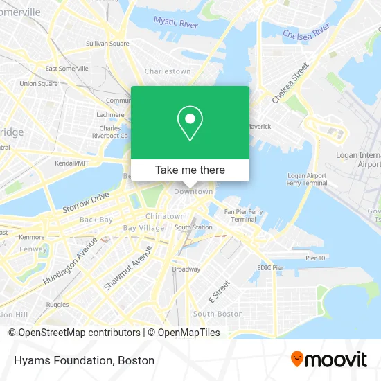
See Hyams Foundation, Boston, on the map
Public Transit to Hyams Foundation in Boston
Wondering how to get to Hyams Foundation in Boston? Moovit helps you find the best way to get to Hyams Foundation with step-by-step directions from the nearest public transit station.
Moovit provides free maps and live directions to help you navigate through your city. View schedules, routes, timetables, and find out how long does it take to get to Hyams Foundation in real time.
Looking for the nearest stop or station to Hyams Foundation? Check out this list of stops closest to your destination: Congress St @ State St; Downtown Crossing; Chauncy St @ Summer St; Downtown Crossing - Franklin St @ Washington St; Otis St @ Summer St; Federal St @ Franklin St; State Street; Park Street; South Station.
Bus: 354, 450, 504, 92, 93, SL4, 4, 15, 39, 57, 11.Train: FRAMINGHAM/WORCESTER, LOWELL, NEWBURYPORT/ROCKPORT, COMMUTER RAIL SHUTTLE, FAIRMOUNT LINE SHUTTLE, FRANKLIN LINE SHUTTLE, KINGSTON LINE SHUTTLE, SL1.Subway: BLUE LINE, GREEN LINE B, GREEN LINE D, ORANGE LINE, RED LINE, GREEN LINE C, GREEN LINE E.
Want to see if there’s another route that gets you there at an earlier time? Moovit helps you find alternative routes or times. Get directions from and directions to Hyams Foundation easily from the Moovit App or Website.
We make riding to Hyams Foundation easy, which is why over 1.7 million users, including users in Boston, trust Moovit as the best app for public transit. You don’t need to download an individual bus app or train app, Moovit is your all-in-one transit app that helps you find the best bus time or train time available.
For information on prices of bus, subway and train, costs and ride fares to Hyams Foundation, please check the Moovit app.
Use the app to navigate to popular places including to the airport, hospital, stadium, grocery store, mall, coffee shop, school, college, and university.
Hyams Foundation Address: 50 Federal St street in Boston
- Crestwood Advisors,
- Charles Schwab Corp,
- One Federal,
- Financial District,
- Downtown Harvard Club of Boston,
- JVS,
- MBTA Federal St & Franklin St Bus Stop,
- Render Coffee,
- Elephant And Castle,
- Angel Althea, DMD (Handa Ratti DMD),
- D'Guru Restaurant,
- WW,
- 75 / 101 Federal Street Parking Garage,
- Elephant & Castle Pub and Restaurant (Ec Restaurants Boston),
- Oliver Street Capital,
- Club Quarters,
- Club Quarters Boston (Club Qtrs Htl Faneuil Hall, Boston),
- Vermilion Software,
- Langham garage,
- The Exchange
Places Near Hyams Foundation (Boston)
- Isabella Stewart Gardner Museum, Boston,
- North End, Boston,
- Mgm Music Hall, Boston,
- Leader Bank Pavilion (Leader Bank Pavillion), Boston,
- Quincy Market, Boston,
- Massachusetts General Hospital, Boston,
- Boston Convention & Exhibition Center, Boston,
- Castle Island, Boston,
- Museum Of Science, Boston,
- Td Garden, Boston,
- Faneuil Hall, Boston,
- House Of Blues, Boston,
- Boston Children's Hospital, Boston,
- Wang Theater, Boston,
- Cheers, Boston,
- Wilbur Theatre, Boston,
- Boston Medical Center, Boston,
- Boston Common, Boston,
- Seaport District, Boston,
- Prudential Center, Boston
How to get to popular places in Boston with public transit
Get around Boston by public transit!
Traveling around Boston has never been so easy. See step by step directions as you travel to any attraction, street or major public transit station. View bus and train schedules, arrival times, service alerts and detailed routes on a map, so you know exactly how to get to anywhere in Boston.
When traveling to any destination around Boston use Moovit's Live Directions with Get Off Notifications to know exactly where and how far to walk, how long to wait for your line, and how many stops are left. Moovit will alert you when it's time to get off — no need to constantly re-check whether yours is the next stop.
Wondering how to use public transit in Boston or how to pay for public transit in Boston? Moovit public transit app can help you navigate your way with public transit easily, and at minimum cost. It includes public transit fees, ticket prices, and costs. Looking for a map of Boston public transit lines? Moovit public transit app shows all public transit maps in Boston with all Bus, Train, Subway and Ferry routes and stops on an interactive map.
Boston has 4 transit type(s), including: Bus, Train, Subway and Ferry, operated by several transit agencies, including MBTA, Southeastern Regional Transit Authority, MetroWest Regional Transit Authority, Rhode Island Public Transit Authority, WRTA, Lowell Regional Transit Authority, Merrimack Valley Transit, Montachusett Regional Transit Authority, Cape Cod Regional Transit Authority, Brockton Area Transit Authority, Martha's Vineyard Transit Authority, the WAVE - Nantucket Regional Transit Authority, GATRA, Cape Ann Transportation Authority and Massport