How to get to Hyperfive by Fullcontrol Network by bus?
Click on the bus route to see step by step directions with maps, line arrival times and updated time schedules.
From Leelawadee Thai Massage, Shawnee
88 minFrom Magtek, Lenexa
68 minFrom Olathe, KS, Olathe
26 minFrom S & S Engineering, Merriam
44 minFrom Broadmoor Junior High School, Overland Park
67 minFrom Nuhope Service, Lenexa
41 minFrom Bate's City BBQ, Shawnee
84 minFrom Avertest, Olathe
25 minFrom Dollar Tree, Overland Park
52 minFrom Poised Imagery Media Production Company, Prairie Village
54 min
Bus stops near Hyperfive by Fullcontrol Network in Lenexa
What are the closest stations to Hyperfive by Fullcontrol Network?
The closest stations to Hyperfive by Fullcontrol Network are:
- On Strang Line Rd at Randall Northbound is 395 yards away, 5 min walk.
- On College Blvd at Strang Line Road Eastbound is 869 yards away, 11 min walk.
Which bus line stops near Hyperfive by Fullcontrol Network?
403 (Walmart Park N Ride)
What’s the nearest bus station to Hyperfive by Fullcontrol Network in Lenexa?
The nearest bus station to Hyperfive by Fullcontrol Network in Lenexa is On Strang Line Rd at Randall Northbound. It’s a 5 min walk away.
What time is the first bus to Hyperfive by Fullcontrol Network in Lenexa?
The 403 is the first bus that goes to Hyperfive by Fullcontrol Network in Lenexa. It stops nearby at 5:19 AM.
What time is the last bus to Hyperfive by Fullcontrol Network in Lenexa?
The 403 is the last bus that goes to Hyperfive by Fullcontrol Network in Lenexa. It stops nearby at 8:55 PM.
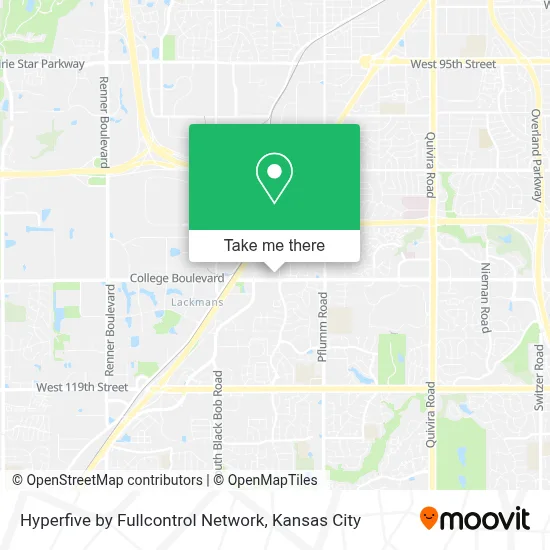
See Hyperfive by Fullcontrol Network, Lenexa, on the map
Public Transit to Hyperfive by Fullcontrol Network in Lenexa
Wondering how to get to Hyperfive by Fullcontrol Network in Lenexa? Moovit helps you find the best way to get to Hyperfive by Fullcontrol Network with step-by-step directions from the nearest public transit station.
Moovit provides free maps and live directions to help you navigate through your city. View schedules, routes, timetables, and find out how long does it take to get to Hyperfive by Fullcontrol Network in real time.
Looking for the nearest stop or station to Hyperfive by Fullcontrol Network? Check out this list of stops closest to your destination: On Strang Line Rd at Randall Northbound; On College Blvd at Strang Line Road Eastbound.
Bus: 403, 402.
Want to see if there’s another route that gets you there at an earlier time? Moovit helps you find alternative routes or times. Get directions from and directions to Hyperfive by Fullcontrol Network easily from the Moovit App or Website.
We make riding to Hyperfive by Fullcontrol Network easy, which is why over 1.5 million users, including users in Lenexa, trust Moovit as the best app for public transit. You don’t need to download an individual bus app or train app, Moovit is your all-in-one transit app that helps you find the best bus time or train time available.
For information on prices of bus, costs and ride fares to Hyperfive by Fullcontrol Network, please check the Moovit app.
Use the app to navigate to popular places including to the airport, hospital, stadium, grocery store, mall, coffee shop, school, college, and university.
Hyperfive by Fullcontrol Network Address: 14400 College Blvd street in Lenexa
- Services & Products Pre-Construction Services Installation,
- American Direct Project Management Team,
- McClure,
- Holiday Greenwood Terrace,
- Cases and Storage Solutions,
- Midwest - Insurance,
- Aerospace and Defense Aerospace and Defense Aerospace and Defense Aerospace,
- Mawd Pathology,
- Ablelight Thrift Store,
- Lumenus Technologies, LLC,
- Advancement of Technology Change,
- Midwest Golf Performance,
- Peavey Security,
- Safety Jackpot Program,
- Realkc.Church,
- Service Depot,
- Infusion Pump Financing,
- Chaudhrys Investment Group,
- Cig,
- Massage Therapy by Richel
Places Near Hyperfive by Fullcontrol Network (Lenexa)
- Grandview, MO, Grandview,
- Kansas City Zoo,
- Stans Glory Hole,
- T-Mobile Center,
- GEHA Field at Arrowhead Stadium,
- St. Luke's Hospital - Medical Plaza I,
- Truman Medical Center,
- Liberty, MO, Liberty,
- Country Club Plaza,
- Amazon Fulfilment Center-MKC6, Kansas City,
- Worlds of Fun,
- Kansas City International Airport (MCI) (Kansas City International Airport),
- Walmart, Kansas City,
- Kauffman Stadium,
- Walmart Supercenter,
- The Glory Hole,
- Arrowhead Stadium,
- Legends Outlets Kansas City, Kansas City,
- Ku Medical Center, Kansas City,
- Harrah's Casino, North Kansas City
How to get to popular places in Kansas City with public transit
Get around Lenexa by public transit!
Traveling around Lenexa has never been so easy. See step by step directions as you travel to any attraction, street or major public transit station. View bus and train schedules, arrival times, service alerts and detailed routes on a map, so you know exactly how to get to anywhere in Lenexa.
When traveling to any destination around Lenexa use Moovit's Live Directions with Get Off Notifications to know exactly where and how far to walk, how long to wait for your line, and how many stops are left. Moovit will alert you when it's time to get off — no need to constantly re-check whether yours is the next stop.
Wondering how to use public transit in Lenexa or how to pay for public transit in Lenexa? Moovit public transit app can help you navigate your way with public transit easily, and at minimum cost. It includes public transit fees, ticket prices, and costs. Looking for a map of Lenexa public transit lines? Moovit public transit app shows all public transit maps in Lenexa with all Bus, Train and Light Rail routes and stops on an interactive map.
Kansas City has 3 transit type(s), including: Bus, Train and Light Rail, operated by several transit agencies, including Kansas City Area Transportation Authority, Lawrence Transit, Topeka Metro, RideKC Johnson County, Amtrak, Greyhound-us and FlixBus-us