How to get to ING Bank by bus?
Click on the bus route to see step by step directions with maps, line arrival times and updated time schedules.
From İstanbul Mehmet Akif Ersoy Eğitim ve Araştırma Hastanesi, Küçükçekmece
100 minFrom Sultangazi Nikah Salonu, Sultangazi
119 minFrom Yeşilköy Prof. Dr. Murat Dilmener Acil Durum Hastanesi, Bakirköy
92 minFrom Dr. Mimar Kadir Topbaş Gösteri Ve Sanat Merkezi, Yenikapı, Fatih
79 minFrom Silivri Ceza İnfaz Kurumu, Sultangazi
125 minFrom SULTANGAZİ, Sultangazi
142 minFrom Sultangazi Haseki Egitim Arastirma Hastanesi, Sultangazi
142 minFrom Marmaray Sirkeci İstasyonu, Sirkeci, Fatih
74 minFrom Topkapı Sarayı, Fatih
108 minFrom Çukur Balat, Balat, Fatih
76 min
How to get to ING Bank by metro?
Click on the metro route to see step by step directions with maps, line arrival times and updated time schedules.
Dolmus & Minibus stations near ING Bank in Güngören
Bus stops near ING Bank in Güngören
Bus lines to ING Bank in Güngören
- 97A, Şehit Osman Yıldız Ticaret Meslek Lisesi-Basınsitesi,VIEW
- MK97, Kerim Çavuşpaşa-Zeytinburnu,VIEW
- 98E, Bakırköy-Basın Tesisleri Son Durak,VIEW
- A03, Bakırköy - Bağcılar,VIEW
- A03, Bakırköy - Mehmet Akif,VIEW
- A03, Bakırköy - Kemalpaşa,VIEW
- A29, İncirli - Barbaros,VIEW
- A29, İncirli - Kocasinan,VIEW
- A29, İncirli - Evren,VIEW
- A29, İncirli - Mahmutbey,VIEW
- A30, Bağcılar - Mall of İstanbul Ring,VIEW
- 36CY, Cebeci - Yenibosna Metro,VIEW
- 92, Yeni Mahalle Metro - Eminönü,VIEW
- 98D, Yeni Mahalle Metro - Bakırköy,VIEW
- 98Y, Giyimkent / Yüzyıl Mahallesi - Bakırköy,VIEW
- 92C, Haznedar - Eminönü / Ring,VIEW
- 98G, Giyimkent-Bakırköy,VIEW
What are the closest stations to ING Bank?
The closest stations to ING Bank are:
- Soğanlı is 64 meters away, 1 min walk.
- Can Sokağı is 212 meters away, 3 min walk.
- Sevinç Sokak is 247 meters away, 4 min walk.
- Şehit Osman Yıldız Ticaret Meslek Lisesi - Soğanlı Yönü is 256 meters away, 4 min walk.
- Soğanlı Çeşme - Haznedar Yönü is 460 meters away, 6 min walk.
- Beyzade Sk. is 466 meters away, 7 min walk.
- Posta Caddesi - Güngören-Haznedar Yönü is 528 meters away, 7 min walk.
Which bus lines stop near ING Bank?
These bus lines stop near ING Bank: 97T, 98D, 98Y.
Which metro line stops near ING Bank?
M3 (Bakırköy Sahil→Kayaşehir Merkez)
What’s the nearest bus station to ING Bank in Güngören?
The nearest bus station to ING Bank in Güngören is Şehit Osman Yıldız Ticaret Meslek Lisesi - Soğanlı Yönü. It’s a 4 min walk away.
What’s the nearest Dolmus & Minibus station to ING Bank in Güngören?
The nearest Dolmus & Minibus station to ING Bank in Güngören is Soğanlı. It’s a 1 min walk away.
What time is the first bus to ING Bank in Güngören?
The MK97 is the first bus that goes to ING Bank in Güngören. It stops nearby at 6:08 AM.
What time is the last bus to ING Bank in Güngören?
The 98Y is the last bus that goes to ING Bank in Güngören. It stops nearby at 12:21 AM.
What time is the first Dolmus & Minibus to ING Bank in Güngören?
The A29 is the first Dolmus & Minibus that goes to ING Bank in Güngören. It stops nearby at 5:29 AM.
What time is the last Dolmus & Minibus to ING Bank in Güngören?
The A30 is the last Dolmus & Minibus that goes to ING Bank in Güngören. It stops nearby at 1:53 AM.
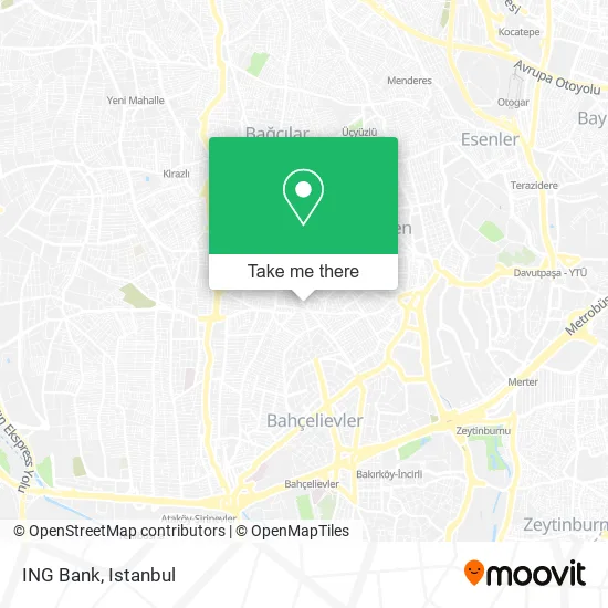
See ING Bank, Güngören, on the map
Public Transit to ING Bank in Güngören
Wondering how to get to ING Bank in Güngören? Moovit helps you find the best way to get to ING Bank with step-by-step directions from the nearest public transit station.
Moovit provides free maps and live directions to help you navigate through your city. View schedules, routes, timetables, and find out how long does it take to get to ING Bank in real time.
Looking for the nearest stop or station to ING Bank? Check out this list of stops closest to your destination: Soğanlı; Can Sokağı; Sevinç Sokak; Şehit Osman Yıldız Ticaret Meslek Lisesi - Soğanlı Yönü; Soğanlı Çeşme - Haznedar Yönü; Beyzade Sk.; Posta Caddesi - Güngören-Haznedar Yönü.
Bus: 97T, 98D, 98Y, 97A, MK97, 98E, A03, A03, A03, A29, A29, 92C, 98G.Metro: M3.Dolmus & Minibus: A28, A28, A28, A30, A30, A03.
Want to see if there’s another route that gets you there at an earlier time? Moovit helps you find alternative routes or times. Get directions from and directions to ING Bank easily from the Moovit App or Website.
We make riding to ING Bank easy, which is why over 1.5 million users, including users in Güngören, trust Moovit as the best app for public transit. You don’t need to download an individual bus app or train app, Moovit is your all-in-one transit app that helps you find the best bus time or train time available.
For information on prices of metro, bus, train, Dolmus & Minibus and Metrobus, costs and ride fares to ING Bank, please check the Moovit app.
Use the app to navigate to popular places including to the airport, hospital, stadium, grocery store, mall, coffee shop, school, college, and university.
ING Bank Address: Bağcılar Caddesi street in Güngören
- Yeni Ümit Src Belgesi,
- Yeni Ümit Eğitim Kurumları,
- Makbul Kuruyemiş Camlıkahve,
- Milenyum Erbir AVM,
- Camlıkahve,
- Bahis Birahane,
- Güngüren Zirve Suruç,
- Class İletişim,
- Ölü Balığın Canlanıp Denize Girdiği Yer,
- Ekingen Elektronik Camlıkahve,
- Livane Müzik,
- Sıhhat Sağlık Kabini,
- Mersin Tatlı Tantuni,
- Bekiroğulları Pastanesi,
- Bekiroğulları,
- Şen Pati Veteriner Kliniği,
- Tuana Tekel Shop,
- Agc gold mücevherat,
- Tamponcu Plastik Tamiri,
- Serhat 1. Sokak, 1
Places Near ING Bank (Güngören)
- Beylikdüzü - 4 Nolu Minibüs Hattı, Beylikduzu,
- Hilltown AVM, Maltepe,
- METROPOL IsTaNBuL, Ataşehir,
- Topkule Kışlası 47.Komando Tugay Komutanlığı, Esenler,
- Mehmet Emin Tokadî Hz. Türbesi, Fatih,
- Şehit Prof. Dr. İlhan Varank Eğitim Ve Araştırma Hastanesi, Sancaktepe,
- 212 AVM, Bagcilar,
- Başakşehir Çam Ve Sakura Şehir Hastanesi, Basaksehir,
- VİALAND AVM, Eyüp,
- Gebze-Harem Minibüs Hattı, Gebze,
- Bakırköy Sosyete Pazarı, Bakirköy,
- Gebze Koop Durağı, Gebze,
- 2 Nolu Minibüss, Beylikduzu,
- Hz. Yuşa Tepesi, Beykoz,
- Karaköy Genelevi, Karaköy, Beyoğlu,
- İstinye Park, Sariyer,
- Tersane İstanbul, Beyoğlu,
- 41 Burda AVM, Kocaeli Merkezi,
- Mall Of İstanbul, Basaksehir,
- İstanbul
How to get to popular places in Istanbul with public transit
Get around Güngören by public transit!
Traveling around Güngören has never been so easy. See step by step directions as you travel to any attraction, street or major public transit station. View bus and train schedules, arrival times, service alerts and detailed routes on a map, so you know exactly how to get to anywhere in Güngören.
When traveling to any destination around Güngören use Moovit's Live Directions with Get Off Notifications to know exactly where and how far to walk, how long to wait for your line, and how many stops are left. Moovit will alert you when it's time to get off — no need to constantly re-check whether yours is the next stop.
Wondering how to use public transit in Güngören or how to pay for public transit in Güngören? Moovit public transit app can help you navigate your way with public transit easily, and at minimum cost. It includes public transit fees, ticket prices, and costs. Looking for a map of Güngören public transit lines? Moovit public transit app shows all public transit maps in Güngören with all Bus, Train, Metro, Tram, Ferry, Metrobus and Dolmus & Minibus routes and stops on an interactive map.
Istanbul has 7 transit type(s), including: Bus, Train, Metro, Tram, Ferry, Metrobus and Dolmus & Minibus, operated by several transit agencies, including Marmaray, Metro İstanbul, Metrobüs, UAB, İETT, İETT ÇIFT KATLI HATLAR, İETT BÖLGESEL HATLAR, TCDD, Şehir Hatları, Dentur Avrasya, Beyden, Turyol, Mavi Marmara, Havaist and Prenstur
