How to get to I Do by bus?
Click on the bus route to see step by step directions with maps, line arrival times and updated time schedules.
From Desiqin Four Seasons Hui - Service Desk, Yuhua District
47 minFrom Hunan Normal University (Physical Education Department), Yuelu District
47 minFrom Yuelu Mountain Juzizhou Tourist Area - Parking Lot, Yuelu District
43 minFrom Changsha College (Former Changsha University), Kaifu District
54 minFrom Tianxin Pavilion, Tianxin District
37 minFrom National Defense University Affiliated Primary School, Kaifu District
54 minFrom National Defense University Affiliated Primary School (Southeast Gate), Kaifu District
53 minFrom Tongcheng Lushan Grand Hotel - Building 3, Yuelu District
46 minFrom Longhui County People's Government Changsha Office, Kaifu District
37 minFrom Route 114 (Changsha Railway Station - Huanghua Airport Terminal), Furong District
28 min
How to get to I Do by metro?
Click on the metro route to see step by step directions with maps, line arrival times and updated time schedules.
From Hunan Normal University (Physical Education Department), Yuelu District
36 minFrom Yuelu Mountain Juzizhou Tourist Area - Parking Lot, Yuelu District
41 minFrom Changsha College (Former Changsha University), Kaifu District
47 minFrom Tianxin Pavilion, Tianxin District
38 minFrom National Defense University Affiliated Primary School, Kaifu District
45 minFrom National Defense University Affiliated Primary School (Southeast Gate), Kaifu District
48 minFrom Tongcheng Lushan Grand Hotel - Building 3, Yuelu District
38 minFrom Longhui County People's Government Changsha Office, Kaifu District
39 minFrom Route 114 (Changsha Railway Station - Huanghua Airport Terminal), Furong District
20 min
Bus stops near I Do in Yuhua District
Metro station near I Do in Yuhua District
- Shawan Park, 6 min walk,VIEW
Bus lines to I Do in Yuhua District
- Route 276, Jinjiang River Bus Terminal - Changsha South Railway Station,VIEW
- Route 601, Houzi Stone Bridge West - Shawan Park,VIEW
- Route 601, Shawan Park - Laodong East Road Huangxing Depot,VIEW
- Line 2, Guangda,VIEW
- Route 121, Taiyu Garden,VIEW
- Temp Route 160, Bisha Lake Terminal,VIEW
- Route 806, Jinjing Community,VIEW
- Temporary Route 156, Martyrs Park East Gate,VIEW
- Temporary Route 601, West Houzi Rock Bridge,VIEW
- Route 368, Sports New City Bus Terminal,VIEW
- Route 917, Jiulong Lingshihui,VIEW
- Temp Route 159, Huxiang Art Market,VIEW
What are the closest stations to I Do?
The closest stations to I Do are:
- Shawan Park is 252 meters away, 5 min walk.
- Lower Baisha Bay is 470 meters away, 8 min walk.
- Sports New City is 540 meters away, 9 min walk.
- Sports New City Terminal is 798 meters away, 12 min walk.
- Qutang Road Shawan Road Intersection is 799 meters away, 12 min walk.
Which bus lines stop near I Do?
These bus lines stop near I Do: Route 121, Route 601, Route 806, Temporary Route 156.
Which metro lines stop near I Do?
These metro lines stop near I Do: Line 2, Line 4.
What’s the nearest metro station to I Do in Yuhua District?
The nearest metro station to I Do in Yuhua District is Shawan Park. It’s a 6 min walk away.
What’s the nearest bus station to I Do in Yuhua District?
The nearest bus station to I Do in Yuhua District is Shawan Park. It’s a 5 min walk away.
What time is the first metro to I Do in Yuhua District?
The Line 4 is the first metro that goes to I Do in Yuhua District. It stops nearby at 6:30 AM.
What time is the last metro to I Do in Yuhua District?
The Line 4 is the last metro that goes to I Do in Yuhua District. It stops nearby at 11:45 PM.
What time is the first bus to I Do in Yuhua District?
The Route 368 is the first bus that goes to I Do in Yuhua District. It stops nearby at 6:00 AM.
What time is the last bus to I Do in Yuhua District?
The Temp Route 159 is the last bus that goes to I Do in Yuhua District. It stops nearby at 10:49 PM.
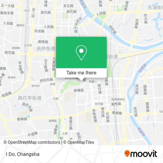
See I Do, Yuhua District, on the map
Public Transit to I Do in Yuhua District
Wondering how to get to I Do in Yuhua District? Moovit helps you find the best way to get to I Do with step-by-step directions from the nearest public transit station.
Moovit provides free maps and live directions to help you navigate through your city. View schedules, routes, timetables, and find out how long does it take to get to I Do in real time.
Looking for the nearest stop or station to I Do? Check out this list of stops closest to your destination: Shawan Park; Lower Baisha Bay; Sports New City; Sports New City Terminal; Qutang Road Shawan Road Intersection.
Bus: Route 121, Route 601, Route 806, Temporary Route 156, Route 276, Route 601, Route 601, Line 2, Route 121, Temp Route 160, Route 806, Temporary Route 156, Temporary Route 601.Metro: Line 2, Line 4, Line 4.
Want to see if there’s another route that gets you there at an earlier time? Moovit helps you find alternative routes or times. Get directions from and directions to I Do easily from the Moovit App or Website.
We make riding to I Do easy, which is why over 1.5 million users, including users in Yuhua District, trust Moovit as the best app for public transit. You don’t need to download an individual bus app or train app, Moovit is your all-in-one transit app that helps you find the best bus time or train time available.
For information on prices of bus and metro, costs and ride fares to I Do, please check the Moovit app.
Use the app to navigate to popular places including to the airport, hospital, stadium, grocery store, mall, coffee shop, school, college, and university.
I Do Address: 劳动东路268号附近 street in Yuhua District
- Baoli Seafood Experience Hall (Baoli MALL Branch),
- Poly Mall,
- Shaofuji Meicai Braised Pork Cake (Poly Mall Store),
- Adidas Trefoil (Poly International Plaza Store),
- Tea Color (Poly Mall Store),
- Monster Charging (Xiabu Xiabu Poly Mall),
- Beibei Bear Mother and Baby Chain (Poly Mall Branch),
- Shangpin Home Delivery (Poly Branch),
- Houcaller (Poly Mall Store),
- MOJON Woodworking Workshop,
- Meidu Yoga (Shawan Park Poly maⅡ),
- Hotwind (Poly Mall Store),
- Sea Treasure Children's Wonderland (Poly Mall),
- Dumpling 1998 Restaurant (Poly Mall Branch),
- OCE (Poly Mall),
- Moonlight Forest Desserts (Poly Mall Branch),
- Poly MALL - Parking Lot,
- Huawei Authorized Experience Store (Poly Mall Branch),
- Chow Sang Sang (Poly Mall Branch),
- Guozhong Star City
Places Near I Do (Yuhua District)
- Central South University Xiangya Second Hospital, Furong District,
- Zhongnan University Xiangya Hospital, Kaifu District,
- Du Fu River Pavilion, Tianxin District,
- Apple Authorized Dealer (Sam Changsha Store), Yuhua District,
- Hunan University of Traditional Chinese Medicine First Affiliated Hospital, Yuhua District,
- Changsha South Station Square, Yuelu District,
- Changsha Yangming Mountain Funeral Home, Yuhua District,
- Hunan Province Tumor Hospital, Yuelu District,
- Xingsha Police Station Songya Community Police Room, Changsha County,
- Hunan Provincial Maternal and Child Health Hospital - Outpatient Department, Kaifu District,
- Hunan Provincial Museum - Multipurpose Hall, Kaifu District,
- Wanjiali International Mall, Furong District,
- Yuelu Mountain Juzizhou Tourist Area, Yuelu District,
- Changsha Bank ATM (Sifang Branch), Kaifu District,
- First Affiliated Hospital of Hunan University of Traditional Chinese Medicine - Outpatient Department, Yuhua District,
- National University of Defense Technology (North Gate), Kaifu District,
- Changsha South Station, Yuhua District,
- First Club, Kaifu District,
- Desiqin City Square, Yuhua District,
- Changsha Bank (Sifang Branch), Kaifu District
How to get to popular places in Changsha with public transit
Get around Yuhua District by public transit!
Traveling around Yuhua District has never been so easy. See step by step directions as you travel to any attraction, street or major public transit station. View bus and train schedules, arrival times, service alerts and detailed routes on a map, so you know exactly how to get to anywhere in Yuhua District.
When traveling to any destination around Yuhua District use Moovit's Live Directions with Get Off Notifications to know exactly where and how far to walk, how long to wait for your line, and how many stops are left. Moovit will alert you when it's time to get off — no need to constantly re-check whether yours is the next stop.
Wondering how to use public transit in Yuhua District or how to pay for public transit in Yuhua District? Moovit public transit app can help you navigate your way with public transit easily, and at minimum cost. It includes public transit fees, ticket prices, and costs. Looking for a map of Yuhua District public transit lines? Moovit public transit app shows all public transit maps in Yuhua District with all Bus and Metro routes and stops on an interactive map.
Changsha has 2 transit type(s), including: Bus and Metro, operated by several transit agencies, including Changsha Metro and Changsha Bus Group