How to get to Icpna by bus?
Click on the bus route to see step by step directions with maps, line arrival times and updated time schedules.
From C.C. La Rambla - Brasil, Breña
36 minFrom Hospital Militar Central, Jesus Mari
46 minFrom Castillo Rospigliosi, Lima
45 minFrom Hospital Nacional Daniel A. Carrión, Ventanilla
53 minFrom Universidad Privada del Norte UPN, Lima
37 minFrom Hospital Daniel Alcides Carrion, Ventanilla
53 minFrom Av. Canevaro, Lince
39 minFrom UNMSM Puerta 1, Lima
40 minFrom Hospital Nacional Alberto Sabogal Sologuren, Ventanilla
47 minFrom LAS ARENAS, Lima
28 min
Bus stops near Icpna in Independen
Bus lines to Icpna in Independen
- 1177, Torre Blanca (Carabayllo) - Metropolitana (Ate),VIEW
- 1235, Manchay (Pachacamac) - Santo Domingo (Carabayllo),VIEW
- 1237, Santo Domingo (Carabayllo) - Velasco Alvarado (Villa El Salvador),VIEW
- 1240, Las Palmas (Pachacamac) - Ciudad Industrial (Ancón),VIEW
- 1243, Santo Domingo (Carabayllo) - Velasco Alvarado (Villa el Salvador),VIEW
- 1260, Huaycán (Ate) - Pachacútec (Ventanilla),VIEW
- 1176, Collique (Comas) - Faraday (Ate),VIEW
- IO38, San Miguel - Los Olivos,VIEW
- 1275, Upc (Santiago De Surco) - Oquendo (San Martín De Porres),VIEW
- 1326 SX, Galerías San Lazaro (Independencia) - Aeropuerto (Callao) ,VIEW
- 1005, Huánuco (La Victoria) - Punchauca (Carabayllo),VIEW
- 1010, Pte. Piedra - Magdalena - Pte. Piedra,VIEW
- 1016, La Florida (Ancon) - Aviación (La Victoria),VIEW
- 1017, Ancón - La Victoria,VIEW
- 1024, Los Sauces - Cerro Candela,VIEW
- 1030, Canta Callao (San Martin De Porres) - San Diego (San Martin De Porres),VIEW
- 1031, Jesus Maria - San Martin De Porres,VIEW
- 1033, S.M.P. - La Victoria - S.M.P.,VIEW
- 1131, Gamarra (La Victoria),VIEW
- 1159, Jesús María - Oquendo,VIEW
What are the closest stations to Icpna?
The closest stations to Icpna are:
- Mega Plaza is 221 meters away, 4 min walk.
- El Pacífico is 311 meters away, 5 min walk.
- Senati is 414 meters away, 6 min walk.
- Tupac Amaru, 4610 is 567 meters away, 8 min walk.
- Pacífico is 621 meters away, 9 min walk.
Which bus lines stop near Icpna?
These bus lines stop near Icpna: 1024, 1159, 1176, 1180, 1183, 1235, 1275.
What’s the nearest bus station to Icpna in Independen?
The nearest bus station to Icpna in Independen is Mega Plaza. It’s a 4 min walk away.
What time is the first bus to Icpna in Independen?
The 1180 is the first bus that goes to Icpna in Independen. It stops nearby at 3:42 AM.
What time is the last bus to Icpna in Independen?
The 1326 SX is the last bus that goes to Icpna in Independen. It stops nearby at 2:28 AM.
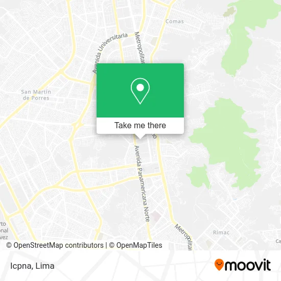
See Icpna, Independen, on the map
Public Transit to Icpna in Independen
Wondering how to get to Icpna in Independen? Moovit helps you find the best way to get to Icpna with step-by-step directions from the nearest public transit station.
Moovit provides free maps and live directions to help you navigate through your city. View schedules, routes, timetables, and find out how long does it take to get to Icpna in real time.
Looking for the nearest stop or station to Icpna? Check out this list of stops closest to your destination: Mega Plaza; El Pacífico; Senati; Tupac Amaru; Pacífico.
Bus: 1024, 1159, 1176, 1180, 1183, 1235, 1275, 1177, 1237, 1240, 1243, IO38, 1326 SX, 1005, 1010, 1016, 1017, 1179, 1262, 1472, 1326, IM47.
Want to see if there’s another route that gets you there at an earlier time? Moovit helps you find alternative routes or times. Get directions from and directions to Icpna easily from the Moovit App or Website.
We make riding to Icpna easy, which is why over 1.5 million users, including users in Independen, trust Moovit as the best app for public transit. You don’t need to download an individual bus app or train app, Moovit is your all-in-one transit app that helps you find the best bus time or train time available.
For information on prices of bus, costs and ride fares to Icpna, please check the Moovit app.
Use the app to navigate to popular places including to the airport, hospital, stadium, grocery store, mall, coffee shop, school, college, and university.
Icpna Address: Avenida El Pacifico street in Independen
- ICPNA Lima Norte,
- Av Pacifico 470 Costado Mega Plaza,
- D'Galia,
- Baterías ETNA,
- Montalvo Salon & Spa,
- Av El pacifico N° 431,
- Luckya Casino & Karaoke,
- Centro Comercial Mega Plaza,
- SAT - Agencia Mega Plaza,
- Konceptos,
- Bellísima,
- Aurica SAC,
- Alfredo Mendiola 3698,
- Zugatti - Mega Plaza,
- Belle-Joyería,
- Probela-Productos de Belleza,
- Perfumerías Unidas,
- Rapid Nails-Uñas,
- Moneygram-Giros Internacionales,
- Urbanización Ingenieria a 2 cuadras de la Av Habich
Places Near Icpna (Independen)
- Plaza San Miguel, San Miguel,
- Paradero Av.Brasil,
- av arequipa, Lima,
- Centro Comercial Plaza Norte, Independen,
- Hospital Edgardo Rebagliati Martins, Jesus Mari,
- Av. Abancay, Lima,
- Aeropuerto Internacional Jorge Chávez, Ventanilla,
- Miraflores, Miraflores,
- Circuito Mágico Del Agua, Lima,
- Real Plaza Puruchuco, Ate,
- Parque Kennedy, Miraflores,
- Parque de las Leyendas, San Miguel,
- Gamarra,
- Larcomar, Miraflores,
- Av. La Marina, San Miguel,
- Barranco, Barranco,
- Av. Salaverry, Jesus Mari,
- Jockey Plaza, Santiago D,
- Pontificia Universidad Católica del Perú - PUCP, San Miguel,
- Mall Del Sur
How to get to popular places in Lima with public transit
Get around Independen by public transit!
Traveling around Independen has never been so easy. See step by step directions as you travel to any attraction, street or major public transit station. View bus and train schedules, arrival times, service alerts and detailed routes on a map, so you know exactly how to get to anywhere in Independen.
When traveling to any destination around Independen use Moovit's Live Directions with Get Off Notifications to know exactly where and how far to walk, how long to wait for your line, and how many stops are left. Moovit will alert you when it's time to get off — no need to constantly re-check whether yours is the next stop.
Wondering how to use public transit in Independen or how to pay for public transit in Independen? Moovit public transit app can help you navigate your way with public transit easily, and at minimum cost. It includes public transit fees, ticket prices, and costs. Looking for a map of Independen public transit lines? Moovit public transit app shows all public transit maps in Independen with all Bus, Metro and Ferry routes and stops on an interactive map.
Lima has 3 transit type(s), including: Bus, Metro and Ferry, operated by several transit agencies, including Metro de Lima Línea 2 , Metro de Lima, Corredor Rojo, Metropolitano, Metropolitano - Alimentadores, Corredor Morado, Corredor Azul, Rutas Tradicionales, Transportes y Servicios La Esperanza S.A., Las Flores S.A., Virgen de la Asunción S.A., Consorcio HAM, Transportes y Service Canadá S.A., ETUL4SA and ETUCHISA