Directions to Idec Displays (Boston) with public transportation
The following transit lines have routes that pass near Idec Displays
 Bus: 716.
- Train: ACELA, NORTHEAST REGIONAL, PROVIDENCE/STOUGHTON.
How to get to Idec Displays by bus?
Click on the bus route to see step by step directions with maps, line arrival times and updated time schedules.
From Milton Academy, Milton
102 minFrom Granite Links Golf Club at Quarry Hills, Quincy
128 minFrom Encompass Health Rehabilitation Hospital of Braintree, Braintree Town
159 minFrom Walpole, MA, Walpole
117 minFrom West Roxbury, Boston
100 minFrom West Roxbury, Boston
120 minFrom Georgetown, Massachusetts, Boston
88 min
How to get to Idec Displays by train?
Click on the train route to see step by step directions with maps, line arrival times and updated time schedules.
Train stations near Idec Displays in Boston
What are the closest stations to Idec Displays?
The closest stations to Idec Displays are:
- Canton Center is 1055 yards away, 13 min walk.
- Route 128 - Westwood is 3079 yards away, 36 min walk.
Which bus line stops near Idec Displays?
716 (Canton Village Shoppes)
Which train lines stop near Idec Displays?
These train lines stop near Idec Displays: ACELA, NORTHEAST REGIONAL, PROVIDENCE/STOUGHTON.
What’s the nearest train station to Idec Displays in Boston?
The nearest train station to Idec Displays in Boston is Canton Center. It’s a 13 min walk away.
What time is the first train to Idec Displays in Boston?
The PROVIDENCE/STOUGHTON is the first train that goes to Idec Displays in Boston. It stops nearby at 4:39 AM.
What time is the last train to Idec Displays in Boston?
The NORTHEAST REGIONAL is the last train that goes to Idec Displays in Boston. It stops nearby at 9:42 AM.
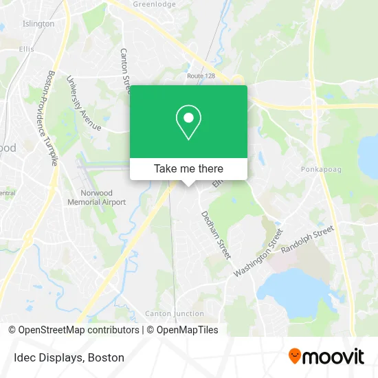
See Idec Displays, Boston, on the map
Public Transit to Idec Displays in Boston
Wondering how to get to Idec Displays in Boston? Moovit helps you find the best way to get to Idec Displays with step-by-step directions from the nearest public transit station.
Moovit provides free maps and live directions to help you navigate through your city. View schedules, routes, timetables, and find out how long does it take to get to Idec Displays in real time.
Looking for the nearest stop or station to Idec Displays? Check out this list of stops closest to your destination: Canton Center; Route 128 - Westwood.
Bus: 716.Train: ACELA, NORTHEAST REGIONAL, PROVIDENCE/STOUGHTON.
Want to see if there’s another route that gets you there at an earlier time? Moovit helps you find alternative routes or times. Get directions from and directions to Idec Displays easily from the Moovit App or Website.
We make riding to Idec Displays easy, which is why over 1.7 million users, including users in Boston, trust Moovit as the best app for public transit. You don’t need to download an individual bus app or train app, Moovit is your all-in-one transit app that helps you find the best bus time or train time available.
For information on prices of bus, train and subway, costs and ride fares to Idec Displays, please check the Moovit app.
Use the app to navigate to popular places including to the airport, hospital, stadium, grocery store, mall, coffee shop, school, college, and university.
Idec Displays Address: 60 Shawmut Rd street in Boston
- Norfolk Probate And Family Court,
- I-95,
- Trillium Brewing,
- Bunkers,
- N And J Painters,
- Osprey,
- Blue Hill Country Club's 4th Hole,
- Yankee Axe & Tool,
- Iron Mountain,
- Mrs. Onyinye Osuagwu, Pmhnp-Bc,
- Kennedy School Playground,
- JFK Capt,
- Cole-Harrington Kindergarten Enrichment Center,
- Wm H Galvin Middle,
- Church St. Brewing Co.,
- Professional Moving & Storage,
- Modern Party Art,
- Shipps,
- Dance with Spirit,
- New England Group Inc
Places Near Idec Displays (Boston)
- Wilbur Theatre, Boston,
- Prudential Center, Boston,
- Mgm Music Hall, Boston,
- House Of Blues, Boston,
- Quincy Market, Boston,
- Massachusetts General Hospital, Boston,
- Boston Children's Hospital, Boston,
- North End, Boston,
- Boston Medical Center, Boston,
- Td Garden, Boston,
- Faneuil Hall, Boston,
- Leader Bank Pavilion (Leader Bank Pavillion), Boston,
- Museum Of Science, Boston,
- Boston Convention & Exhibition Center, Boston,
- Boston Common, Boston,
- Cheers, Boston,
- Isabella Stewart Gardner Museum, Boston,
- Castle Island, Boston,
- Wang Theater, Boston,
- Seaport District, Boston
How to get to popular places in Boston with public transit
Get around Boston by public transit!
Traveling around Boston has never been so easy. See step by step directions as you travel to any attraction, street or major public transit station. View bus and train schedules, arrival times, service alerts and detailed routes on a map, so you know exactly how to get to anywhere in Boston.
When traveling to any destination around Boston use Moovit's Live Directions with Get Off Notifications to know exactly where and how far to walk, how long to wait for your line, and how many stops are left. Moovit will alert you when it's time to get off — no need to constantly re-check whether yours is the next stop.
Wondering how to use public transit in Boston or how to pay for public transit in Boston? Moovit public transit app can help you navigate your way with public transit easily, and at minimum cost. It includes public transit fees, ticket prices, and costs. Looking for a map of Boston public transit lines? Moovit public transit app shows all public transit maps in Boston with all Bus, Train, Subway and Ferry routes and stops on an interactive map.
Boston has 4 transit type(s), including: Bus, Train, Subway and Ferry, operated by several transit agencies, including MBTA, Southeastern Regional Transit Authority, MetroWest Regional Transit Authority, Rhode Island Public Transit Authority, WRTA, Lowell Regional Transit Authority, Merrimack Valley Transit, Montachusett Regional Transit Authority, Cape Cod Regional Transit Authority, Brockton Area Transit Authority, Martha's Vineyard Transit Authority, the WAVE - Nantucket Regional Transit Authority, GATRA, Cape Ann Transportation Authority and Massport